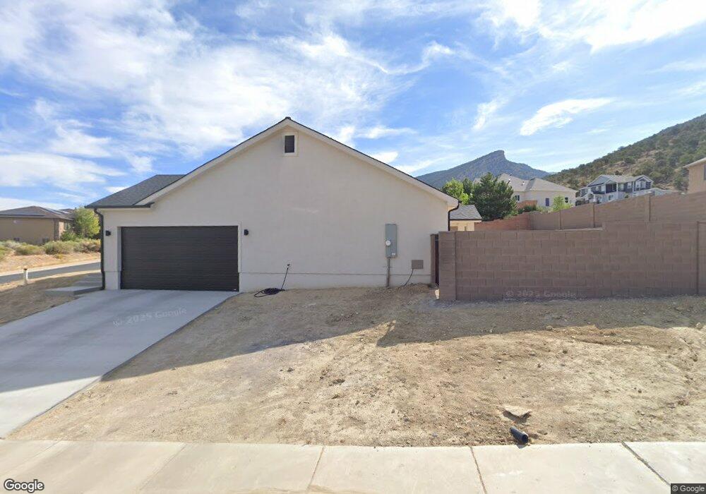
1946 N 1125 E Cedar City, UT 84721
Estimated Value: $383,127 - $512,000
--
Bed
--
Bath
12,632
Sq Ft
$35/Sq Ft
Est. Value
About This Home
This home is located at 1946 N 1125 E, Cedar City, UT 84721 and is currently estimated at $443,532, approximately $35 per square foot. 1946 N 1125 E is a home located in Iron County with nearby schools including Fiddlers Canyon School, Cedar Middle School, and Cedar City High School.
Ownership History
Date
Name
Owned For
Owner Type
Purchase Details
Closed on
Feb 20, 2024
Sold by
Ferrell Kathryn A
Bought by
Lewis Jodare and Lewis Ana Cristina
Current Estimated Value
Purchase Details
Closed on
Apr 19, 2006
Sold by
Ferrell Richard W and Ferrell Kathryn A
Bought by
Ferrell Kathryn A
Purchase Details
Closed on
Sep 16, 2005
Sold by
Ferrell Richard and Ferrell Kathryn
Bought by
Ferrell Richard W and Ferrell Kathryn A
Purchase Details
Closed on
Aug 10, 2005
Sold by
Fiddlers Canyon Developments Ltd
Bought by
Ferrell Richard and Ferrell Kathryn
Create a Home Valuation Report for This Property
The Home Valuation Report is an in-depth analysis detailing your home's value as well as a comparison with similar homes in the area
Home Values in the Area
Average Home Value in this Area
Purchase History
| Date | Buyer | Sale Price | Title Company |
|---|---|---|---|
| Lewis Jodare | -- | Cedar Land Title | |
| Ferrell Kathryn A | -- | -- | |
| Ferrell Richard W | -- | -- | |
| Ferrell Richard | -- | -- |
Source: Public Records
Tax History Compared to Growth
Tax History
| Year | Tax Paid | Tax Assessment Tax Assessment Total Assessment is a certain percentage of the fair market value that is determined by local assessors to be the total taxable value of land and additions on the property. | Land | Improvement |
|---|---|---|---|---|
| 2025 | $1,657 | $213,077 | $58,722 | $154,355 |
| 2023 | $415 | $60,660 | $60,660 | $0 |
| 2022 | $429 | $46,660 | $46,660 | $0 |
| 2021 | $299 | $32,490 | $32,490 | $0 |
| 2020 | $278 | $26,770 | $26,770 | $0 |
| 2019 | $290 | $26,770 | $26,770 | $0 |
| 2018 | $423 | $37,760 | $37,760 | $0 |
| 2017 | $358 | $31,465 | $31,465 | $0 |
| 2016 | $385 | $31,465 | $31,465 | $0 |
| 2015 | $254 | $19,735 | $0 | $0 |
| 2014 | $433 | $31,425 | $0 | $0 |
Source: Public Records
Map
Nearby Homes
- 1931 N Mahogany Cir
- 1927 N Mahogany Cir
- 1073 E Mill Hollow Way
- 1073 E Mill Hollow Way Unit 5
- 1152 Smokey Trail Way
- 1054 E Ashdown Forest Rd
- 1824 N Splinter Wood Ln
- 1940 N Pinyon Grove Cir
- 1918 N Pinyon Grove Cir
- 1937 N Pinyon Grove Cir
- 1952 N Pinyon Grove Cir S
- 2154 N Sumack Cir
- 1896 N Pinyon Grove Cir
- 1906 N Pinyon Grove Cir
- 2254 Amberwood Ln
- 1927 N Pinyon Grove Cir
- 1930 N Pinyon Grove Cir E
- 1945 N Pinyon Grove Cir
- 1884 N Pinyon Grove Cir E
- 673 E Fiddlers Canyon Rd
- 1148 E Ashdown Forest Rd
- 1928 N Mahogany Cir
- 1931 N Mahogany Cir Unit 14
- 1945 N 1125 Unit 39
- 1945 W 1125 N
- 1127 Ashdown Forest Rd
- 1127 E Ashdown Forest Rd Unit 4
- 1127 E Ashdown Forest Rd Unit Lot 35
- 1127 E Ashdown Forest Rd
- 1927 N Mahogany Cir Unit 6
- 1113 E Ashdown Forest Rd
- 1113 E Ashdown Forest Rd Unit 4
- 1113 E Ashdown Forest Rd Unit Phase 4
- 1939 N Mahogany Cir
- 1939 N Mahogany Cir Unit 13
- 1157 E Ashdown Forest Rd
- 1102 E Ashdown Forest Rd
- 1096 E Sagewood Ln
- 1912 N Matchstick Way
- 1099 E Ashdown Forest Rd Unit 4