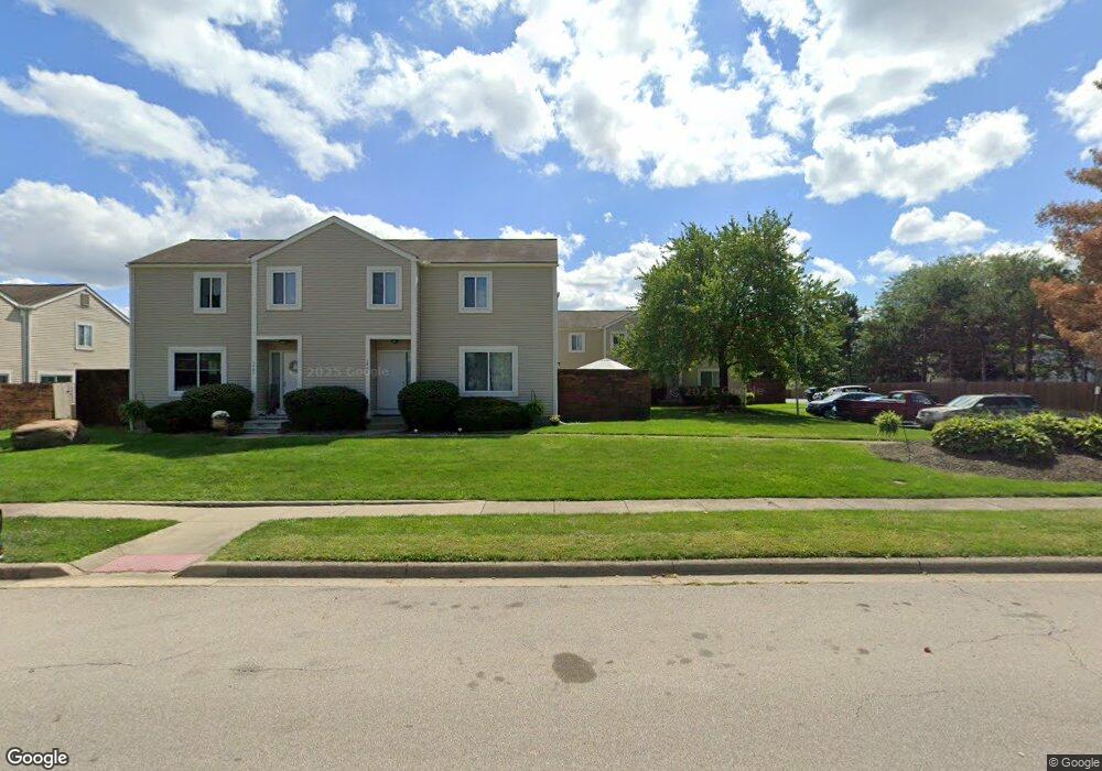
1946 Slaton Ct Columbus, OH 43235
Summerwood NeighborhoodEstimated Value: $199,663 - $215,000
2
Beds
2
Baths
1,024
Sq Ft
$201/Sq Ft
Est. Value
About This Home
This home is located at 1946 Slaton Ct, Columbus, OH 43235 and is currently estimated at $205,916, approximately $201 per square foot. 1946 Slaton Ct is a home located in Franklin County with nearby schools including Granby Elementary School, McCord Middle School, and Worthington Kilbourne High School.
Ownership History
Date
Name
Owned For
Owner Type
Purchase Details
Closed on
Dec 14, 2011
Sold by
Collart Clarence R and Collart Clarence Roy
Bought by
Collart Juliann
Current Estimated Value
Purchase Details
Closed on
Mar 19, 1986
Bought by
Collart Clarence R
Purchase Details
Closed on
Oct 1, 1980
Create a Home Valuation Report for This Property
The Home Valuation Report is an in-depth analysis detailing your home's value as well as a comparison with similar homes in the area
Home Values in the Area
Average Home Value in this Area
Purchase History
| Date | Buyer | Sale Price | Title Company |
|---|---|---|---|
| Collart Juliann | -- | Attorney | |
| Collart Clarence R | $38,100 | -- | |
| -- | $44,900 | -- |
Source: Public Records
Tax History Compared to Growth
Tax History
| Year | Tax Paid | Tax Assessment Tax Assessment Total Assessment is a certain percentage of the fair market value that is determined by local assessors to be the total taxable value of land and additions on the property. | Land | Improvement |
|---|---|---|---|---|
| 2024 | $2,590 | $51,980 | $10,500 | $41,480 |
| 2023 | $2,513 | $51,975 | $10,500 | $41,475 |
| 2022 | $1,782 | $32,830 | $4,830 | $28,000 |
| 2021 | $1,644 | $32,830 | $4,830 | $28,000 |
| 2020 | $1,583 | $32,830 | $4,830 | $28,000 |
| 2019 | $1,013 | $22,650 | $3,330 | $19,320 |
| 2018 | $491 | $22,650 | $3,330 | $19,320 |
| 2017 | $908 | $22,650 | $3,330 | $19,320 |
| 2016 | $937 | $21,950 | $4,170 | $17,780 |
| 2015 | $469 | $21,950 | $4,170 | $17,780 |
| 2014 | $937 | $21,950 | $4,170 | $17,780 |
| 2013 | $507 | $23,100 | $4,375 | $18,725 |
Source: Public Records
Map
Nearby Homes
- 2001 Sawbury Blvd Unit 2001
- 1889 Slaton Ct Unit 1889
- 1827 Watertower Dr Unit 1827
- 1828 Gardenstone Dr
- 1825 Watertower Dr Unit 1825
- 1930 Shallowford Ave
- 2074 Hard Rd
- 1692 Weather Stone Ln
- 2220 Surreygate Dr
- 1721 Worthington Run Dr Unit 1721-1731
- 6921 Spruce Pine Dr
- 2161 Heatherfield Ave
- 1637 Park Row Dr Unit F
- 1620 Park Row Dr Unit A
- 2392 Dunsworth Dr
- 8108 Smoky Row Rd
- 2456 Sanford Dr
- 2469 Sandstrom Dr
- 7373 Palmleaf Ln
- 2488 Dunstan Dr
- 1950 Slaton Ct
- 1952 Slaton Ct Unit 1952
- 1954 Slaton Ct
- 1956 Slaton Ct Unit 1956
- 1983 Sawbury Blvd
- 1981 Sawbury Blvd
- 1958 Slaton Ct Unit 1958
- 1944 Slaton Ct Unit 1944
- 1942 Slaton Ct
- 1940 Slaton Ct Unit 1940
- 1960 Slaton Ct Unit 1960
- 1979 Sawbury Blvd
- 1977 Sawbury Blvd Unit 1977
- 1957 Sawbury Blvd
- 1953 Sawbury Blvd
- 1955 Sawbury Blvd
- 1951 Sawbury Blvd
- 1975 Sawbury Blvd
- 1964 Slaton Ct
- 1973 Sawbury Blvd