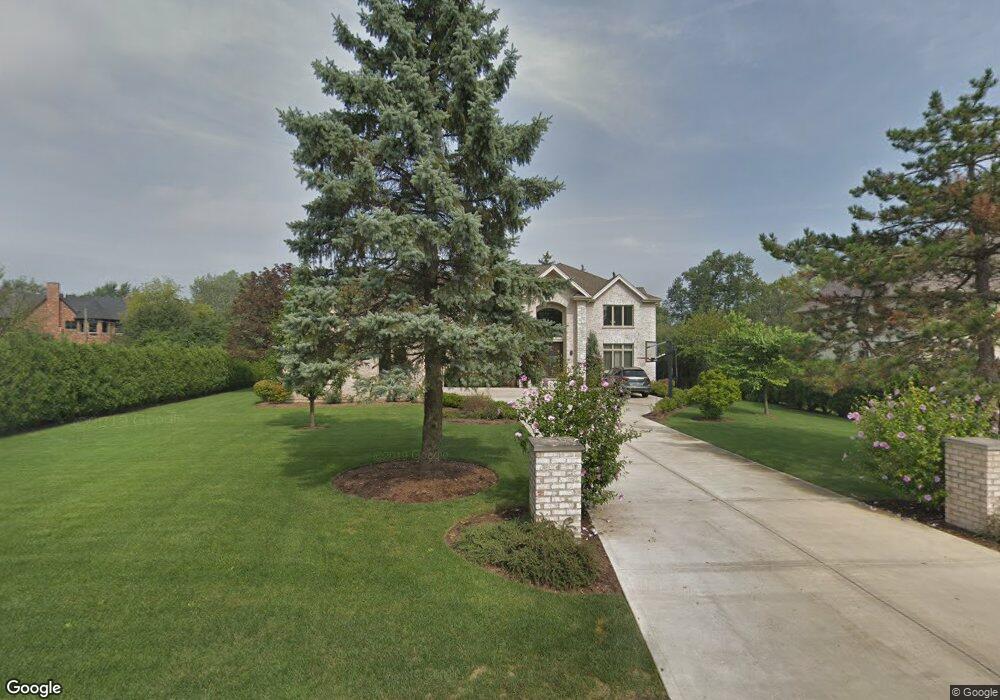
1946 Walnut Cir Northbrook, IL 60062
Glenbrook Countryside NeighborhoodEstimated Value: $638,000 - $1,591,899
3
Beds
2
Baths
4,516
Sq Ft
$274/Sq Ft
Est. Value
About This Home
This home is located at 1946 Walnut Cir, Northbrook, IL 60062 and is currently estimated at $1,239,300, approximately $274 per square foot. 1946 Walnut Cir is a home located in Cook County with nearby schools including Westmoor Elementary School, Northbrook Junior High School, and Glenbrook North High School.
Ownership History
Date
Name
Owned For
Owner Type
Purchase Details
Closed on
Dec 18, 2023
Sold by
Elperin Jacob A and Elperin Alina B
Bought by
Jacob A Elperin Revocable Trust and Aline B Elperin Revocable Trust
Current Estimated Value
Purchase Details
Closed on
Jan 14, 2012
Sold by
Elperin Jacob A and Elperin Alina B
Bought by
Elperin Jacob A and Elperin Alina B
Home Financials for this Owner
Home Financials are based on the most recent Mortgage that was taken out on this home.
Original Mortgage
$400,000
Interest Rate
3.87%
Mortgage Type
New Conventional
Purchase Details
Closed on
Apr 13, 2010
Sold by
Thomas Bella
Bought by
Elperin Jacob A
Purchase Details
Closed on
Nov 12, 2002
Sold by
Thomas Bella and Thomas Tom
Bought by
Thomas Bella and Thomas Tom
Create a Home Valuation Report for This Property
The Home Valuation Report is an in-depth analysis detailing your home's value as well as a comparison with similar homes in the area
Home Values in the Area
Average Home Value in this Area
Purchase History
| Date | Buyer | Sale Price | Title Company |
|---|---|---|---|
| Jacob A Elperin Revocable Trust | -- | None Listed On Document | |
| Elperin Jacob A | -- | Cambridge Title Company | |
| Elperin Jacob A | $325,000 | Attorneys Title Guaranty Fun | |
| Thomas Bella | -- | -- |
Source: Public Records
Mortgage History
| Date | Status | Borrower | Loan Amount |
|---|---|---|---|
| Previous Owner | Elperin Jacob A | $400,000 |
Source: Public Records
Tax History
| Year | Tax Paid | Tax Assessment Tax Assessment Total Assessment is a certain percentage of the fair market value that is determined by local assessors to be the total taxable value of land and additions on the property. | Land | Improvement |
|---|---|---|---|---|
| 2025 | $22,887 | $134,379 | $11,390 | $122,989 |
| 2024 | $22,887 | $107,173 | $9,492 | $97,681 |
| 2023 | $22,153 | $107,173 | $9,492 | $97,681 |
| 2022 | $22,153 | $107,173 | $9,492 | $97,681 |
| 2021 | $19,722 | $85,866 | $22,780 | $63,086 |
| 2020 | $19,336 | $85,866 | $22,780 | $63,086 |
| 2019 | $18,656 | $94,359 | $22,780 | $71,579 |
| 2018 | $19,359 | $89,525 | $19,933 | $69,592 |
| 2017 | $18,954 | $89,525 | $19,933 | $69,592 |
| 2016 | $18,189 | $89,525 | $19,933 | $69,592 |
| 2015 | $19,101 | $82,341 | $16,136 | $66,205 |
| 2014 | $18,399 | $82,341 | $16,136 | $66,205 |
| 2013 | $19,957 | $92,223 | $16,136 | $76,087 |
Source: Public Records
Map
Nearby Homes
- 1921 Beechnut Rd
- 2065 Walnut Cir
- 2140 Beechnut Rd
- 1744 Walnut Cir
- 1851 Oakwood Rd
- 1709 Koehling Rd
- 316 Linden Rd
- 50 Red Oak Ln
- 326 Briar Ln
- 1380 Rosemary Ln
- 520 Standish Dr
- 370 Briar Ln
- 1280 Rudolph Rd Unit 1F
- 2535 Stonebridge Ln
- 1250 Rudolph Rd Unit 4F
- 1220 Rudolph Rd Unit 3H
- 1220 Rudolph Rd Unit 1B
- 2348 Ash Ln
- 309 Ridge Rd
- 440 Lee Rd
- 1940 Walnut Cir
- 135 Birchwood Rd
- 1945 Beechnut Rd
- 1947 Beechnut Rd
- 1932 Walnut Cir
- 1925 Beechnut Rd
- 1949 Walnut Cir
- 121 Birchwood Rd
- 1933 Walnut Cir
- 1949 Beechnut Rd
- 2001 Walnut Cir
- 2000 Walnut Cir
- 1925 Walnut Cir
- 130 Birchwood Rd
- 1926 Walnut Cir
- 1915 Beechnut Rd
- 2015 Walnut Cir
- 1942 Beechnut Rd
- 2029 Beechnut Rd
- 2000 Beechnut Rd
Your Personal Tour Guide
Ask me questions while you tour the home.