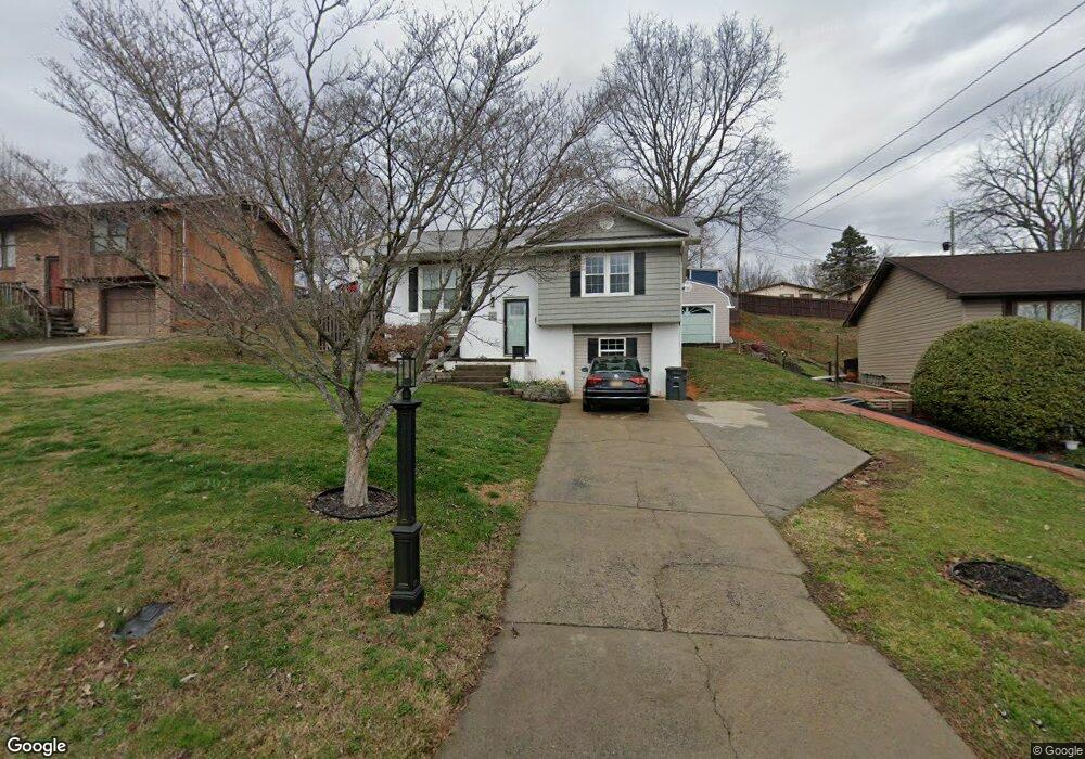
1946 Woodbine St Kingsport, TN 37660
Estimated Value: $194,000 - $241,000
3
Beds
2
Baths
1,488
Sq Ft
$144/Sq Ft
Est. Value
About This Home
This home is located at 1946 Woodbine St, Kingsport, TN 37660 and is currently estimated at $214,293, approximately $144 per square foot. 1946 Woodbine St is a home located in Sullivan County with nearby schools including George Washington Elementary School, John Sevier Middle School, and Ross N. Robinson Middle School.
Ownership History
Date
Name
Owned For
Owner Type
Purchase Details
Closed on
Jan 14, 2008
Sold by
American General Financial
Bought by
Jonathan Wilhelm
Current Estimated Value
Purchase Details
Closed on
Feb 28, 2007
Purchase Details
Closed on
Jan 3, 1997
Sold by
Jones Elmer L and Jones Wanda L
Bought by
Oliver Epley
Home Financials for this Owner
Home Financials are based on the most recent Mortgage that was taken out on this home.
Original Mortgage
$84,150
Interest Rate
7.43%
Purchase Details
Closed on
Aug 26, 1987
Create a Home Valuation Report for This Property
The Home Valuation Report is an in-depth analysis detailing your home's value as well as a comparison with similar homes in the area
Home Values in the Area
Average Home Value in this Area
Purchase History
| Date | Buyer | Sale Price | Title Company |
|---|---|---|---|
| Jonathan Wilhelm | $100,000 | -- | |
| -- | $99,900 | -- | |
| Oliver Epley | $84,500 | -- | |
| -- | $51,500 | -- |
Source: Public Records
Mortgage History
| Date | Status | Borrower | Loan Amount |
|---|---|---|---|
| Previous Owner | -- | $84,150 |
Source: Public Records
Tax History Compared to Growth
Tax History
| Year | Tax Paid | Tax Assessment Tax Assessment Total Assessment is a certain percentage of the fair market value that is determined by local assessors to be the total taxable value of land and additions on the property. | Land | Improvement |
|---|---|---|---|---|
| 2024 | -- | $25,150 | $1,725 | $23,425 |
| 2023 | $1,108 | $25,150 | $1,725 | $23,425 |
| 2022 | $1,108 | $25,150 | $1,725 | $23,425 |
| 2021 | $1,077 | $25,150 | $1,725 | $23,425 |
| 2020 | $589 | $25,150 | $1,725 | $23,425 |
| 2019 | $1,062 | $22,900 | $1,725 | $21,175 |
| 2018 | $1,036 | $22,900 | $1,725 | $21,175 |
| 2017 | $1,036 | $22,900 | $1,725 | $21,175 |
| 2016 | $1,167 | $25,125 | $1,725 | $23,400 |
| 2014 | $1,099 | $25,113 | $0 | $0 |
Source: Public Records
Map
Nearby Homes
- 1950 W Stone Dr
- 2001 Sand St
- 606 Hollis St
- 241 Bent St
- 1461 Gress Mag Mountain
- 2137 Hiara Dr
- 1244 Stamp Lodge Rd
- 2029 Louita Ave
- 1237 Stamp Lodge Rd
- 1249 Stamp Lodge Rd
- 1824&1828 Netherland Inn Rd
- 1104 Tay Station
- 2228 Hall St
- 0 Stonegate Rd
- 2046 Lowell Dr
- 1413 Gress Mag Mountain
- 1109 Tay Station
- 1133 Tay Station
- 0 Granby Rd Unit 9960138
- 1320 Mimosa Dr
- 1946 Woodbine St Unit 1
- 1942 Woodbine St
- 1950 Woodbine St
- 609 Rogan St
- 517 Rogan St
- 1937 Oakland St
- 1941 Oakland St
- 1928 Woodbine St
- 1945 Woodbine St
- 513 Rogan St
- 1933 Oakland St
- 1941 Woodbine St
- 604 Rogan St
- 1926 Woodbine St
- 2004 Woodbine St
- 1929 Oakland St
- 1937 Woodbine St
- 509 Rogan St
- 610 Rogan St
- 518 Rogan St