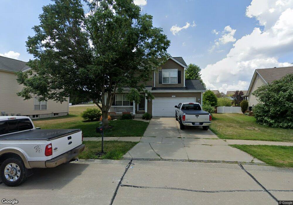
1947 Briarfield Dr Lake Saint Louis, MO 63367
Estimated Value: $384,000 - $475,000
4
Beds
3
Baths
2,146
Sq Ft
$194/Sq Ft
Est. Value
About This Home
This home is located at 1947 Briarfield Dr, Lake Saint Louis, MO 63367 and is currently estimated at $416,536, approximately $194 per square foot. 1947 Briarfield Dr is a home located in St. Charles County with nearby schools including Discovery Ridge Elementary School, Frontier Middle School, and Liberty High School.
Ownership History
Date
Name
Owned For
Owner Type
Purchase Details
Closed on
Nov 2, 2011
Sold by
Woodard Timothy D and Woodard Susan Rebecca
Bought by
Woodard Timothy D
Current Estimated Value
Home Financials for this Owner
Home Financials are based on the most recent Mortgage that was taken out on this home.
Original Mortgage
$175,610
Outstanding Balance
$120,095
Interest Rate
4.08%
Mortgage Type
VA
Estimated Equity
$296,441
Purchase Details
Closed on
Feb 8, 2011
Sold by
Woodard Timothy D and Woodard Susan Rebecca
Bought by
Woodard Timothy D and Woodard Susan Rebecca
Purchase Details
Closed on
Apr 25, 2005
Sold by
Mcbride & Son Homes Inc
Bought by
Woodard Timothy D and Woodard Susan
Home Financials for this Owner
Home Financials are based on the most recent Mortgage that was taken out on this home.
Original Mortgage
$176,519
Interest Rate
6.06%
Mortgage Type
Fannie Mae Freddie Mac
Create a Home Valuation Report for This Property
The Home Valuation Report is an in-depth analysis detailing your home's value as well as a comparison with similar homes in the area
Home Values in the Area
Average Home Value in this Area
Purchase History
| Date | Buyer | Sale Price | Title Company |
|---|---|---|---|
| Woodard Timothy D | -- | None Available | |
| Woodard Timothy D | -- | None Available | |
| Woodard Timothy D | -- | Multiple |
Source: Public Records
Mortgage History
| Date | Status | Borrower | Loan Amount |
|---|---|---|---|
| Open | Woodard Timothy D | $175,610 | |
| Closed | Woodard Timothy D | $176,519 |
Source: Public Records
Tax History Compared to Growth
Tax History
| Year | Tax Paid | Tax Assessment Tax Assessment Total Assessment is a certain percentage of the fair market value that is determined by local assessors to be the total taxable value of land and additions on the property. | Land | Improvement |
|---|---|---|---|---|
| 2025 | $4,071 | $67,133 | -- | -- |
| 2023 | $4,074 | $59,426 | $0 | $0 |
| 2022 | $3,689 | $50,149 | $0 | $0 |
| 2021 | $3,698 | $50,149 | $0 | $0 |
| 2020 | $3,276 | $42,686 | $0 | $0 |
| 2019 | $3,076 | $42,686 | $0 | $0 |
| 2018 | $2,927 | $38,639 | $0 | $0 |
| 2017 | $2,902 | $38,639 | $0 | $0 |
| 2016 | $2,589 | $33,060 | $0 | $0 |
| 2015 | $2,551 | $33,060 | $0 | $0 |
| 2014 | $2,419 | $33,636 | $0 | $0 |
Source: Public Records
Map
Nearby Homes
- 1832 English Oak Dr
- 507 Country Chase Dr
- 650 Country Village Dr
- 1800 English Oak Dr
- 316 Country Orchard Dr
- 104 Long Pass Ct
- 618 Country Heights Dr
- 142 Countryshire Dr
- 126 Far Meadow Dr
- 31 Briscoe Glen Ct
- 341 Pointe Loma Blvd
- 320 Briarchase Cir
- 125 Far Meadow Dr
- 506 Country Landing Dr
- 2021 Lynwood Ridge Dr
- 357 Briarchase Cir
- 355 Countryshire Dr
- 2022 Lynwood Ridge Dr
- 523 Long Creek Dr
- 522 Long Creek Dr
- 1945 Briarfield Dr
- 1949 Briarfield Dr
- 2063 Preston Woods Pkwy
- 2061 Preston Woods Pkwy
- 1943 Briarfield Dr
- 2065 Preston Woods Pkwy
- 2059 Preston Woods Pkwy
- 1944 Briarfield Dr
- 1941 Briarfield Dr
- 1951 Briarfield Dr
- 2057 Preston Woods Pkwy
- 1942 Briarfield Dr
- 1946 Briarfield Dr
- 2101 Preston Woods Pkwy
- 1940 Briarfield Dr
- 1939 Briarfield Dr
- 1948 Briarfield Dr
- 2055 Preston Woods Pkwy
- 1953 Briarfield Dr
- 2054 Preston Woods Pkwy