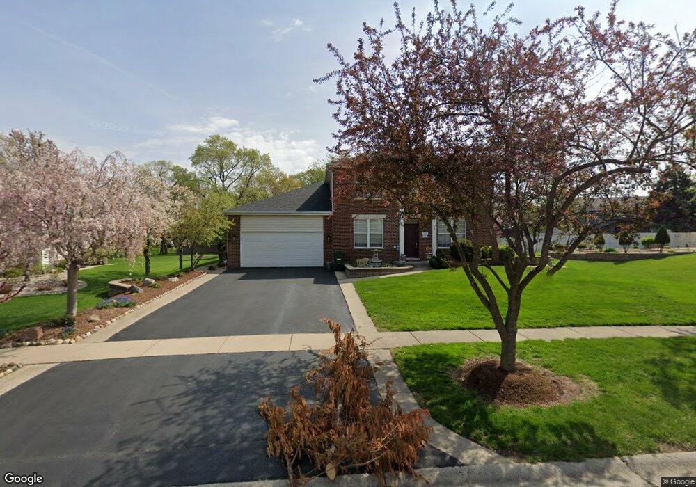
1947 Eagle Cir New Lenox, IL 60451
Estimated Value: $494,328 - $595,000
4
Beds
3
Baths
2,600
Sq Ft
$206/Sq Ft
Est. Value
About This Home
This home is located at 1947 Eagle Cir, New Lenox, IL 60451 and is currently estimated at $535,832, approximately $206 per square foot. 1947 Eagle Cir is a home located in Will County with nearby schools including Spencer Trail, Spencer Pointe, and Spencer Crossing Intermediate School.
Ownership History
Date
Name
Owned For
Owner Type
Purchase Details
Closed on
Feb 3, 2010
Sold by
Le Hanh
Bought by
Ballerini Richard and Ballerini Aileen
Current Estimated Value
Home Financials for this Owner
Home Financials are based on the most recent Mortgage that was taken out on this home.
Original Mortgage
$299,475
Outstanding Balance
$199,092
Interest Rate
5.12%
Mortgage Type
FHA
Estimated Equity
$336,740
Purchase Details
Closed on
Jan 22, 2007
Sold by
Le Hanh and Le Kim
Bought by
Le Hanh
Purchase Details
Closed on
Mar 8, 2001
Sold by
Nlsb
Bought by
Le Hanh and Le Kim
Home Financials for this Owner
Home Financials are based on the most recent Mortgage that was taken out on this home.
Original Mortgage
$178,000
Interest Rate
7.13%
Purchase Details
Closed on
Jun 12, 2000
Sold by
Harris Bank Hinsdale
Bought by
Nlsb and Trust #2451
Create a Home Valuation Report for This Property
The Home Valuation Report is an in-depth analysis detailing your home's value as well as a comparison with similar homes in the area
Home Values in the Area
Average Home Value in this Area
Purchase History
| Date | Buyer | Sale Price | Title Company |
|---|---|---|---|
| Ballerini Richard | $305,000 | First American Title Ins Co | |
| Le Hanh | -- | None Available | |
| Le Hanh | $210,000 | First American Title | |
| Nlsb | $170,000 | -- |
Source: Public Records
Mortgage History
| Date | Status | Borrower | Loan Amount |
|---|---|---|---|
| Open | Ballerini Richard | $299,475 | |
| Previous Owner | Le Hanh | $178,000 |
Source: Public Records
Tax History
| Year | Tax Paid | Tax Assessment Tax Assessment Total Assessment is a certain percentage of the fair market value that is determined by local assessors to be the total taxable value of land and additions on the property. | Land | Improvement |
|---|---|---|---|---|
| 2024 | $10,736 | $140,295 | $36,393 | $103,902 |
| 2023 | $10,736 | $127,890 | $33,175 | $94,715 |
| 2022 | $9,675 | $117,817 | $30,562 | $87,255 |
| 2021 | $9,185 | $110,804 | $28,743 | $82,061 |
| 2020 | $8,924 | $106,850 | $27,717 | $79,133 |
| 2019 | $8,541 | $103,537 | $26,858 | $76,679 |
| 2018 | $7,738 | $93,146 | $25,932 | $67,214 |
| 2017 | $7,352 | $90,468 | $25,186 | $65,282 |
| 2016 | $7,136 | $88,047 | $24,512 | $63,535 |
| 2015 | $6,907 | $85,275 | $23,740 | $61,535 |
| 2014 | $6,907 | $84,222 | $23,447 | $60,775 |
| 2013 | $6,907 | $85,357 | $23,763 | $61,594 |
Source: Public Records
Map
Nearby Homes
- 1535 Glenbrooke Ln
- 2402 Bluestone Bay Dr
- 1956 Cornell Dr
- 732 Teal Dr Unit 1
- 1351 E Lincoln Hwy
- 2757 Genoa Dr
- 2019 Royalglen Dr
- 1851 Glenlake Ct
- 1869 Glenlake Ct
- 320 Garfield Ave
- 1587 Glenbrooke Ln
- 1583 Glenbrooke Ln
- 2931 Northwind Dr
- 1558 Glenbrooke Ln
- 1738 Orchard Ln
- 1750 Orchard Ln
- 500 E Laraway Rd
- 550 E Laraway Rd
- 1212 Georgias Way
- 1245 Georgias Way
- 1939 Eagle Cir
- 1965 Talon Dr
- 705 S Schoolhouse Rd
- 833 S Schoolhouse Rd
- 1929 Eagle Cir
- 1935 Talon Dr
- 703 S Schoolhouse Rd
- 1930 Eagle Cir
- 1919 Eagle Cir
- 1921 Talon Dr
- 1980 Talon Dr
- 1960 Talon Dr
- 1990 Talon Dr
- 1940 Harvard Ln
- 1909 Eagle Cir
- 1940 Talon Dr
- 1915 Talon Dr
- 1900 Eagle Cir
- 12755 W Quails Roost Dr
- 1930 Harvard Ln
Your Personal Tour Guide
Ask me questions while you tour the home.