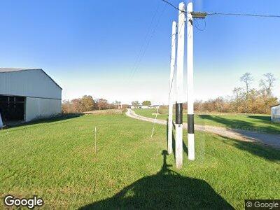
1947 Laurel Ridge Rd Piketon, OH 45661
Estimated Value: $214,053 - $263,000
3
Beds
1
Bath
2,432
Sq Ft
$96/Sq Ft
Est. Value
About This Home
This home is located at 1947 Laurel Ridge Rd, Piketon, OH 45661 and is currently estimated at $233,263, approximately $95 per square foot. 1947 Laurel Ridge Rd is a home located in Pike County with nearby schools including Jasper Elementary School, Zahns Middle School, and Piketon Junior/Senior High School.
Ownership History
Date
Name
Owned For
Owner Type
Purchase Details
Closed on
Nov 27, 2018
Sold by
Hyland Molly A
Bought by
Bryant Kenneth and Bryant Kayla
Current Estimated Value
Home Financials for this Owner
Home Financials are based on the most recent Mortgage that was taken out on this home.
Original Mortgage
$117,826
Outstanding Balance
$106,349
Interest Rate
5.62%
Mortgage Type
FHA
Estimated Equity
$126,914
Purchase Details
Closed on
Aug 24, 2005
Sold by
Hyland Gerald E
Bought by
Hyland Molly A
Home Financials for this Owner
Home Financials are based on the most recent Mortgage that was taken out on this home.
Original Mortgage
$126,022
Interest Rate
5.89%
Mortgage Type
Fannie Mae Freddie Mac
Purchase Details
Closed on
May 26, 2005
Sold by
Hyland Lisa G
Bought by
Hyland Gerald E
Create a Home Valuation Report for This Property
The Home Valuation Report is an in-depth analysis detailing your home's value as well as a comparison with similar homes in the area
Home Values in the Area
Average Home Value in this Area
Purchase History
| Date | Buyer | Sale Price | Title Company |
|---|---|---|---|
| Bryant Kenneth | $120,000 | None Available | |
| Hyland Molly A | $128,000 | None Available | |
| Hyland Gerald E | -- | None Available |
Source: Public Records
Mortgage History
| Date | Status | Borrower | Loan Amount |
|---|---|---|---|
| Open | Bryant Kenneth | $117,826 | |
| Previous Owner | Hyland Molly A | $126,022 |
Source: Public Records
Tax History Compared to Growth
Tax History
| Year | Tax Paid | Tax Assessment Tax Assessment Total Assessment is a certain percentage of the fair market value that is determined by local assessors to be the total taxable value of land and additions on the property. | Land | Improvement |
|---|---|---|---|---|
| 2024 | $1,908 | $59,540 | $12,680 | $46,860 |
| 2023 | $1,908 | $59,540 | $12,680 | $46,860 |
| 2022 | $1,655 | $51,420 | $12,060 | $39,360 |
| 2021 | $1,609 | $51,420 | $12,060 | $39,360 |
| 2020 | $1,632 | $51,420 | $12,060 | $39,360 |
| 2019 | $1,469 | $47,070 | $10,970 | $36,100 |
| 2018 | $1,461 | $47,070 | $10,970 | $36,100 |
| 2017 | $1,456 | $47,070 | $10,970 | $36,100 |
| 2016 | $1,453 | $44,910 | $5,500 | $39,410 |
| 2015 | $1,454 | $44,910 | $5,500 | $39,410 |
| 2014 | $1,481 | $44,910 | $5,500 | $39,410 |
| 2013 | $1,473 | $44,120 | $4,710 | $39,410 |
| 2012 | $1,527 | $44,120 | $4,710 | $39,410 |
Source: Public Records
Map
Nearby Homes
- ac Union Hill Rd
- 0 Beavers Ridge Rd Unit 1 225010990
- 0 Beavers Ridge Rd
- 473 Hilterbran Rd
- 220 Current Rd Unit T333
- 4655 Grassy Fork Rd
- 16 Dodds Rd
- 948 Big Bear Creek Rd
- 0 Dry Run Rd
- 1105 Tennyson Rd Unit C85
- 542 Black Hollow Rd
- 0 Bear Creek Rarden Rd
- 1962 Tennyson Rd
- 31 ac Green Ridge Rd
- 836 Hackleshin Rd
- 13553 Ohio 124
- 1784 Edwards Rd
- 0 Rarden Hazelbaker Rd Unit 1815457
- 0 Nace Corner Rd
- 325 Edwards Rd
