Estimated Value: $144,000 - $221,461
3
Beds
1
Bath
1,123
Sq Ft
$153/Sq Ft
Est. Value
About This Home
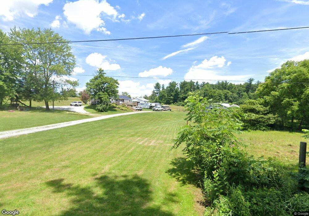
This home is located at 1947 Leiter Rd, Lucas, OH 44843 and is currently estimated at $171,487, approximately $152 per square foot. 1947 Leiter Rd is a home located in Richland County with nearby schools including Lucas Elementary School, Lucas Heritage Middle School, and Lucas High School.
Ownership History
Date
Name
Owned For
Owner Type
Purchase Details
Closed on
May 6, 2017
Sold by
Thompson Danny O and Thompson Shirley M
Bought by
Thompson Danny O and Thompson Shirley M
Current Estimated Value
Purchase Details
Closed on
Dec 6, 2005
Sold by
Myers James H
Bought by
Federal National Mortgage Association
Create a Home Valuation Report for This Property
The Home Valuation Report is an in-depth analysis detailing your home's value as well as a comparison with similar homes in the area
Home Values in the Area
Average Home Value in this Area
Purchase History
| Date | Buyer | Sale Price | Title Company |
|---|---|---|---|
| Thompson Danny O | -- | Chicago Title Agency | |
| Federal National Mortgage Association | $100,000 | None Available |
Source: Public Records
Tax History Compared to Growth
Tax History
| Year | Tax Paid | Tax Assessment Tax Assessment Total Assessment is a certain percentage of the fair market value that is determined by local assessors to be the total taxable value of land and additions on the property. | Land | Improvement |
|---|---|---|---|---|
| 2024 | $1,709 | $50,200 | $18,940 | $31,260 |
| 2023 | $1,709 | $50,200 | $18,940 | $31,260 |
| 2022 | $1,393 | $38,160 | $16,930 | $21,230 |
| 2021 | $1,396 | $38,160 | $16,930 | $21,230 |
| 2020 | $1,418 | $38,160 | $16,930 | $21,230 |
| 2019 | $1,224 | $32,590 | $14,350 | $18,240 |
| 2018 | $1,260 | $32,590 | $14,350 | $18,240 |
| 2017 | $1,268 | $32,590 | $14,350 | $18,240 |
| 2016 | $1,220 | $31,940 | $13,060 | $18,880 |
| 2015 | $1,220 | $31,940 | $13,060 | $18,880 |
| 2014 | $1,225 | $31,940 | $13,060 | $18,880 |
| 2012 | $1,202 | $31,940 | $13,060 | $18,880 |
Source: Public Records
Map
Nearby Homes
- 174 W Main St
- 27 E Main St
- 0 Moffett Rd
- 1679 Pulver Rd
- 0 Mount Zion Rd Unit 9069748
- 2905 Tucker Rd
- 0 State Route 39 & I-71 Northeast Quadrant
- 2061 Washington North Rd
- 0 State Route 39 & I-71 Southeast Quadrant
- 1875 Mansfield Lucas Rd
- 1135 E Hanley Rd
- 929 Antionette Dr
- 3261 Moffett Rd
- 0 Peterson Rd
- 2221 Pleasant Valley Rd
- 0 Tucker Rd
- 0 Garver Rd Washington Rd S Unit 20253648
- 0 Applegate Rd
- 0 Garver Washington Rd S
- 2428 Applegate Rd
- 1916 Leiter Rd
- 1889 Leiter Rd
- 2037 Leiter Rd
- 151 Brightwood Blvd
- 152 Brightwood Blvd
- 137 Brightwood Blvd
- 137 Brightwood Blvd Unit 139
- 136 Brightwood Blvd
- 135 Brightwood Blvd
- 2053 Leiter Rd
- 122 Brightwood Blvd
- 1858 Leiter Rd
- 121 Brightwood Blvd
- 11 St Michael St
- 112 Brightwood Blvd Unit 114
- 111 Brightwood Blvd
- 1842 Leiter Rd
- 98 Brightwood Blvd
- 87 Brightwood Blvd
- 96 Brightwood Blvd