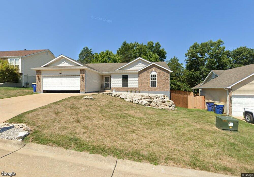
1947 McKinley Range Festus, MO 63028
Festus/Crystal City NeighborhoodEstimated Value: $322,000 - $345,000
Studio
1
Bath
1,568
Sq Ft
$214/Sq Ft
Est. Value
About This Home
This home is located at 1947 McKinley Range, Festus, MO 63028 and is currently estimated at $335,031, approximately $213 per square foot. 1947 McKinley Range is a home with nearby schools including Festus Elementary School, Festus Intermediate School, and Festus Middle School.
Ownership History
Date
Name
Owned For
Owner Type
Purchase Details
Closed on
Mar 28, 2025
Sold by
Barnes Jeffrey S and Barnes Linda S
Bought by
Barnes Revocable Trust and Barnes
Current Estimated Value
Purchase Details
Closed on
Jul 6, 2005
Sold by
Russell Michael
Bought by
Barnes Jeffrey S and Barnes Linda S
Home Financials for this Owner
Home Financials are based on the most recent Mortgage that was taken out on this home.
Original Mortgage
$93,500
Interest Rate
5.63%
Mortgage Type
Fannie Mae Freddie Mac
Purchase Details
Closed on
Jun 2, 2004
Sold by
K A B Construction Co Llc
Bought by
Wood Doris Russell
Create a Home Valuation Report for This Property
The Home Valuation Report is an in-depth analysis detailing your home's value as well as a comparison with similar homes in the area
Home Values in the Area
Average Home Value in this Area
Purchase History
| Date | Buyer | Sale Price | Title Company |
|---|---|---|---|
| Barnes Revocable Trust | -- | None Listed On Document | |
| Barnes Jeffrey S | $197,500 | U S Title Guaranty Company | |
| Wood Doris Russell | -- | -- |
Source: Public Records
Mortgage History
| Date | Status | Borrower | Loan Amount |
|---|---|---|---|
| Previous Owner | Barnes Jeffrey S | $93,500 |
Source: Public Records
Tax History
| Year | Tax Paid | Tax Assessment Tax Assessment Total Assessment is a certain percentage of the fair market value that is determined by local assessors to be the total taxable value of land and additions on the property. | Land | Improvement |
|---|---|---|---|---|
| 2025 | $2,248 | $42,600 | $8,800 | $33,800 |
| 2024 | $2,248 | $39,700 | $8,800 | $30,900 |
| 2023 | $2,248 | $39,700 | $8,800 | $30,900 |
| 2022 | $2,236 | $39,700 | $8,800 | $30,900 |
| 2021 | $2,238 | $39,700 | $8,800 | $30,900 |
| 2020 | $2,134 | $35,500 | $8,000 | $27,500 |
| 2019 | $2,133 | $35,500 | $8,000 | $27,500 |
| 2018 | $1,924 | $35,500 | $8,000 | $27,500 |
| 2017 | $1,923 | $35,500 | $8,000 | $27,500 |
| 2016 | $1,727 | $31,700 | $6,400 | $25,300 |
| 2015 | $1,643 | $31,700 | $6,400 | $25,300 |
| 2013 | $1,643 | $31,400 | $6,400 | $25,000 |
Source: Public Records
Map
Nearby Homes
- 1434 Moose Pass
- 9 Dawson Ct
- 19 Parkville Ln
- 17 Parkville Ln
- 1604 Sugar Creek Dr
- 59 Jackson Cir
- 1810 Gardina Dr
- 1605 Sugar Creek Dr
- 1607 Sugar Creek Dr
- 1614 Sugar Creek Dr
- 715 Tanglewood Acres
- 120 Greenbrier Blvd
- 45 Ashford Place
- 61 Ashford Place
- 11787 Gamel Cemetery Rd
- 621 Westwood Dr S Unit A
- 0 Tbb Birchwood Overlook-Hickory
- 518 Westwood Place
- 0 Tbb Birchwood Overlook -Pin Oa Unit MAR24022705
- 17 Ash Ct
- 1951 McKinley Range
- 1943 McKinley Range
- 1948 Anchorage Dr
- 1944 Anchorage Dr
- 1433 Moose Pass
- 1939 McKinley Range
- 1954 McKinley Range
- 1952 Anchorage Dr
- 1958 McKinley Range
- 1940 Anchorage Dr
- 1950 McKinley Range
- 1956 Anchorage Dr
- 1962 McKinley Range
- 1935 McKinley Range
- 1936 Anchorage Dr
- 1946 McKinley Range
- 1947 Anchorage Dr
- 1409 Moose Pass
- 1931 McKinley Range
- 1942 McKinley Range
Your Personal Tour Guide
Ask me questions while you tour the home.