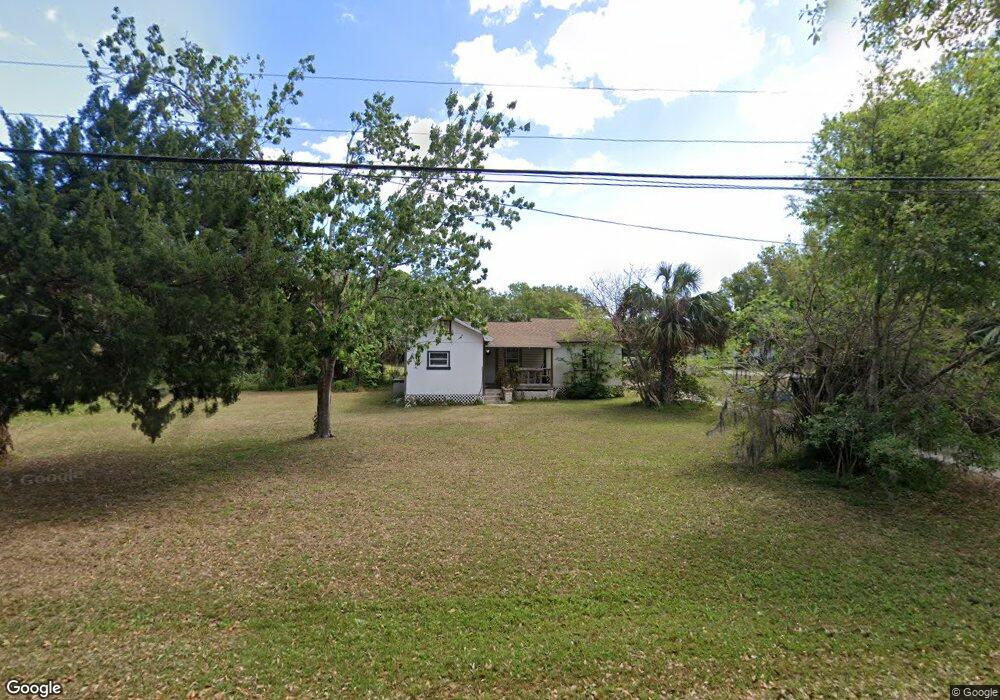
1947 Pioneer Trail New Smyrna Beach, FL 32168
Ellison Acres NeighborhoodEstimated Value: $191,000 - $270,000
3
Beds
2
Baths
1,356
Sq Ft
$174/Sq Ft
Est. Value
About This Home
This home is located at 1947 Pioneer Trail, New Smyrna Beach, FL 32168 and is currently estimated at $236,327, approximately $174 per square foot. 1947 Pioneer Trail is a home located in Volusia County with nearby schools including Read-Pattillo Elementary School, New Smyrna Beach Middle School, and New Smyrna Beach High School.
Ownership History
Date
Name
Owned For
Owner Type
Purchase Details
Closed on
Apr 1, 2013
Sold by
Schonbrun Harvey
Bought by
Baker Lynette
Current Estimated Value
Home Financials for this Owner
Home Financials are based on the most recent Mortgage that was taken out on this home.
Original Mortgage
$53,550
Outstanding Balance
$46,603
Interest Rate
10%
Mortgage Type
Seller Take Back
Estimated Equity
$189,724
Purchase Details
Closed on
Nov 30, 2010
Sold by
Owens Marcus Jerome and Pell Stephanie D
Bought by
Schonbrun Harvey
Purchase Details
Closed on
Mar 27, 2008
Sold by
Owens Marcus Jerome
Bought by
Owens Marcus Jerome and Pell Stephanie D
Purchase Details
Closed on
Apr 15, 1991
Bought by
Baker Lynette
Purchase Details
Closed on
Aug 15, 1972
Bought by
Baker Lynette
Create a Home Valuation Report for This Property
The Home Valuation Report is an in-depth analysis detailing your home's value as well as a comparison with similar homes in the area
Home Values in the Area
Average Home Value in this Area
Purchase History
| Date | Buyer | Sale Price | Title Company |
|---|---|---|---|
| Baker Lynette | $59,500 | None Available | |
| Schonbrun Harvey | -- | Attorney | |
| Owens Marcus Jerome | $4,400 | Southern Title Holding Co | |
| Baker Lynette | $49,900 | -- | |
| Baker Lynette | $3,000 | -- |
Source: Public Records
Mortgage History
| Date | Status | Borrower | Loan Amount |
|---|---|---|---|
| Open | Baker Lynette | $53,550 |
Source: Public Records
Tax History Compared to Growth
Tax History
| Year | Tax Paid | Tax Assessment Tax Assessment Total Assessment is a certain percentage of the fair market value that is determined by local assessors to be the total taxable value of land and additions on the property. | Land | Improvement |
|---|---|---|---|---|
| 2025 | $940 | $96,053 | -- | -- |
| 2024 | $940 | $93,346 | -- | -- |
| 2023 | $940 | $90,628 | $0 | $0 |
| 2022 | $904 | $87,988 | $0 | $0 |
| 2021 | $910 | $85,425 | $0 | $0 |
| 2020 | $891 | $84,246 | $0 | $0 |
| 2019 | $1,019 | $82,352 | $0 | $0 |
| 2018 | $1,115 | $80,816 | $0 | $0 |
| 2017 | $1,079 | $79,154 | $0 | $0 |
| 2016 | $1,072 | $77,526 | $0 | $0 |
| 2015 | $1,091 | $76,987 | $0 | $0 |
| 2014 | $1,076 | $76,376 | $0 | $0 |
Source: Public Records
Map
Nearby Homes
- 2005 Sunny Ln
- 1926 Pioneer Trail
- 1910 Enterprise Ave Unit 17
- 293 Newcomb St
- 265 Newcomb St
- 1818 Enterprise Ave Unit B
- 181 Fox Fire Cir
- 1929 Jungle Rd
- 163 Fox Fire Cir
- 1907 Jungle Rd
- 1941 Jungle Rd
- 211 Mourning Dove Dr
- 701 West St
- 69 Pelican Dr
- 241 Quail Hollow Dr
- 0 Spruce St
- 1219 Wayne Ave
- 56 Pelican Dr
- 2051 Pioneer Trail Unit 32
- 2051 Pioneer Trail Unit 197
- 1951 Pioneer Trail
- 1935 Pioneer Trail
- 1944 Pioneer Trail
- 354 Routh Ave
- 1942 Pioneer Trail
- 1971 Pioneer Trail
- 1956 Pioneer Trail
- 1934 Pioneer Trail
- 369 Routh Ave
- 1977 Pioneer Trail
- 1968 Pioneer Trail
- 1925 Pioneer Trail
- 2006 Debbie St
- 340 Routh Ave
- 2004 Sunny Ln
- 349 Routh Ave
- 2007 Sunny Ln
- 2005 Debbie St
- 326 Routh Ave
- 341 Routh Ave