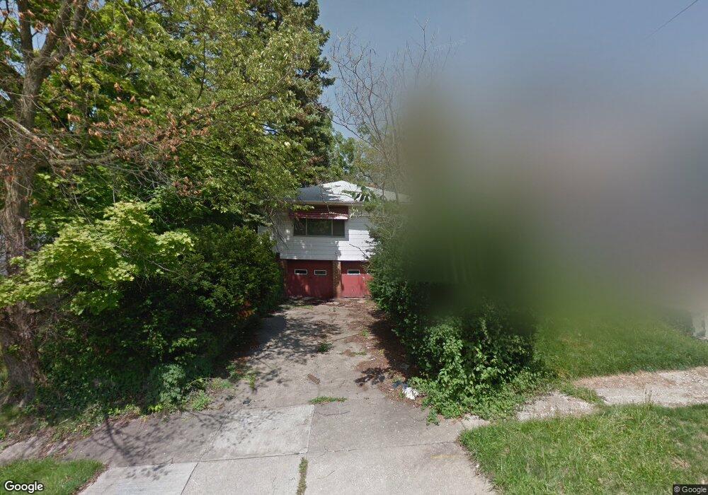
1947 Reyburn Rd Cleveland, OH 44112
Euclid-Green NeighborhoodEstimated Value: $62,286 - $114,000
3
Beds
1
Bath
1,064
Sq Ft
$72/Sq Ft
Est. Value
About This Home
This home is located at 1947 Reyburn Rd, Cleveland, OH 44112 and is currently estimated at $76,572, approximately $71 per square foot. 1947 Reyburn Rd is a home located in Cuyahoga County with nearby schools including Bolton, Anton Grdina School, and Andrew J. Rickoff School.
Ownership History
Date
Name
Owned For
Owner Type
Purchase Details
Closed on
Dec 20, 2019
Sold by
Greater Collinwood Development Corp
Bought by
Kimes Elaine
Current Estimated Value
Purchase Details
Closed on
Dec 6, 2019
Sold by
Cuyahoga County Land Reutilization Corp
Bought by
Greater Collinwood Development Corp
Purchase Details
Closed on
Dec 5, 2019
Sold by
County Of Cuyahoga
Bought by
Cuyahoga County Land Reutilization Corp
Purchase Details
Closed on
Oct 19, 1976
Sold by
Hall James D and Hall Rachel L
Bought by
Riffe John E
Purchase Details
Closed on
Jan 1, 1975
Bought by
Hall James D and Hall Rachel L
Create a Home Valuation Report for This Property
The Home Valuation Report is an in-depth analysis detailing your home's value as well as a comparison with similar homes in the area
Home Values in the Area
Average Home Value in this Area
Purchase History
| Date | Buyer | Sale Price | Title Company |
|---|---|---|---|
| Kimes Elaine | -- | None Available | |
| Greater Collinwood Development Corp | -- | American Title & Trust | |
| Cuyahoga County Land Reutilization Corp | -- | None Available | |
| Riffe John E | $30,700 | -- | |
| Hall James D | -- | -- |
Source: Public Records
Tax History Compared to Growth
Tax History
| Year | Tax Paid | Tax Assessment Tax Assessment Total Assessment is a certain percentage of the fair market value that is determined by local assessors to be the total taxable value of land and additions on the property. | Land | Improvement |
|---|---|---|---|---|
| 2024 | $182 | $12,565 | $3,920 | $8,645 |
| 2023 | $570 | $7,350 | $1,540 | $5,810 |
| 2022 | $567 | $7,350 | $1,540 | $5,810 |
| 2021 | $561 | $7,350 | $1,540 | $5,810 |
| 2020 | $0 | $7,350 | $1,540 | $5,810 |
| 2019 | $924 | $21,000 | $4,400 | $16,600 |
| 2018 | $846 | $7,350 | $1,540 | $5,810 |
| 2017 | $1,452 | $9,380 | $420 | $8,960 |
| 2016 | $768 | $9,380 | $420 | $8,960 |
| 2015 | $2,749 | $9,380 | $420 | $8,960 |
| 2014 | $2,749 | $9,660 | $420 | $9,240 |
Source: Public Records
Map
Nearby Homes
- 2116 Reyburn Rd
- 2121 Alton Rd
- 1875 Lampson Rd
- 2133 Reyburn Rd
- 1816 Lampson Rd
- 1767 Algonac Rd Unit 2
- 1758 Algonac Rd
- 3595 Runnymede Blvd
- 1762 Alcoy Rd
- 1897 Torbenson Dr
- 3609 Langton Rd
- 3511 Randolph Rd
- 16208 Greyton Rd
- 3547 Randolph Rd
- 825 Helmsdale Rd
- 3598 Atherstone Rd
- 3655 Langton Rd
- 833 Nela View Rd
- 841 Helmsdale Rd
- 839 Nela View Rd
- 1951 Reyburn Rd
- 1957 Reyburn Rd
- 1941 Reyburn Rd
- 1950 Haverhill Rd
- 1961 Reyburn Rd
- 1954 Haverhill Rd
- 1937 Reyburn Rd
- 1946 Haverhill Rd
- 1958 Haverhill Rd
- 1942 Haverhill Rd
- 1965 Reyburn Rd
- 1948 Reyburn Rd
- 1952 Reyburn Rd
- 1944 Reyburn Rd
- 1956 Reyburn Rd
- 1962 Haverhill Rd
- 1938 Haverhill Rd
- 1940 Reyburn Rd
- 1960 Reyburn Rd
- 1966 Haverhill Rd