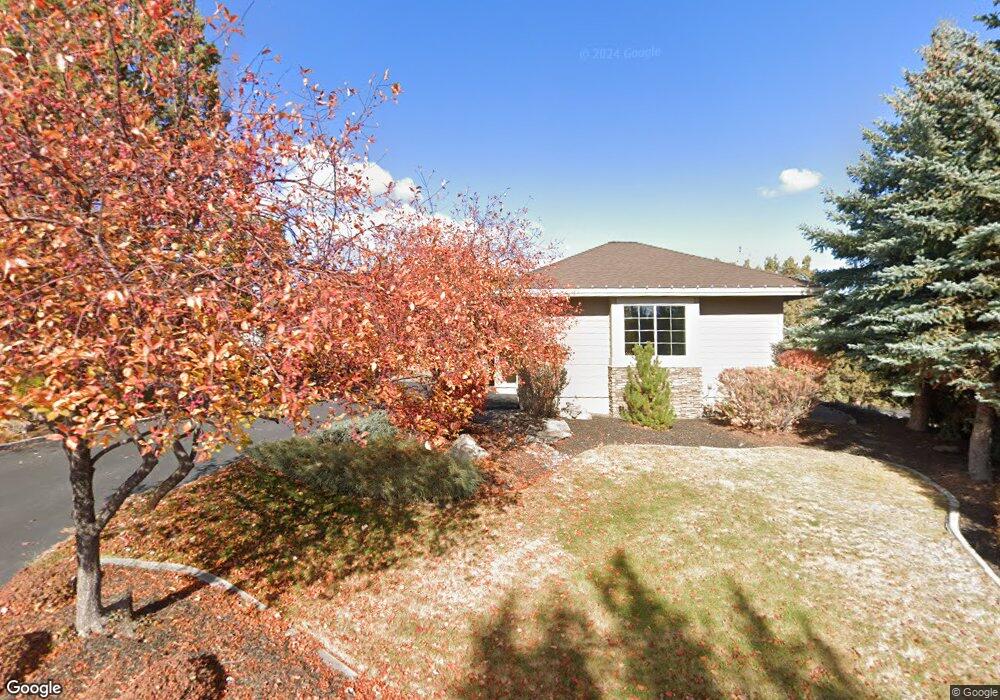
1947 Turnstone Rd Redmond, OR 97756
Estimated Value: $1,043,000 - $1,166,000
3
Beds
3
Baths
2,953
Sq Ft
$378/Sq Ft
Est. Value
About This Home
This home is located at 1947 Turnstone Rd, Redmond, OR 97756 and is currently estimated at $1,114,835, approximately $377 per square foot. 1947 Turnstone Rd is a home located in Deschutes County with nearby schools including Tumalo Community School, Obsidian Middle School, and Ridgeview High School.
Ownership History
Date
Name
Owned For
Owner Type
Purchase Details
Closed on
May 15, 2020
Sold by
Price David and Price Paula J
Bought by
Paula David and Price Paula J
Current Estimated Value
Purchase Details
Closed on
Nov 11, 2011
Sold by
Fusaro Carmon and Fusaro Carolyn
Bought by
Price David and Price Paula J
Home Financials for this Owner
Home Financials are based on the most recent Mortgage that was taken out on this home.
Original Mortgage
$375,000
Outstanding Balance
$253,907
Interest Rate
3.95%
Mortgage Type
New Conventional
Estimated Equity
$860,928
Purchase Details
Closed on
Sep 21, 2005
Sold by
Fusaro Carmon and Fusaro Carolyn
Bought by
Fusaro Carmon and Fusaro Carolyn
Purchase Details
Closed on
Apr 19, 2005
Sold by
Sage Builders Llc
Bought by
Fusaro Carmon and Fusaro Carolyn
Create a Home Valuation Report for This Property
The Home Valuation Report is an in-depth analysis detailing your home's value as well as a comparison with similar homes in the area
Home Values in the Area
Average Home Value in this Area
Purchase History
| Date | Buyer | Sale Price | Title Company |
|---|---|---|---|
| Paula David | -- | None Available | |
| Price David | $500,000 | Amerititle | |
| Fusaro Carmon | -- | Western Title & Escrow Co | |
| Fusaro Carmon | -- | Western Title & Escrow Co | |
| Fusaro Carmon | $531,669 | Western Title & Escrow Co |
Source: Public Records
Mortgage History
| Date | Status | Borrower | Loan Amount |
|---|---|---|---|
| Open | Price David | $375,000 |
Source: Public Records
Tax History Compared to Growth
Tax History
| Year | Tax Paid | Tax Assessment Tax Assessment Total Assessment is a certain percentage of the fair market value that is determined by local assessors to be the total taxable value of land and additions on the property. | Land | Improvement |
|---|---|---|---|---|
| 2025 | $9,532 | $563,670 | -- | -- |
| 2024 | $9,112 | $547,260 | -- | -- |
| 2023 | $8,686 | $531,330 | $0 | $0 |
| 2022 | $7,733 | $500,840 | $0 | $0 |
| 2021 | $7,732 | $486,260 | $0 | $0 |
| 2020 | $7,358 | $486,260 | $0 | $0 |
| 2019 | $7,014 | $472,100 | $0 | $0 |
| 2018 | $6,846 | $458,350 | $0 | $0 |
| 2017 | $6,693 | $445,000 | $0 | $0 |
| 2016 | $6,614 | $432,040 | $0 | $0 |
| 2015 | $6,409 | $419,460 | $0 | $0 |
| 2014 | $6,241 | $407,250 | $0 | $0 |
Source: Public Records
Map
Nearby Homes
- 1937 Turnstone Rd
- 1940 Murrelet Dr
- 8413 Forest Ridge Loop
- 1777 Turnstone Rd
- 1845 Cinnamon Teal Dr
- 8578 Red Wing Ln
- 8811 Cliff Swallow Dr
- 8831 Cliff Swallow Dr
- 8825 SW Canyon Wren Ct
- 8998 Cliff Swallow Dr
- 1612 Prairie Falcon Dr
- 1471 Red Wing Loop
- 1442 Eagle Springs Ct
- 1540 Cinnamon Teal Dr Unit EC3I
- 1540 Cinnamon Teal Dr Unit EC 3E
- 1927 Mountain Quail Dr
- 2315 Linnet Ln
- 1140 Golden Pheasant Dr
- 1084 Golden Pheasant Dr
- 1044 Golden Pheasant Dr
- 1917 Turnstone Rd
- 1946 Turnstone Rd
- 19 Dunlin Ct
- 0 Dunlin Ct
- 1956 Turnstone Rd
- 1967 Turnstone Rd
- 1936 Turnstone Rd
- 1907 Turnstone Rd
- 2262 Dunlin Ct
- 2272 Dunlin Ct
- 1916 Turnstone Rd
- 2254 Crossbill Ct
- 2264 Crossbill Ct
- 1987 Turnstone Rd
- 2274 Crossbill Ct
- 2245 Crossbill Ct
- 2255 Crossbill Ct
- 2255 Crossbill Ct Unit d
- 1997 Turnstone Rd
- 2265 Crossbill Ct