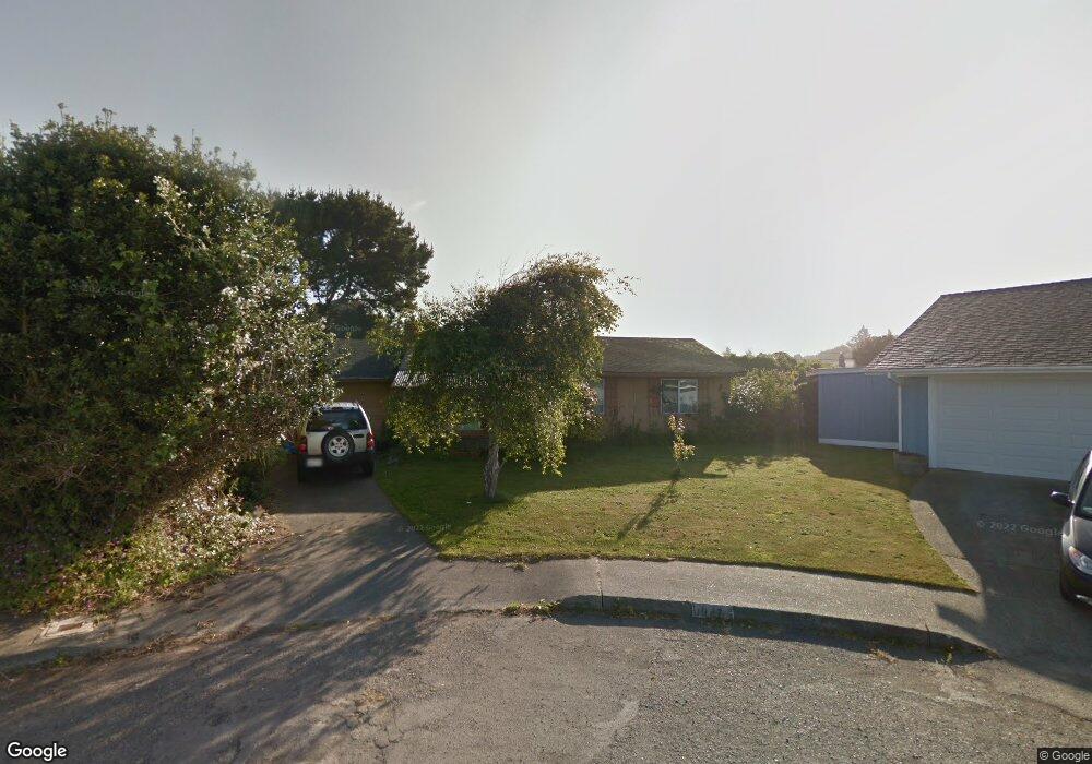
1947 Wavecrest Ave McKinleyville, CA 95519
Estimated Value: $259,000 - $392,000
3
Beds
1
Bath
988
Sq Ft
$345/Sq Ft
Est. Value
About This Home
This home is located at 1947 Wavecrest Ave, McKinleyville, CA 95519 and is currently estimated at $340,915, approximately $345 per square foot. 1947 Wavecrest Ave is a home located in Humboldt County with nearby schools including Morris Elementary School, Dow's Prairie Elementary School, and McKinleyville Middle School.
Ownership History
Date
Name
Owned For
Owner Type
Purchase Details
Closed on
Apr 11, 1997
Sold by
Shurvinton Glenn D and Shurvinton Dorothy J
Bought by
Whitehead Rebecca Jane
Current Estimated Value
Home Financials for this Owner
Home Financials are based on the most recent Mortgage that was taken out on this home.
Original Mortgage
$97,863
Outstanding Balance
$12,620
Interest Rate
7.86%
Mortgage Type
FHA
Estimated Equity
$328,295
Create a Home Valuation Report for This Property
The Home Valuation Report is an in-depth analysis detailing your home's value as well as a comparison with similar homes in the area
Home Values in the Area
Average Home Value in this Area
Purchase History
| Date | Buyer | Sale Price | Title Company |
|---|---|---|---|
| Whitehead Rebecca Jane | $98,500 | First American Title Ins Co |
Source: Public Records
Mortgage History
| Date | Status | Borrower | Loan Amount |
|---|---|---|---|
| Open | Whitehead Rebecca Jane | $97,863 |
Source: Public Records
Tax History Compared to Growth
Tax History
| Year | Tax Paid | Tax Assessment Tax Assessment Total Assessment is a certain percentage of the fair market value that is determined by local assessors to be the total taxable value of land and additions on the property. | Land | Improvement |
|---|---|---|---|---|
| 2025 | $1,880 | $160,034 | $73,277 | $86,757 |
| 2024 | $1,880 | $156,897 | $71,841 | $85,056 |
| 2023 | $1,807 | $153,822 | $70,433 | $83,389 |
| 2022 | $1,814 | $150,806 | $69,052 | $81,754 |
| 2021 | $1,733 | $147,850 | $67,699 | $80,151 |
| 2020 | $1,643 | $146,335 | $67,005 | $79,330 |
| 2019 | $1,631 | $143,467 | $65,692 | $77,775 |
| 2018 | $1,569 | $140,654 | $64,404 | $76,250 |
| 2017 | $1,529 | $137,897 | $63,142 | $74,755 |
| 2016 | $1,502 | $135,194 | $61,904 | $73,290 |
| 2015 | $1,473 | $133,165 | $60,975 | $72,190 |
| 2014 | $1,450 | $130,557 | $59,781 | $70,776 |
Source: Public Records
Map
Nearby Homes
- 1865 Ashdown Ave
- 2070 Thiel Ave
- 2150 Thiel Ave
- 2099 Silkwood St
- 000 Anderson Ave
- 755 Eucalyptus Rd
- 1181 Chelsea Way
- 835 Sweet Pea Ln
- 1472 Gavin (Lot G2) Ln
- 1658/1656 Ascent Place
- 2257 Walnut Ave
- 1090 Murray Rd
- 2822 Sandpointe Dr
- 2911 Sandpointe Dr
- 2951 Sandpointe Dr
- 3002 Sandpointe Dr
- 2910 Springer Dr
- 2937 Springer Dr
- 2580 Central Ave
- 2973 Springer Dr
- 654 Hiller Rd
- 664 Hiller Rd
- 1951 Wavecrest Ave
- 1945 Wavecrest Ave
- 644 Hiller Rd
- 680 Hiller Rd
- 1979 Ashdown Ave
- 1965 Wavecrest Ave
- 1955 Wavecrest Ave
- 1955 Wavecrest Ave
- 634 Hiller Rd
- 1939 Wavecrest Ave
- 702 Hiller Rd
- 1963 Wavecrest Ave
- 1929 Wavecrest Ave
- 622 Hiller Rd
- 1961 Ashdown Ave
- 1969 Wavecrest Ave
- 704 Hiller Rd
- 653 Hiller Rd