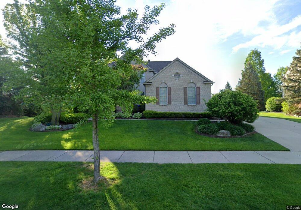
1948 Watson Cir Rochester, MI 48306
Estimated Value: $755,617 - $876,000
4
Beds
5
Baths
3,440
Sq Ft
$244/Sq Ft
Est. Value
About This Home
This home is located at 1948 Watson Cir, Rochester, MI 48306 and is currently estimated at $837,904, approximately $243 per square foot. 1948 Watson Cir is a home located in Oakland County with nearby schools including Hart Middle School, Hugger Elementary School, and Stoney Creek High School.
Ownership History
Date
Name
Owned For
Owner Type
Purchase Details
Closed on
Oct 5, 2010
Sold by
Payne Park A and Payne Sheryl M
Bought by
Bank Of America National Association
Current Estimated Value
Purchase Details
Closed on
Dec 17, 1998
Sold by
Pulte Land Dev Corp
Bought by
Payne Park A
Home Financials for this Owner
Home Financials are based on the most recent Mortgage that was taken out on this home.
Original Mortgage
$370,340
Interest Rate
6.76%
Create a Home Valuation Report for This Property
The Home Valuation Report is an in-depth analysis detailing your home's value as well as a comparison with similar homes in the area
Home Values in the Area
Average Home Value in this Area
Purchase History
| Date | Buyer | Sale Price | Title Company |
|---|---|---|---|
| Bank Of America National Association | $340,000 | None Available | |
| Payne Park A | $90,000 | -- |
Source: Public Records
Mortgage History
| Date | Status | Borrower | Loan Amount |
|---|---|---|---|
| Previous Owner | Payne Park A | $370,340 |
Source: Public Records
Tax History Compared to Growth
Tax History
| Year | Tax Paid | Tax Assessment Tax Assessment Total Assessment is a certain percentage of the fair market value that is determined by local assessors to be the total taxable value of land and additions on the property. | Land | Improvement |
|---|---|---|---|---|
| 2024 | $6,975 | $333,380 | $0 | $0 |
| 2023 | $6,679 | $297,540 | $0 | $0 |
| 2022 | $7,105 | $275,610 | $0 | $0 |
| 2021 | $6,675 | $272,060 | $0 | $0 |
| 2020 | $6,268 | $262,330 | $0 | $0 |
| 2019 | $6,891 | $254,870 | $0 | $0 |
| 2018 | $6,881 | $250,140 | $0 | $0 |
| 2017 | $6,747 | $248,510 | $0 | $0 |
| 2016 | $6,533 | $239,360 | $0 | $0 |
| 2015 | -- | $226,950 | $0 | $0 |
| 2014 | -- | $211,050 | $0 | $0 |
| 2011 | -- | $177,670 | $0 | $0 |
Source: Public Records
Map
Nearby Homes
- 1955 Clearwood Ct Unit 665
- 1983 Dunham Dr
- 1322 Copper Cir Unit 26
- 2156 Willow Cir
- 2423 Buckthorn Dr
- 2583 Barberry Dr
- 2113 Marissa Way Unit 99
- 54673 Marissa Way Unit 93
- 1985 Monarch Dr Unit 7
- 2632 Hawthorne Dr S
- 628 Springview Dr Unit 120
- 2282 Kingscross Dr
- 6230 Winkler Mill Rd
- 54782 Whitby Way
- 1600 Mill Race
- 54660 Whitby Way
- 674 Springview Dr
- 620 Appoline Ct
- 2239 Regency Hills Dr
- 877 Quarry
- 1936 Watson Cir
- 1960 Watson Cir
- 1216 Miners Run
- 1222 Miners Run
- 1210 Miners Run
- 1935 Watson Cir
- 1945 Catlin Dr
- 1966 Watson Cir
- 1930 Watson Cir
- 1957 Catlin Dr
- 1959 Watson Cir
- 1204 Miners Run
- 1939 Catlin Dr
- 1215 Miners Run
- 1977 Watson Cir
- 1219 Miners Run
- 1978 Watson Cir
- 1209 Miners Run
- 1198 Miners Run
- 1283 Miners Run