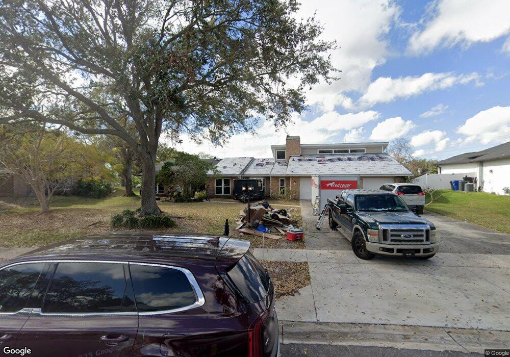
1949 Cove Ln Clearwater, FL 33764
Estimated Value: $845,725 - $1,080,000
5
Beds
3
Baths
3,437
Sq Ft
$273/Sq Ft
Est. Value
About This Home
This home is located at 1949 Cove Ln, Clearwater, FL 33764 and is currently estimated at $938,181, approximately $272 per square foot. 1949 Cove Ln is a home located in Pinellas County with nearby schools including Belcher Elementary School, Largo High School, and Oak Grove Middle School.
Ownership History
Date
Name
Owned For
Owner Type
Purchase Details
Closed on
Jan 7, 2015
Sold by
Friedman Mark D
Bought by
Colon Brian M and Colon Sarah Anna
Current Estimated Value
Home Financials for this Owner
Home Financials are based on the most recent Mortgage that was taken out on this home.
Original Mortgage
$403,750
Outstanding Balance
$310,845
Interest Rate
3.98%
Mortgage Type
New Conventional
Estimated Equity
$627,336
Purchase Details
Closed on
Jun 30, 2009
Sold by
Friedman Mark D
Bought by
Bar Joseph Dan and Bar Joseph Maria
Purchase Details
Closed on
Jun 11, 2002
Sold by
Pentlarge Victor H
Bought by
Pentlarge Victor H Trust
Purchase Details
Closed on
Mar 1, 1996
Sold by
Mccall Thomas V and Mccall Elizabeth R
Bought by
Mccall Anthony T
Create a Home Valuation Report for This Property
The Home Valuation Report is an in-depth analysis detailing your home's value as well as a comparison with similar homes in the area
Home Values in the Area
Average Home Value in this Area
Purchase History
| Date | Buyer | Sale Price | Title Company |
|---|---|---|---|
| Colon Brian M | $425,000 | Star Title Partners Of Palm | |
| Bar Joseph Dan | $150,000 | Attorney | |
| Pentlarge Victor H Trust | -- | -- | |
| Mccall Anthony T | -- | -- |
Source: Public Records
Mortgage History
| Date | Status | Borrower | Loan Amount |
|---|---|---|---|
| Open | Colon Brian M | $403,750 | |
| Previous Owner | Mccall Anthony T | $40,021 |
Source: Public Records
Tax History Compared to Growth
Tax History
| Year | Tax Paid | Tax Assessment Tax Assessment Total Assessment is a certain percentage of the fair market value that is determined by local assessors to be the total taxable value of land and additions on the property. | Land | Improvement |
|---|---|---|---|---|
| 2024 | $6,998 | $424,545 | -- | -- |
| 2023 | $6,998 | $412,180 | $0 | $0 |
| 2022 | $6,812 | $400,175 | $0 | $0 |
| 2021 | $6,910 | $388,519 | $0 | $0 |
| 2020 | $6,908 | $383,155 | $0 | $0 |
| 2019 | $6,792 | $374,541 | $0 | $0 |
| 2018 | $6,742 | $367,557 | $0 | $0 |
| 2017 | $6,686 | $359,997 | $0 | $0 |
| 2016 | $6,518 | $352,593 | $0 | $0 |
| 2015 | $6,560 | $356,914 | $0 | $0 |
| 2014 | $5,648 | $286,415 | $0 | $0 |
Source: Public Records
Map
Nearby Homes
- 1670 Fox Rd
- 1849 Del Robles Dr
- 1950 Arvis Cir W
- 1954 Arvis Cir W
- 2015 Belleair Rd
- 1948 Belleair Rd
- 1681 Long Bow Ln
- 1978 Arvis Cir W
- 1857 Belleair Rd
- 1880 Belleair Rd
- 3119 Roberta St
- 2168 Waterside Dr
- 1560 Bel Keene Dr
- 2146 Egret Dr
- 947 Sousa Dr
- 1012 Irene Ave
- 2156 Egret Dr
- 2186 Waterside Dr
- 853 Seacrest Dr
- 1466 S Hercules Ave