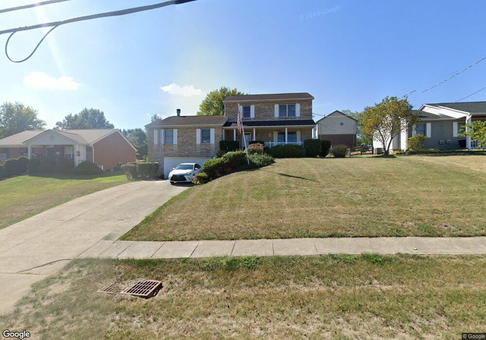
1949 Independence Rd Independence, KY 41051
Estimated Value: $336,000 - $379,000
4
Beds
3
Baths
2,370
Sq Ft
$149/Sq Ft
Est. Value
About This Home
This home is located at 1949 Independence Rd, Independence, KY 41051 and is currently estimated at $352,418, approximately $148 per square foot. 1949 Independence Rd is a home located in Kenton County with nearby schools including Kenton Elementary School, Twenhofel Middle School, and Simon Kenton High School.
Ownership History
Date
Name
Owned For
Owner Type
Purchase Details
Closed on
Mar 25, 2015
Sold by
Mullen Kenneth W and Mullen Patricia
Bought by
The Taylor Mill Pentecostal Church Incor
Current Estimated Value
Home Financials for this Owner
Home Financials are based on the most recent Mortgage that was taken out on this home.
Original Mortgage
$90,000
Outstanding Balance
$69,063
Interest Rate
3.89%
Mortgage Type
Future Advance Clause Open End Mortgage
Estimated Equity
$283,355
Purchase Details
Closed on
Aug 22, 2005
Sold by
Walton Patricia A
Bought by
Ggm Properties Inc
Purchase Details
Closed on
Feb 15, 2001
Sold by
Estenfelder John M
Bought by
Mullen Kenneth W and Mullen Patricia
Home Financials for this Owner
Home Financials are based on the most recent Mortgage that was taken out on this home.
Original Mortgage
$90,000
Interest Rate
7.03%
Mortgage Type
New Conventional
Create a Home Valuation Report for This Property
The Home Valuation Report is an in-depth analysis detailing your home's value as well as a comparison with similar homes in the area
Home Values in the Area
Average Home Value in this Area
Purchase History
| Date | Buyer | Sale Price | Title Company |
|---|---|---|---|
| The Taylor Mill Pentecostal Church Incor | $171,000 | Prominent Title Agency Llc | |
| Ggm Properties Inc | -- | None Available | |
| Mullen Kenneth W | $137,000 | -- |
Source: Public Records
Mortgage History
| Date | Status | Borrower | Loan Amount |
|---|---|---|---|
| Open | The Taylor Mill Pentecostal Church Incor | $90,000 | |
| Previous Owner | Mullen Kenneth W | $90,000 |
Source: Public Records
Tax History
| Year | Tax Paid | Tax Assessment Tax Assessment Total Assessment is a certain percentage of the fair market value that is determined by local assessors to be the total taxable value of land and additions on the property. | Land | Improvement |
|---|---|---|---|---|
| 2025 | -- | $283,600 | $35,000 | $248,600 |
| 2024 | -- | $200,900 | $30,000 | $170,900 |
| 2023 | $70 | $200,900 | $30,000 | $170,900 |
| 2022 | $75 | $200,900 | $30,000 | $170,900 |
| 2021 | $75 | $200,900 | $30,000 | $170,900 |
| 2020 | $75 | $171,000 | $30,000 | $141,000 |
| 2019 | $75 | $171,000 | $30,000 | $141,000 |
| 2018 | $75 | $171,000 | $30,000 | $141,000 |
| 2017 | $75 | $171,000 | $30,000 | $141,000 |
| 2015 | $1,937 | $171,000 | $30,000 | $141,000 |
| 2014 | $1,468 | $150,700 | $30,000 | $120,700 |
Source: Public Records
Map
Nearby Homes
- 5261 Millcreek Cir
- 2033 Flintwood Ct
- 6500 Julia Meadow
- 10737 Cypresswood Dr
- 2144 Hartland Blvd
- 10434 Sharpsburg Dr
- 2037 Patriot Way
- 1247 Monocacy Ct
- 64 Sherwood Dr
- 8382 Greenmere Cir
- 10362 Petersburg Ct
- 1217 Cannonball Way
- 1197 Catletts Ct
- 10422 Flintrock Bluff
- 10529 Greenbrook Dr
- 1365 Cairns Ct
- 9971 Meadow Glen Dr
- 10363 Canberra Dr
- 93 Roselawn Dr
- 1436 Rosewynne Way
- 1945 Independence Rd
- 1953 Independence Rd
- 9005 Supreme Ct
- 1957 Independence Rd
- 1922 Appeals Ct
- 8991 Supreme Ct
- 1948 Independence Rd
- 9009 Supreme Ct
- 1941 Independence Rd
- 1961 Independence Rd
- 1924 Appeals Ct
- 8987 Supreme Ct
- 9004 Supreme Ct
- 8990 Supreme Ct
- 8990 Supreme Ct Unit 8972
- 8990 Supreme Ct Unit 92
- 1935 Independence Rd
- 1926 Appeals Ct
- 9008 Supreme Ct
- 1958 Independence Rd
Your Personal Tour Guide
Ask me questions while you tour the home.