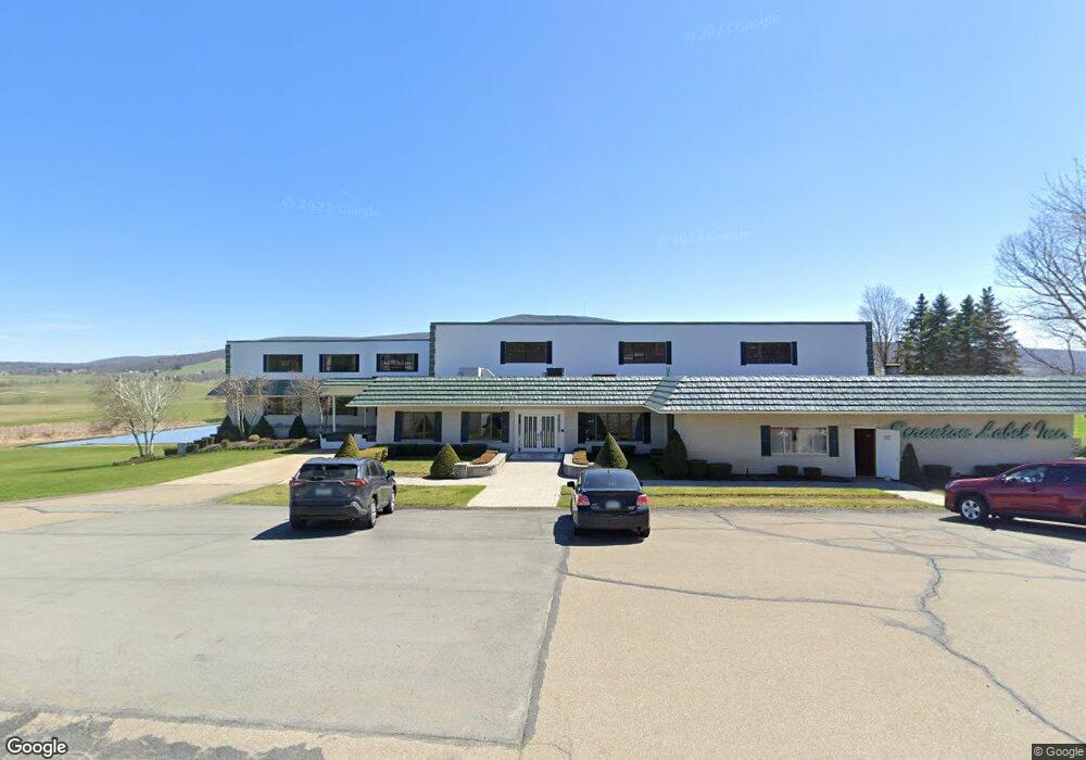
1949 Newton Ransom Blvd Clarks Summit, PA 18411
Estimated Value: $220,000 - $406,000
--
Bed
--
Bath
--
Sq Ft
5.89
Acres
About This Home
This home is located at 1949 Newton Ransom Blvd, Clarks Summit, PA 18411 and is currently estimated at $331,667. 1949 Newton Ransom Blvd is a home located in Lackawanna County with nearby schools including Abington Heights High School.
Ownership History
Date
Name
Owned For
Owner Type
Purchase Details
Closed on
Feb 24, 2023
Sold by
Carr Kevin J
Bought by
Conaboy Richard L
Current Estimated Value
Purchase Details
Closed on
Jan 5, 2023
Sold by
Carr Kevin J
Bought by
Carr Kevin J
Purchase Details
Closed on
Nov 24, 2009
Sold by
First National Community Bank
Bought by
Carr Edmund J
Purchase Details
Closed on
Feb 12, 2009
Sold by
Conaboy Conan J and Conaboy Theresa
Bought by
First National Community Bank
Create a Home Valuation Report for This Property
The Home Valuation Report is an in-depth analysis detailing your home's value as well as a comparison with similar homes in the area
Home Values in the Area
Average Home Value in this Area
Purchase History
| Date | Buyer | Sale Price | Title Company |
|---|---|---|---|
| Conaboy Richard L | $38,176 | -- | |
| Carr Kevin J | -- | -- | |
| Carr Edmund J | $102,500 | None Available | |
| First National Community Bank | -- | None Available |
Source: Public Records
Tax History Compared to Growth
Tax History
| Year | Tax Paid | Tax Assessment Tax Assessment Total Assessment is a certain percentage of the fair market value that is determined by local assessors to be the total taxable value of land and additions on the property. | Land | Improvement |
|---|---|---|---|---|
| 2025 | $5,112 | $21,000 | $5,000 | $16,000 |
| 2024 | $4,221 | $21,000 | $5,000 | $16,000 |
| 2023 | $4,221 | $21,000 | $5,000 | $16,000 |
| 2022 | $4,133 | $21,000 | $5,000 | $16,000 |
| 2021 | $4,133 | $21,000 | $5,000 | $16,000 |
| 2020 | $4,133 | $21,000 | $5,000 | $16,000 |
| 2019 | $3,997 | $21,000 | $5,000 | $16,000 |
| 2018 | $3,960 | $21,000 | $5,000 | $16,000 |
| 2017 | $3,939 | $21,000 | $5,000 | $16,000 |
| 2016 | $2,523 | $21,000 | $5,000 | $16,000 |
| 2015 | -- | $21,000 | $5,000 | $16,000 |
| 2014 | -- | $21,000 | $5,000 | $16,000 |
Source: Public Records
Map
Nearby Homes
- 1932 Newton Ransom Blvd
- 2441 Milwaukee Rd
- 0 Milwaukee Rd Unit GSBSC254290
- 2225 Cherry Hill Rd
- 10 Bald Mt Rd
- 1736 Falls Rd
- 2694 Ransom Rd
- 0 Blvd
- 2352 Newton Ransom Blvd
- 2500 Falls Rd
- 2356 Newton Ransom Blvd
- 3018 Main St
- 0 Spring & Red Oak Dr Unit GSBSC1753
- 3061 Main St
- 1502 Forest Acres Dr
- 314 Terrace Ave
- 9 Circle Dr
- 9119 Valley View Dr
- 162 Highland Rd
- 52 Ivywood Dr Unit L 6
- 1949 Newton Ransom Blvd
- 1949 Newton Ransom Blvd
- 1949 Newton Ransom Blvd
- 1949 Newton Ransom Blvd
- 1951 Newton Ransom Blvd
- 1959 Newton Ransom Blvd
- 1966 Newton Ransom Blvd
- 1950 Newton Ransom Blvd
- 1952 Newton Ransom Blvd
- 1952 Newton Ransom Blvd
- 1953 Newton Ransom Blvd
- 1941 Newton Ransom Blvd
- 2024 Newton Ransom Blvd
- 104 Thompson Farms Rd
- 1972 Newton Ransom Blvd
- 101 Thompson Farms Rd
- 114 Thompson Farms Rd
- 102 Thompson Farms Rd
- 1936 Newton Ransom Blvd
- 1936 Newton Ransom Blvd