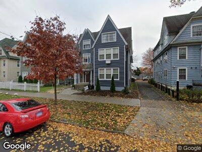
1949 North Ave Unit 1953 Bridgeport, CT 06604
West End-West Side NeighborhoodEstimated Value: $557,126 - $732,000
9
Beds
3
Baths
5,280
Sq Ft
$122/Sq Ft
Est. Value
About This Home
This home is located at 1949 North Ave Unit 1953, Bridgeport, CT 06604 and is currently estimated at $646,032, approximately $122 per square foot. 1949 North Ave Unit 1953 is a home located in Fairfield County with nearby schools including Cesar Batalla School, Bassick High School, and Catholic Academy of Bridgeport-St. Raphael Academy.
Ownership History
Date
Name
Owned For
Owner Type
Purchase Details
Closed on
Aug 21, 2002
Sold by
Vita Peter N and Vita Maureen
Bought by
Dorelus Josue and Dorelus Marie J
Current Estimated Value
Create a Home Valuation Report for This Property
The Home Valuation Report is an in-depth analysis detailing your home's value as well as a comparison with similar homes in the area
Home Values in the Area
Average Home Value in this Area
Purchase History
| Date | Buyer | Sale Price | Title Company |
|---|---|---|---|
| Dorelus Josue | $296,000 | -- | |
| Dorelus Josue | $296,000 | -- |
Source: Public Records
Mortgage History
| Date | Status | Borrower | Loan Amount |
|---|---|---|---|
| Open | Dorelus Josue | $114,558 | |
| Open | Dorelus Josue | $407,015 | |
| Closed | Dorelus Josue | $382,500 | |
| Closed | Dorelus Josue | $314,000 |
Source: Public Records
Tax History Compared to Growth
Tax History
| Year | Tax Paid | Tax Assessment Tax Assessment Total Assessment is a certain percentage of the fair market value that is determined by local assessors to be the total taxable value of land and additions on the property. | Land | Improvement |
|---|---|---|---|---|
| 2024 | $9,993 | $229,979 | $42,169 | $187,810 |
| 2023 | $9,993 | $229,979 | $42,169 | $187,810 |
| 2022 | $9,993 | $229,979 | $42,169 | $187,810 |
| 2021 | $9,993 | $229,979 | $42,169 | $187,810 |
| 2020 | $9,226 | $170,880 | $14,690 | $156,190 |
| 2019 | $9,226 | $170,880 | $14,690 | $156,190 |
| 2018 | $9,291 | $170,880 | $14,690 | $156,190 |
| 2017 | $9,291 | $170,880 | $14,690 | $156,190 |
| 2016 | $9,291 | $170,880 | $14,690 | $156,190 |
| 2015 | $9,671 | $229,170 | $22,410 | $206,760 |
| 2014 | $9,671 | $229,170 | $22,410 | $206,760 |
Source: Public Records
Map
Nearby Homes
- 501 Pequonnock St
- 64-66 Maplewood Ave
- 599 Laurel Ave
- 2370 North Ave Unit 12G
- 2370 North Ave Unit 6A
- 2370 North Ave Unit 10A
- 2370 North Ave Unit 9D
- 2370 North Ave Unit 5A
- 2370 North Ave Unit 9G
- 485 Laurel Ave
- 265 Olive St
- 128 Bancroft Ave
- 393 Laurel Ave Unit 409
- 59-61 Grove St
- 1057 Briarwood Ave
- 40 Rosedale St
- 224 Denver Ave Unit 226
- 276 Pequonnock St
- 127 Jones Ave
- 1169 Iranistan Ave
- 1949 North Ave Unit 1953
- 1959 North Ave Unit 1963
- 1959 North Ave Unit 2
- 1969 North Ave Unit 1971
- 1929 North Ave
- 1958 North Ave Unit 1960
- 1958 North Ave Unit 2
- 204 Beechwood Ave Unit F
- 204 Beechwood Ave Unit E
- 204 Beechwood Ave Unit D
- 204 Beechwood Ave Unit C
- 204 Beechwood Ave Unit B
- 204 Beechwood Ave Unit A
- 206 Beechwood Ave Unit G
- 206 Beechwood Ave Unit F
- 206 Beechwood Ave Unit E
- 206 Beechwood Ave Unit D
- 206 Beechwood Ave Unit C
- 206 Beechwood Ave Unit B
- 206 Beechwood Ave Unit A