Estimated Value: $386,000 - $508,000
3
Beds
2
Baths
1,680
Sq Ft
$275/Sq Ft
Est. Value
About This Home
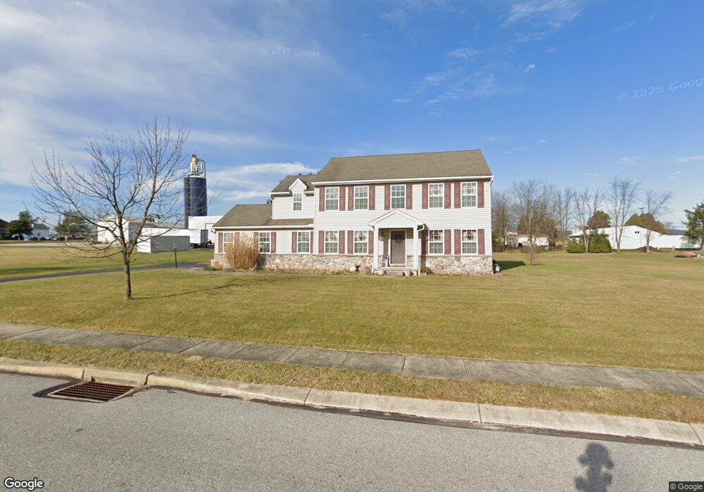
This home is located at 195 Autumnwood Ave, York, PA 17404 and is currently estimated at $461,176, approximately $274 per square foot. 195 Autumnwood Ave is a home located in York County with nearby schools including Northeastern Senior High School, Bible Baptist Christian Academy, and Christian School of York.
Ownership History
Date
Name
Owned For
Owner Type
Purchase Details
Closed on
Nov 15, 2010
Sold by
Ellwood Llc
Bought by
Keller Larry Y and Keller Eleanor G
Current Estimated Value
Home Financials for this Owner
Home Financials are based on the most recent Mortgage that was taken out on this home.
Original Mortgage
$268,256
Outstanding Balance
$176,811
Interest Rate
4.25%
Mortgage Type
FHA
Estimated Equity
$284,365
Purchase Details
Closed on
Aug 18, 2010
Sold by
Stewartstown Cornerstone Limited Partner
Bought by
Ellwood Llc
Create a Home Valuation Report for This Property
The Home Valuation Report is an in-depth analysis detailing your home's value as well as a comparison with similar homes in the area
Home Values in the Area
Average Home Value in this Area
Purchase History
| Date | Buyer | Sale Price | Title Company |
|---|---|---|---|
| Keller Larry Y | $271,870 | None Available | |
| Ellwood Llc | $66,000 | None Available |
Source: Public Records
Mortgage History
| Date | Status | Borrower | Loan Amount |
|---|---|---|---|
| Open | Keller Larry Y | $268,256 |
Source: Public Records
Tax History Compared to Growth
Tax History
| Year | Tax Paid | Tax Assessment Tax Assessment Total Assessment is a certain percentage of the fair market value that is determined by local assessors to be the total taxable value of land and additions on the property. | Land | Improvement |
|---|---|---|---|---|
| 2025 | $8,102 | $225,440 | $70,070 | $155,370 |
| 2024 | $7,920 | $225,440 | $70,070 | $155,370 |
| 2023 | $7,920 | $225,440 | $70,070 | $155,370 |
| 2022 | $7,870 | $225,440 | $70,070 | $155,370 |
| 2021 | $7,654 | $225,440 | $70,070 | $155,370 |
| 2020 | $7,654 | $225,440 | $70,070 | $155,370 |
| 2019 | $7,552 | $225,440 | $70,070 | $155,370 |
| 2018 | $7,516 | $225,440 | $70,070 | $155,370 |
| 2017 | $7,516 | $225,440 | $70,070 | $155,370 |
| 2016 | $0 | $225,440 | $70,070 | $155,370 |
| 2015 | -- | $225,440 | $70,070 | $155,370 |
| 2014 | -- | $225,440 | $70,070 | $155,370 |
Source: Public Records
Map
Nearby Homes
- 640 E Canal Rd
- 433 Waldorf Dr
- 115 Hickory Ridge Cir
- GALEN Plan at Fox Run Heights
- HENLEY Plan at Fox Run Heights
- PENWELL Plan at Fox Run Heights
- NEUVILLE Plan at Fox Run Heights
- 120 Grantway Dr
- 270 Hickory Ridge Cir
- 170 Bella Dr
- 160 Bella Dr
- 180 Bella Dr
- 175 Bella Dr
- 195 Bella Dr
- 135 Amber Ln
- 190 Bella Dr
- Griffin Plan at Sagebrook
- Wynn Plan at Sagebrook
- Maeve II Plan at Sagebrook
- Maeve Plan at Sagebrook
- 185 Autumnwood Ave
- 190 Autumnwood Ave
- 1845 Mill Creek Rd
- 130 Nursery Ln
- 1850 Mill Creek Rd
- 175 Autumnwood Ave
- 1840 Mill Creek Rd
- 170 Autumnwood Ave
- 120 Nursery Ln
- 1870 Mill Creek Rd
- 115 Nursery Ln
- 1800 Mill Creek Rd
- 1810 Mill Creek Rd
- 699 E Canal Rd
- 1755 Mill Creek Rd
- 1755 Mill Creek Rd
- 160 Autumnwood Ave
- 1760 Mill Creek Rd
- 95 Nursery Ln
- 645 E Canal Rd