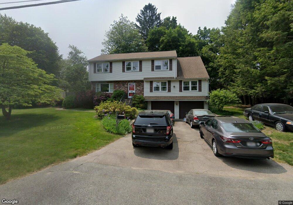
195 Fairbanks Rd Dedham, MA 02026
Oakdale NeighborhoodEstimated Value: $973,000 - $1,023,000
4
Beds
3
Baths
2,534
Sq Ft
$396/Sq Ft
Est. Value
About This Home
This home is located at 195 Fairbanks Rd, Dedham, MA 02026 and is currently estimated at $1,002,763, approximately $395 per square foot. 195 Fairbanks Rd is a home located in Norfolk County with nearby schools including Oakdale Elementary School, Dedham Middle School, and Dedham High School.
Create a Home Valuation Report for This Property
The Home Valuation Report is an in-depth analysis detailing your home's value as well as a comparison with similar homes in the area
Home Values in the Area
Average Home Value in this Area
Tax History
| Year | Tax Paid | Tax Assessment Tax Assessment Total Assessment is a certain percentage of the fair market value that is determined by local assessors to be the total taxable value of land and additions on the property. | Land | Improvement |
|---|---|---|---|---|
| 2025 | $11,629 | $921,500 | $383,300 | $538,200 |
| 2024 | $11,323 | $905,800 | $352,800 | $553,000 |
| 2023 | $10,363 | $807,100 | $327,500 | $479,600 |
| 2022 | $9,623 | $720,800 | $299,600 | $421,200 |
| 2021 | $9,242 | $676,100 | $299,600 | $376,500 |
| 2020 | $9,195 | $670,200 | $286,900 | $383,300 |
| 2019 | $8,770 | $619,800 | $260,300 | $359,500 |
| 2018 | $8,654 | $594,800 | $235,300 | $359,500 |
| 2017 | $8,362 | $566,500 | $226,100 | $340,400 |
| 2016 | $8,423 | $543,800 | $201,000 | $342,800 |
| 2015 | $8,489 | $534,900 | $196,000 | $338,900 |
| 2014 | $8,315 | $517,100 | $196,000 | $321,100 |
Source: Public Records
Map
Nearby Homes
Your Personal Tour Guide
Ask me questions while you tour the home.