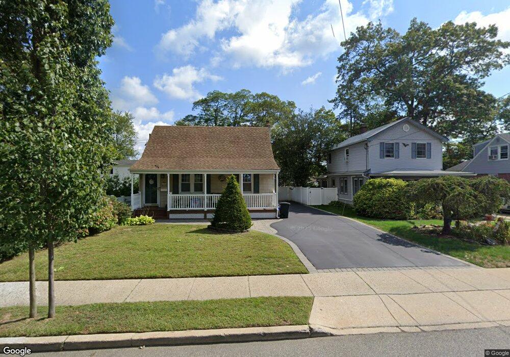
195 Livingston Ave Babylon, NY 11702
Estimated Value: $601,442 - $755,000
--
Bed
--
Bath
1,434
Sq Ft
$485/Sq Ft
Est. Value
About This Home
This home is located at 195 Livingston Ave, Babylon, NY 11702 and is currently estimated at $695,361, approximately $484 per square foot. 195 Livingston Ave is a home located in Suffolk County with nearby schools including Babylon Elementary School, Babylon Memorial Grade School, and Babylon High School.
Ownership History
Date
Name
Owned For
Owner Type
Purchase Details
Closed on
Sep 4, 2009
Sold by
Moleski Ruth E Peter J Jr,Patrici
Bought by
Alveari Ernest
Current Estimated Value
Home Financials for this Owner
Home Financials are based on the most recent Mortgage that was taken out on this home.
Original Mortgage
$295,000
Outstanding Balance
$193,809
Interest Rate
5.28%
Mortgage Type
Purchase Money Mortgage
Estimated Equity
$501,552
Purchase Details
Closed on
Apr 18, 2001
Sold by
Moleski Ruth E
Bought by
Moleski Peter J and Moleski Patricia J
Purchase Details
Closed on
Apr 11, 1995
Sold by
Mele Joel C
Bought by
Moleski Peter J and Moleski Ruth E
Create a Home Valuation Report for This Property
The Home Valuation Report is an in-depth analysis detailing your home's value as well as a comparison with similar homes in the area
Home Values in the Area
Average Home Value in this Area
Purchase History
| Date | Buyer | Sale Price | Title Company |
|---|---|---|---|
| Alveari Ernest | $345,000 | Justin Angelino | |
| Moleski Peter J | -- | Fidelity National Title Ins | |
| Moleski Peter J | -- | Commonwealth Land Title Ins | |
| Moleski Peter J | -- | Fidelity National Title Ins | |
| Moleski Peter J | $120,000 | Commonwealth Land Title Ins |
Source: Public Records
Mortgage History
| Date | Status | Borrower | Loan Amount |
|---|---|---|---|
| Open | Alveari Ernest | $295,000 |
Source: Public Records
Tax History Compared to Growth
Tax History
| Year | Tax Paid | Tax Assessment Tax Assessment Total Assessment is a certain percentage of the fair market value that is determined by local assessors to be the total taxable value of land and additions on the property. | Land | Improvement |
|---|---|---|---|---|
| 2024 | $12,645 | $3,760 | $240 | $3,520 |
| 2023 | $11,304 | $3,760 | $240 | $3,520 |
| 2022 | $8,554 | $3,760 | $240 | $3,520 |
| 2021 | $8,554 | $3,760 | $240 | $3,520 |
| 2020 | $10,039 | $3,350 | $240 | $3,110 |
| 2019 | $10,020 | $0 | $0 | $0 |
| 2018 | $8,638 | $3,350 | $240 | $3,110 |
| 2017 | $8,638 | $3,350 | $240 | $3,110 |
| 2016 | $8,553 | $3,350 | $240 | $3,110 |
| 2015 | -- | $3,350 | $240 | $3,110 |
| 2014 | -- | $3,350 | $240 | $3,110 |
Source: Public Records
Map
Nearby Homes
- 91 Beverly Rd
- 157 Cadman Ave
- 104 Frederick Ave
- 461 Ann St
- 104 Ralph Ave
- 219 Litchfield Ave
- 79 Woodrow Pkwy
- 6 Waltie Ct
- 5 Lime Ct
- 29 Bailey Ave
- 144 Woodrow Pkwy
- 4 Lime Ct
- 102 Park Ave
- 7 Bailey Ave
- 204 Millard Ave Unit 204
- 162 Millard Ave Unit 162
- 246 Locust Ave
- 252 Locust Ave
- 5 Petersen Ct Unit 5
- 227 N Railroad Ave
- 191 Livingston Ave
- 199 Livingston Ave
- 185 Livingston Ave
- 201 Livingston Ave
- 181 Livingston Ave
- 188 Ralph Ave
- 190 Ralph Ave
- 184 Ralph Ave
- 190 Livingston Ave
- 177 Livingston Ave
- 196 Livingston Ave
- 192 Ralph Ave
- 186 Livingston Ave
- 180 Livingston Ave
- 174 Ralph Ave
- 215 Livingston Ave
- 171 Livingston Ave
- 69 Beverly Rd
- 208 Ralph Ave
- 95 Beverly Rd