Estimated Value: $318,000 - $430,000
--
Bed
--
Bath
1,848
Sq Ft
$201/Sq Ft
Est. Value
About This Home
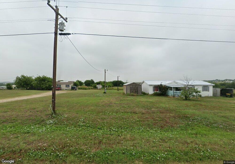
This home is located at 195 Prairie Trail Unit 4721, Rhome, TX 76078 and is currently estimated at $371,862, approximately $201 per square foot. 195 Prairie Trail Unit 4721 is a home located in Wise County with nearby schools including Decatur High School.
Ownership History
Date
Name
Owned For
Owner Type
Purchase Details
Closed on
Nov 28, 2006
Sold by
Collins Debbie
Bought by
Collins Barry Dale
Current Estimated Value
Home Financials for this Owner
Home Financials are based on the most recent Mortgage that was taken out on this home.
Original Mortgage
$65,000
Outstanding Balance
$38,991
Interest Rate
6.37%
Estimated Equity
$332,871
Purchase Details
Closed on
Aug 4, 1999
Sold by
Collins Barry Dale
Bought by
Collins Barry Dale
Purchase Details
Closed on
Jan 1, 1901
Bought by
Collins Barry Dale
Create a Home Valuation Report for This Property
The Home Valuation Report is an in-depth analysis detailing your home's value as well as a comparison with similar homes in the area
Home Values in the Area
Average Home Value in this Area
Purchase History
| Date | Buyer | Sale Price | Title Company |
|---|---|---|---|
| Collins Barry Dale | -- | None Available | |
| Collins Barry Dale | -- | -- | |
| Collins Barry Dale | -- | -- |
Source: Public Records
Mortgage History
| Date | Status | Borrower | Loan Amount |
|---|---|---|---|
| Open | Collins Barry Dale | $65,000 |
Source: Public Records
Tax History Compared to Growth
Tax History
| Year | Tax Paid | Tax Assessment Tax Assessment Total Assessment is a certain percentage of the fair market value that is determined by local assessors to be the total taxable value of land and additions on the property. | Land | Improvement |
|---|---|---|---|---|
| 2025 | $577 | $257,277 | -- | -- |
| 2024 | $577 | $233,888 | $0 | $0 |
| 2023 | $2,967 | $212,625 | $0 | $0 |
| 2022 | $3,249 | $193,295 | $0 | $0 |
| 2021 | $3,285 | $175,730 | $70,000 | $105,730 |
| 2020 | $3,146 | $172,560 | $70,000 | $102,560 |
| 2019 | $3,127 | $168,420 | $70,000 | $98,420 |
| 2018 | $2,819 | $159,330 | $62,500 | $96,830 |
| 2017 | $2,563 | $136,180 | $52,500 | $83,680 |
| 2016 | $2,290 | $121,980 | $45,000 | $76,980 |
| 2015 | -- | $125,550 | $47,500 | $78,050 |
| 2014 | -- | $126,190 | $47,500 | $78,690 |
Source: Public Records
Map
Nearby Homes
- 173 Prairie Trail
- 146 Ridge Trail
- 220 Coyote Trail
- 276 Coyote Trail
- 308 Coyote Trail
- 279 Ridge Trail
- 175 Private Road 4420
- 234 Private Road 4441
- 414 County Road 4421
- 279 Private Road 4418
- 249 Private Road 4434
- 510 Chisholm Hills Dr
- 5090 Fm 2264
- 109 Hawkins Way
- 461 Lange Way
- 237 Chisholm Hills Dr
- 336 Wilson Ct
- TBD Branding Iron Rd
- 135 Branding Iron Rd
- 268 Hilltop Trail
- 195 Prairie Trail Unit 4436
- 195 Prairie Trail Unit 3496
- 193 Prairie Trail Unit 4652
- 187 Prairie Trail
- 188 Prairie Trail Unit 4732
- 188 Prairie Trail
- 205 Prairie Trail Unit 2194
- 183 Prairie Trail Unit 4737
- 131 Prairie Trail
- 204 County Road 2937 Unit 2179
- 204 County Road 2937 Unit 2179
- 177 Prairie Trail Unit 4671
- 213 Prairie Trail Unit 4818
- 213 Prairie Trail Unit 4724
- 150 Prairie Trail Unit 4737
- 199 Prairie Trail
- 192 Prairie Trail Unit 4622
- 217 Prairie Trail Unit 4737
- 217 Prairie Trail Unit 4928
- 167 Prairie Trail Unit 4424