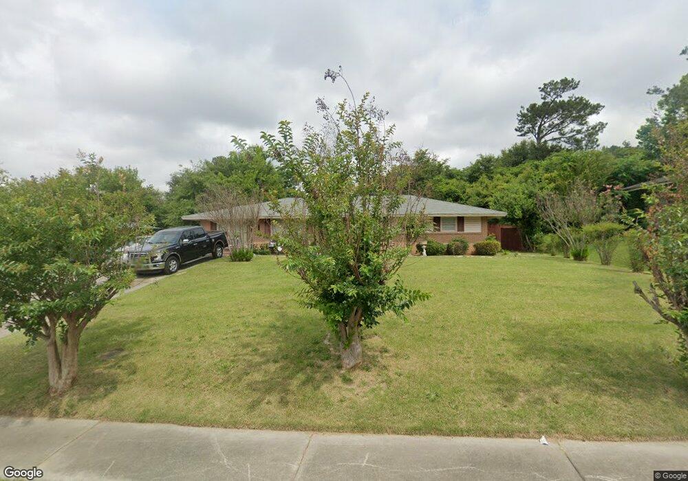
1950 Canterbury Rd Macon, GA 31206
Estimated Value: $120,000 - $139,000
3
Beds
2
Baths
1,662
Sq Ft
$79/Sq Ft
Est. Value
About This Home
This home is located at 1950 Canterbury Rd, Macon, GA 31206 and is currently estimated at $131,004, approximately $78 per square foot. 1950 Canterbury Rd is a home located in Bibb County with nearby schools including Hartley Elementary School, Southwest High School, and Cirrus Charter Academy.
Ownership History
Date
Name
Owned For
Owner Type
Purchase Details
Closed on
Aug 28, 2006
Sold by
Dious Virgus R and Dious Rosa Lee
Bought by
Braswell Willie F and Braswell Elaine A
Current Estimated Value
Home Financials for this Owner
Home Financials are based on the most recent Mortgage that was taken out on this home.
Original Mortgage
$86,541
Outstanding Balance
$51,604
Interest Rate
6.73%
Mortgage Type
FHA
Estimated Equity
$79,400
Purchase Details
Closed on
Jan 21, 2005
Create a Home Valuation Report for This Property
The Home Valuation Report is an in-depth analysis detailing your home's value as well as a comparison with similar homes in the area
Home Values in the Area
Average Home Value in this Area
Purchase History
| Date | Buyer | Sale Price | Title Company |
|---|---|---|---|
| Braswell Willie F | $87,900 | None Avelable | |
| -- | $85,000 | -- |
Source: Public Records
Mortgage History
| Date | Status | Borrower | Loan Amount |
|---|---|---|---|
| Open | Braswell Willie F | $86,541 |
Source: Public Records
Tax History Compared to Growth
Tax History
| Year | Tax Paid | Tax Assessment Tax Assessment Total Assessment is a certain percentage of the fair market value that is determined by local assessors to be the total taxable value of land and additions on the property. | Land | Improvement |
|---|---|---|---|---|
| 2025 | $938 | $45,173 | $4,640 | $40,533 |
| 2024 | $969 | $45,173 | $4,640 | $40,533 |
| 2023 | $402 | $40,830 | $4,640 | $36,190 |
| 2022 | $779 | $29,495 | $3,785 | $25,710 |
| 2021 | $588 | $22,473 | $2,884 | $19,589 |
| 2020 | $383 | $16,855 | $2,163 | $14,692 |
| 2019 | $386 | $16,855 | $2,163 | $14,692 |
| 2018 | $771 | $16,855 | $2,163 | $14,692 |
| 2017 | $369 | $16,855 | $2,163 | $14,692 |
| 2016 | $341 | $16,854 | $2,163 | $14,692 |
| 2015 | $595 | $19,146 | $2,163 | $16,983 |
| 2014 | $736 | $19,146 | $2,163 | $16,983 |
Source: Public Records
Map
Nearby Homes
- 1740 Downing Cir
- 1504 Berkshire Dr
- 3254 Markwood Dr
- 2350 Anthony Terrace
- 808 Patton Ave
- 800 Patton Ave
- 815 Edwards Ave
- 736 Key St
- 2249 Lowe St
- 3339 Markwood Dr
- 742 Grayson Ave
- 717 Patton Ave
- 1545 Anthony Rd
- 777 Grosso Ave
- 755 Grosso Ave
- 1870 Bethlea Ave
- 1196 Harley St
- 1740 Dixon Dr
- 1727 Eveline Ave
- 1049 Anthony Rd
- 1942 Canterbury Rd
- 1958 Canterbury Rd
- 2045 Winston Dr
- 1930 Canterbury Rd
- 2053 Winston Dr
- 2035 Winston Dr
- 1974 Canterbury Rd
- 1947 Canterbury Rd
- 1955 Canterbury Rd
- 1939 Canterbury Rd
- 2027 Winston Dr
- 1922 Canterbury Rd
- 1963 Canterbury Rd
- 1931 Canterbury Rd
- 1971 Canterbury Rd
- 2019 Winston Dr
- 2048 Winston Dr
- 1949 Winston Dr
- 1914 Canterbury Rd
- 2056 Winston Dr