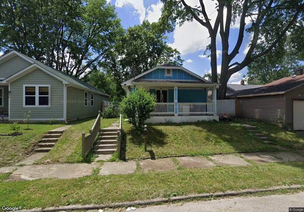
1950 Houston St Indianapolis, IN 46218
Near Eastside NeighborhoodEstimated Value: $86,000 - $144,000
2
Beds
--
Bath
432
Sq Ft
$266/Sq Ft
Est. Value
About This Home
This home is located at 1950 Houston St, Indianapolis, IN 46218 and is currently estimated at $115,000, approximately $266 per square foot. 1950 Houston St is a home located in Marion County with nearby schools including Thomas D. Gregg School No. 15, Washington Irving School 14, and Brookside School 54.
Ownership History
Date
Name
Owned For
Owner Type
Purchase Details
Closed on
May 28, 2021
Sold by
Nevarei Soiedad Medrano
Bought by
Ramos Rebekah L
Current Estimated Value
Purchase Details
Closed on
Mar 12, 2015
Sold by
Perez Diana Yasmin
Bought by
Nevarez Soledad Medrano
Purchase Details
Closed on
Jun 7, 2011
Sold by
Pizarro Soledad
Bought by
Perez Diana Yasmin
Purchase Details
Closed on
Jun 1, 2010
Sold by
Pizarro Vidal
Bought by
Pizarro Soledad
Purchase Details
Closed on
Mar 16, 2007
Sold by
Fannie Mae
Bought by
Pizarro Vidal
Purchase Details
Closed on
Oct 3, 2006
Sold by
Spalding William K and Spalding William
Bought by
Gmac Mortgage Corp
Purchase Details
Closed on
Sep 15, 2006
Sold by
Gmac Mortgage Corp
Bought by
Federal National Mortgaeg Corp
Create a Home Valuation Report for This Property
The Home Valuation Report is an in-depth analysis detailing your home's value as well as a comparison with similar homes in the area
Home Values in the Area
Average Home Value in this Area
Purchase History
| Date | Buyer | Sale Price | Title Company |
|---|---|---|---|
| Ramos Rebekah L | -- | None Available | |
| Nevarez Soledad Medrano | -- | None Available | |
| Perez Diana Yasmin | -- | Title One | |
| Pizarro Soledad | -- | Title One | |
| Pizarro Vidal | -- | None Available | |
| Gmac Mortgage Corp | $33,040 | None Available | |
| Federal National Mortgaeg Corp | -- | None Available |
Source: Public Records
Tax History Compared to Growth
Tax History
| Year | Tax Paid | Tax Assessment Tax Assessment Total Assessment is a certain percentage of the fair market value that is determined by local assessors to be the total taxable value of land and additions on the property. | Land | Improvement |
|---|---|---|---|---|
| 2024 | $709 | $46,300 | $6,500 | $39,800 |
| 2023 | $709 | $43,900 | $6,500 | $37,400 |
| 2022 | $736 | $44,900 | $6,500 | $38,400 |
| 2021 | $583 | $34,900 | $6,500 | $28,400 |
| 2020 | $839 | $32,000 | $2,600 | $29,400 |
| 2019 | $824 | $30,800 | $2,600 | $28,200 |
| 2018 | $805 | $29,800 | $2,600 | $27,200 |
| 2017 | $710 | $29,000 | $2,600 | $26,400 |
| 2016 | $224 | $6,300 | $2,600 | $3,700 |
| 2014 | $132 | $6,100 | $2,600 | $3,500 |
| 2013 | $125 | $6,000 | $2,600 | $3,400 |
Source: Public Records
Map
Nearby Homes
- 2030 Houston St
- 3208 Brookside Parkway Dr N
- 1938 N Dearborn St
- 2049 Houston St
- 2921 E Brookside Ave
- 2934 E Brookside Ave
- 2924 E 18th St
- 2822 E 19th St
- 1835 N Rural St
- 1534 N Lasalle St
- 2729 Massachusetts Ave
- 1505 N Dearborn St
- 2646 E 18th St
- 3601 Brookside Parkway Dr S
- 2309 N Dearborn St
- 2626 E Brookside Ave
- 2820 E 16th St
- 2624 E 18th St
- 2612 Brookway St
- 2621 Brookway St
- 1946 Houston St
- 3321 E 20th St
- 3325 E 20th St
- 3315 E 20th St
- 1942 Houston St
- 1938 Houston St
- 1947 N Lasalle St
- 1949 N Lasalle St
- 1945 N Lasalle St
- 1934 Houston St
- 1943 N Lasalle St
- 2002 Houston St
- 3339 E 20th St
- 1949 Houston St
- 1999 N Lasalle St
- 1945 Houston St
- 1928 Houston St
- 1937 Houston St
- 2003 N Lasalle St
- 3340 E 20th St
