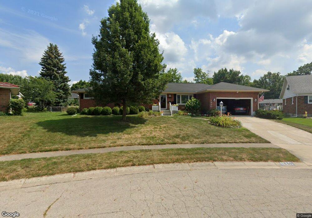
1950 Kimberly Cir Springfield, OH 45503
Estimated Value: $263,000 - $306,000
4
Beds
2
Baths
1,895
Sq Ft
$152/Sq Ft
Est. Value
About This Home
This home is located at 1950 Kimberly Cir, Springfield, OH 45503 and is currently estimated at $288,057, approximately $152 per square foot. 1950 Kimberly Cir is a home located in Clark County with nearby schools including Northridge Elementary School, Kenton Ridge Middle & High School, and Emmanuel Christian Academy.
Ownership History
Date
Name
Owned For
Owner Type
Purchase Details
Closed on
Oct 29, 2019
Sold by
Spragg Jane F and Spragg Jane F
Bought by
Holt Nicole E and Jane F Spragg Irrevocable Trust
Current Estimated Value
Purchase Details
Closed on
Sep 5, 2006
Sold by
Spragg David L and Spragg Jane F
Bought by
Spragg David L and Spragg Jane F
Purchase Details
Closed on
Mar 10, 1986
Sold by
Eastep Carl W
Bought by
Spragg David L and Spragg Jane F
Purchase Details
Closed on
Mar 1, 1983
Create a Home Valuation Report for This Property
The Home Valuation Report is an in-depth analysis detailing your home's value as well as a comparison with similar homes in the area
Home Values in the Area
Average Home Value in this Area
Purchase History
| Date | Buyer | Sale Price | Title Company |
|---|---|---|---|
| Holt Nicole E | -- | None Available | |
| Holt Nicole E | -- | None Available | |
| Spragg David L | -- | None Available | |
| Spragg David L | $60,000 | -- | |
| -- | $62,500 | -- |
Source: Public Records
Tax History
| Year | Tax Paid | Tax Assessment Tax Assessment Total Assessment is a certain percentage of the fair market value that is determined by local assessors to be the total taxable value of land and additions on the property. | Land | Improvement |
|---|---|---|---|---|
| 2025 | $2,715 | $94,860 | $20,000 | $74,860 |
| 2024 | -- | $71,880 | $13,380 | $58,500 |
| 2023 | $2,652 | $71,880 | $13,380 | $58,500 |
| 2022 | $138 | $71,880 | $13,380 | $58,500 |
| 2021 | $2,870 | $56,030 | $10,620 | $45,410 |
| 2020 | $2,873 | $56,030 | $10,620 | $45,410 |
| 2019 | $2,415 | $56,030 | $10,620 | $45,410 |
| 2018 | $2,096 | $48,140 | $9,520 | $38,620 |
| 2017 | $1,796 | $50,320 | $9,524 | $40,796 |
| 2016 | $1,784 | $50,320 | $9,524 | $40,796 |
| 2015 | $967 | $47,635 | $9,156 | $38,479 |
| 2014 | $848 | $47,635 | $9,156 | $38,479 |
| 2013 | $879 | $47,635 | $9,156 | $38,479 |
Source: Public Records
Map
Nearby Homes
- 1921 Elaina Dr
- 3942 Harris Ln
- 4028 Ryland Dr Unit 4028
- 4256 Midfield St Unit 9
- 4446 Ridgewood Rd E Unit 3
- 4577 Reno Ln Unit 2
- 1831 Pinehurst Dr Unit 37
- 4652 Reno Ln Unit 15
- 1711 Pinehurst Dr
- 1341 Student Ave
- 1505 Kingsgate Rd
- 1503 Kingsgate Rd
- 1507 Kingsgate Rd
- 1500 Kingsgate Rd
- 1502 Kingsgate Rd
- 1500 Kingsgate Rd Unit 19430
- 1502 Kingsgate Rd Unit 19432
- 1509 Kingsgate Rd
- 4500 Bosart Rd
- 3631 Kingsgate Ln
- 1958 Kimberly Cir
- 4213 Reno Rd
- 1942 Kimberly Cir
- 4205 Reno Rd
- 1951 Kimberly Cir
- 4219 Reno Rd
- 1966 Kimberly Cir
- 4161 Middle Urbana Rd
- 1936 Kimberly Cir
- 4143 Middle Urbana Rd
- 1969 Kimberly Cir
- 4125 Middle Urbana Rd
- 1972 Kimberly Cir
- 1927 Kimberly Cir
- 4194 Phoenix Dr
- 1928 Kimberly Cir
- 4182 Phoenix Dr
- 4216 Reno Rd
- 0 Middle Urbana Rd Unit 2522105
- 0 Middle Urbana Rd Unit 732640
Your Personal Tour Guide
Ask me questions while you tour the home.