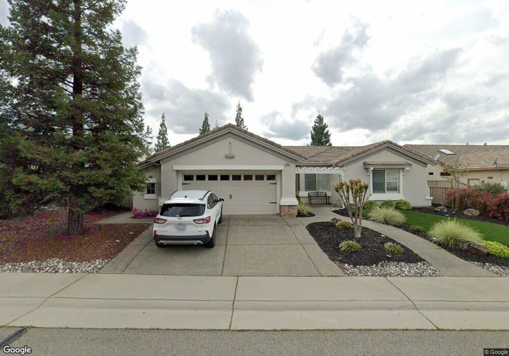
1950 Laurelhurst Ln Lincoln, CA 95648
Sun City Lincoln Hills NeighborhoodEstimated Value: $651,372 - $707,000
2
Beds
2
Baths
1,810
Sq Ft
$374/Sq Ft
Est. Value
About This Home
This home is located at 1950 Laurelhurst Ln, Lincoln, CA 95648 and is currently estimated at $676,843, approximately $373 per square foot. 1950 Laurelhurst Ln is a home located in Placer County with nearby schools including Twelve Bridges Elementary School, Twelve Bridges Middle School, and John Adams Academy - Lincoln.
Ownership History
Date
Name
Owned For
Owner Type
Purchase Details
Closed on
Mar 31, 2021
Sold by
Mossawir Mark Edward
Bought by
Muse Cathy H
Current Estimated Value
Home Financials for this Owner
Home Financials are based on the most recent Mortgage that was taken out on this home.
Original Mortgage
$500,000
Outstanding Balance
$449,975
Interest Rate
2.8%
Mortgage Type
New Conventional
Estimated Equity
$226,868
Purchase Details
Closed on
Mar 25, 2003
Sold by
Del Webb California Corp
Bought by
Nackord Murray Donald and Nackord Patricia Ann
Home Financials for this Owner
Home Financials are based on the most recent Mortgage that was taken out on this home.
Original Mortgage
$120,000
Interest Rate
5.79%
Mortgage Type
Purchase Money Mortgage
Create a Home Valuation Report for This Property
The Home Valuation Report is an in-depth analysis detailing your home's value as well as a comparison with similar homes in the area
Home Values in the Area
Average Home Value in this Area
Purchase History
| Date | Buyer | Sale Price | Title Company |
|---|---|---|---|
| Muse Cathy H | $625,000 | Fidelity Natl Ttl Co Of Ca | |
| Nackord Murray Donald | $293,000 | First American Title |
Source: Public Records
Mortgage History
| Date | Status | Borrower | Loan Amount |
|---|---|---|---|
| Open | Muse Cathy H | $500,000 | |
| Previous Owner | Nackord Murray Donald | $120,000 |
Source: Public Records
Tax History Compared to Growth
Tax History
| Year | Tax Paid | Tax Assessment Tax Assessment Total Assessment is a certain percentage of the fair market value that is determined by local assessors to be the total taxable value of land and additions on the property. | Land | Improvement |
|---|---|---|---|---|
| 2025 | $2,568 | $250,661 | $201,177 | $49,484 |
| 2023 | $2,568 | $240,929 | $193,366 | $47,563 |
| 2022 | $2,835 | $236,206 | $189,575 | $46,631 |
| 2021 | $4,770 | $418,262 | $77,597 | $340,665 |
| 2020 | $4,746 | $413,974 | $76,802 | $337,172 |
| 2019 | $4,632 | $405,858 | $75,297 | $330,561 |
| 2018 | $4,526 | $397,901 | $73,821 | $324,080 |
| 2017 | $4,392 | $390,100 | $72,374 | $317,726 |
| 2016 | $4,294 | $382,452 | $70,955 | $311,497 |
| 2015 | $4,207 | $376,709 | $69,890 | $306,819 |
| 2014 | $4,107 | $369,330 | $68,521 | $300,809 |
Source: Public Records
Map
Nearby Homes
- 2076 Stonecrest Ln
- 1905 Mary Rose Ln
- 2251 Pebblestone Ln
- 2182 Pebblestone Ln
- 1260 Picket Fence Ln
- 1821 Carnelian Ct
- 1509 Dapple Dawn Ln
- 1347 Rose Bouquet Dr
- 1304 Rose Bouquet Dr
- 2024 Farmgate Ln
- 310 Dinis Cottage Ct
- 1647 Gingersnap Ln
- 109 Ivy Arbor Ct
- 2012 Gatehouse Ln
- 1856 Farmgate Ln
- 310 Elderberry Ct
- 2966 Pulp Mill Ln
- 2984 Bowery Ln
- 2955 Pulp Mill Ln
- 2954 Pulp Mill Ln
- 1960 Laurelhurst Ln
- 1940 Laurelhurst Ln
- 1995 Briarcliff Ln
- 1970 Laurelhurst Ln
- 1985 Briarcliff Ln
- 1945 Laurelhurst Ln
- 2005 Briarcliff Ln
- 1955 Laurelhurst Ln
- 1935 Laurelhurst Ln
- 1980 Laurelhurst Ln
- 1965 Laurelhurst Ln
- 1895 Laurelhurst Ln
- 1905 Laurelhurst Ln
- 1925 Laurelhurst Ln
- 1885 Laurelhurst Ln
- 408 Cinnabar Ct
- 1975 Laurelhurst Ln
- 1915 Laurelhurst Ln
- 2015 Briarcliff Ln
- 1875 Laurelhurst Ln