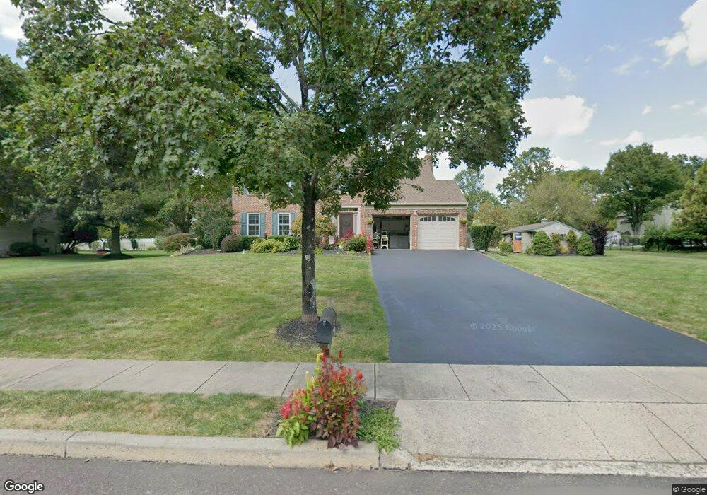
1950 Linden Ln Hatfield, PA 19440
Estimated Value: $616,000 - $685,000
4
Beds
3
Baths
2,248
Sq Ft
$283/Sq Ft
Est. Value
About This Home
This home is located at 1950 Linden Ln, Hatfield, PA 19440 and is currently estimated at $636,800, approximately $283 per square foot. 1950 Linden Ln is a home located in Montgomery County with nearby schools including A. M. Kulp Elementary School, Pennfield Middle School, and North Penn Senior High School.
Ownership History
Date
Name
Owned For
Owner Type
Purchase Details
Closed on
Jan 31, 2005
Sold by
Not Provided
Bought by
Not Provided
Current Estimated Value
Home Financials for this Owner
Home Financials are based on the most recent Mortgage that was taken out on this home.
Original Mortgage
$219,200
Outstanding Balance
$111,855
Interest Rate
5.81%
Mortgage Type
Purchase Money Mortgage
Estimated Equity
$524,945
Create a Home Valuation Report for This Property
The Home Valuation Report is an in-depth analysis detailing your home's value as well as a comparison with similar homes in the area
Home Values in the Area
Average Home Value in this Area
Purchase History
| Date | Buyer | Sale Price | Title Company |
|---|---|---|---|
| Not Provided | -- | -- |
Source: Public Records
Mortgage History
| Date | Status | Borrower | Loan Amount |
|---|---|---|---|
| Open | Not Provided | $219,200 |
Source: Public Records
Tax History Compared to Growth
Tax History
| Year | Tax Paid | Tax Assessment Tax Assessment Total Assessment is a certain percentage of the fair market value that is determined by local assessors to be the total taxable value of land and additions on the property. | Land | Improvement |
|---|---|---|---|---|
| 2025 | $7,139 | $178,290 | $52,630 | $125,660 |
| 2024 | $7,139 | $178,290 | $52,630 | $125,660 |
| 2023 | $6,832 | $178,290 | $52,630 | $125,660 |
| 2022 | $6,609 | $178,290 | $52,630 | $125,660 |
| 2021 | $6,422 | $178,290 | $52,630 | $125,660 |
| 2020 | $6,270 | $178,290 | $52,630 | $125,660 |
| 2019 | $6,165 | $178,290 | $52,630 | $125,660 |
| 2018 | $6,166 | $178,290 | $52,630 | $125,660 |
| 2017 | $5,930 | $178,290 | $52,630 | $125,660 |
| 2016 | $5,861 | $178,290 | $52,630 | $125,660 |
| 2015 | $5,626 | $178,290 | $52,630 | $125,660 |
| 2014 | $5,626 | $178,290 | $52,630 | $125,660 |
Source: Public Records
Map
Nearby Homes
- 2317 E Orvilla Rd
- 0 Fairmount St
- 1744 Lydia Dr
- 1306 W Orvilla Rd
- 36 N Maple Ave
- 105 S Main St
- 3 Diamond St
- 1226 Cabin Rd
- 24 S Wayne Ave
- 138 Diamond St Unit 31
- 480 Bentwood Dr
- 142 Orchard Ln
- 732 Cowpath Rd
- 302 W Broad St
- 1315 Deer Run Rd
- 109 Hickory Dr
- 113 Hickory Dr
- 2713 Beech St
- 2801 Denbeigh Dr
- 2031 Oak Ave
- 1942 Linden Ln
- 1958 Linden Ln
- 1974 Linden Ln
- 0 Linden Ln
- 1951 Linden Ln
- 1990 Linden Ln
- 1943 Linden Ln
- 1934 Linden Ln
- 1959 Linden Ln
- 1967 Linden Ln
- 1977 Hawthorne Ln
- 1961 Hawthorne Ln
- 1993 Hawthorne Ln
- 1983 Linden Ln
- 1975 Linden Ln
- 1945 Hawthorne Ln
- 1991 Linden Ln
- 2234 Hedgewood Rd
- 2226 Hedgewood Rd
- 2242 Hedgewood Rd