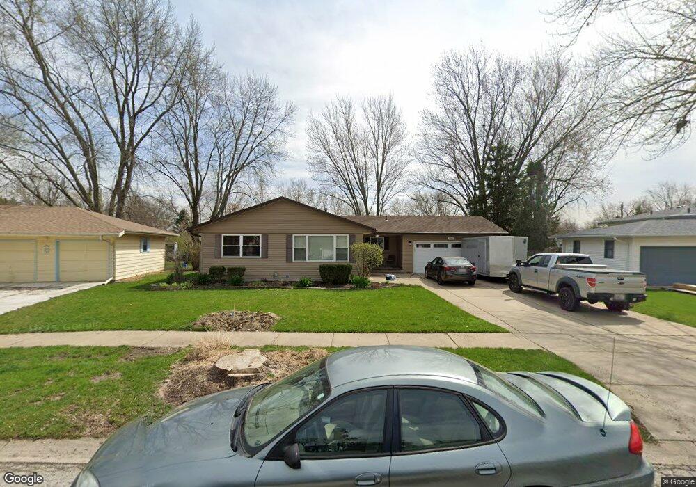
1950 Richard St Unit 1 Aurora, IL 60506
Edgelawn Randall NeighborhoodEstimated Value: $305,291 - $325,000
3
Beds
1
Bath
1,184
Sq Ft
$265/Sq Ft
Est. Value
About This Home
This home is located at 1950 Richard St Unit 1, Aurora, IL 60506 and is currently estimated at $313,823, approximately $265 per square foot. 1950 Richard St Unit 1 is a home located in Kane County with nearby schools including Hall Elementary School, Jefferson Middle School, and West Aurora High School.
Ownership History
Date
Name
Owned For
Owner Type
Purchase Details
Closed on
Dec 11, 1995
Sold by
Lieser Guy B and Burton Lisa A
Bought by
Johnson Richard A and Johnson Carrie L
Current Estimated Value
Home Financials for this Owner
Home Financials are based on the most recent Mortgage that was taken out on this home.
Original Mortgage
$127,500
Outstanding Balance
$2,624
Interest Rate
7.43%
Estimated Equity
$311,199
Create a Home Valuation Report for This Property
The Home Valuation Report is an in-depth analysis detailing your home's value as well as a comparison with similar homes in the area
Home Values in the Area
Average Home Value in this Area
Purchase History
| Date | Buyer | Sale Price | Title Company |
|---|---|---|---|
| Johnson Richard A | $130,000 | First American Title Ins Co |
Source: Public Records
Mortgage History
| Date | Status | Borrower | Loan Amount |
|---|---|---|---|
| Open | Johnson Richard A | $127,500 |
Source: Public Records
Tax History Compared to Growth
Tax History
| Year | Tax Paid | Tax Assessment Tax Assessment Total Assessment is a certain percentage of the fair market value that is determined by local assessors to be the total taxable value of land and additions on the property. | Land | Improvement |
|---|---|---|---|---|
| 2024 | $5,720 | $80,244 | $15,912 | $64,332 |
| 2023 | $5,456 | $71,697 | $14,217 | $57,480 |
| 2022 | $5,260 | $65,417 | $12,972 | $52,445 |
| 2021 | $4,933 | $59,989 | $12,077 | $47,912 |
| 2020 | $4,655 | $55,721 | $11,218 | $44,503 |
| 2019 | $4,682 | $53,883 | $10,394 | $43,489 |
| 2018 | $4,283 | $48,906 | $9,614 | $39,292 |
| 2017 | $4,641 | $51,094 | $8,858 | $42,236 |
| 2016 | $4,021 | $43,848 | $7,593 | $36,255 |
| 2015 | -- | $37,169 | $6,529 | $30,640 |
| 2014 | -- | $33,642 | $6,279 | $27,363 |
| 2013 | -- | $33,163 | $6,190 | $26,973 |
Source: Public Records
Map
Nearby Homes
- 1120 Emerald Dr
- 960 Sapphire Ln
- 964 Sapphire Ln
- 967 Sapphire Ln
- 959 Sapphire Ln
- 963 Sapphire Ln
- 1747 W Illinois Ave
- 972 Westgate Dr
- 1035 Newcastle Ln
- 1149 Newcastle Ln
- 1467 Elder Dr Unit 2
- 1475 Elder Dr
- 1513 Elder Dr
- 2220 Mayflower Dr
- 630 N Buell Ave
- 833 N Randall Rd Unit C4
- 1389 Monomoy St Unit B2
- 1390 N Glen Cir Unit B
- 1815 Brighton Cir
- 1116 Village Center Pkwy Unit 4
- 1960 Richard St
- 1940 Richard St
- 1953 Robert St
- 1941 Robert St Unit 1
- 1963 Robert St
- 1970 Richard St Unit 1
- 1930 Richard St Unit 1
- 1929 Robert St
- 1973 Robert St Unit 1
- 1955 Richard St Unit 2
- 1010 Cochran St
- 1917 Robert St
- 1980 Richard St
- 1920 Richard St
- 1983 Robert St
- 1975 Richard St
- 1020 Cochran St Unit 3
- 1899 Robert St
- 1990 Richard St
- 1956 Robert St