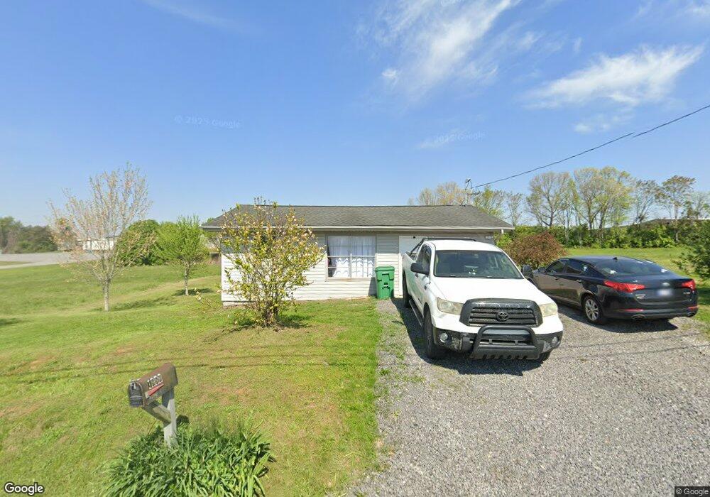
1950 S Economy Rd Morristown, TN 37813
Estimated Value: $177,192 - $191,000
--
Bed
1
Bath
684
Sq Ft
$267/Sq Ft
Est. Value
About This Home
This home is located at 1950 S Economy Rd, Morristown, TN 37813 and is currently estimated at $182,731, approximately $267 per square foot. 1950 S Economy Rd is a home located in Hamblen County with nearby schools including Lincoln Heights Elementary School, Lincoln Heights Middle School, and Morristown West High School.
Ownership History
Date
Name
Owned For
Owner Type
Purchase Details
Closed on
Jul 29, 2021
Sold by
Markhan Otto Milicent Telia and Hill Melissa F
Bought by
Markham Otto Milicent Telia and Hill Melissa F
Current Estimated Value
Purchase Details
Closed on
Jun 23, 2020
Sold by
Williams John Carroll
Bought by
Markham Teddy
Home Financials for this Owner
Home Financials are based on the most recent Mortgage that was taken out on this home.
Original Mortgage
$100,000
Outstanding Balance
$88,642
Interest Rate
3.2%
Mortgage Type
Unknown
Estimated Equity
$94,089
Purchase Details
Closed on
Dec 14, 2017
Sold by
Williams John C
Bought by
Williamsid John Carroll
Purchase Details
Closed on
Oct 15, 1960
Bought by
Lawson Carl and Lawson Hazel W
Create a Home Valuation Report for This Property
The Home Valuation Report is an in-depth analysis detailing your home's value as well as a comparison with similar homes in the area
Home Values in the Area
Average Home Value in this Area
Purchase History
| Date | Buyer | Sale Price | Title Company |
|---|---|---|---|
| Markham Otto Milicent Telia | -- | None Available | |
| Markham Teddy | -- | None Available | |
| Williamsid John Carroll | -- | None Available | |
| Lawson Carl | -- | -- |
Source: Public Records
Mortgage History
| Date | Status | Borrower | Loan Amount |
|---|---|---|---|
| Open | Markham Teddy | $100,000 |
Source: Public Records
Tax History Compared to Growth
Tax History
| Year | Tax Paid | Tax Assessment Tax Assessment Total Assessment is a certain percentage of the fair market value that is determined by local assessors to be the total taxable value of land and additions on the property. | Land | Improvement |
|---|---|---|---|---|
| 2024 | $822 | $46,720 | $37,800 | $8,920 |
| 2023 | $822 | $46,720 | $0 | $0 |
| 2022 | $1,476 | $46,720 | $37,800 | $8,920 |
| 2021 | $1,476 | $46,720 | $37,800 | $8,920 |
| 2020 | $1,474 | $46,720 | $37,800 | $8,920 |
| 2019 | $1,532 | $45,040 | $37,800 | $7,240 |
| 2018 | $1,419 | $45,040 | $37,800 | $7,240 |
| 2017 | $1,396 | $45,040 | $37,800 | $7,240 |
| 2016 | $1,333 | $45,040 | $37,800 | $7,240 |
| 2015 | $1,240 | $45,040 | $37,800 | $7,240 |
| 2014 | -- | $45,040 | $37,800 | $7,240 |
| 2013 | -- | $39,640 | $0 | $0 |
Source: Public Records
Map
Nearby Homes
- 2444 Sandstone Dr
- 2454 Sandstone Dr
- 2430 Sandstone Dr
- 440 S Fairmont Ave
- 2310 Sandstone Dr
- 1530 Rayburn Dr
- 1476 Darbee Dr
- 2045 N Economy Rd Unit A3
- 707 Walters Dr
- Darwin Plan at Southwood
- Penwell Plan at Southwood
- Elston Plan at Southwood
- Robie Plan at Southwood
- Cali Plan at Southwood
- Belhaven Plan at Southwood
- 1049 Greenway Dr
- 2018 Southwood Cir
- 1442 Darbee Dr
- 941 Heykoop Dr
- 1211 W 6th St N
- 1937 S Economy Rd
- 1839 W Morris Blvd
- 2101 Maden Dr
- 1907 W Morris Blvd
- 1907 W Morris Blvd Unit Suite F
- 1907 W Morris Blvd Unit Suite E
- 1907 W Morris Blvd Unit Suite A
- 1907 W Morris Blvd Unit Suite D
- 1907 W Morris Blvd Unit Suite A-300
- 1840 W Morris Blvd
- 1838 W Morris Blvd
- 1826 W Morris Blvd
- 1925 Thomas R James Dr
- 1955 Gretchen Dr
- 0 Western Ave
- 230 Bowman St
- 1771 W Morris Blvd
- 1895 Thomas R James Dr
- 1887 Thomas R James Dr
- 1882 Thomas R James Dr