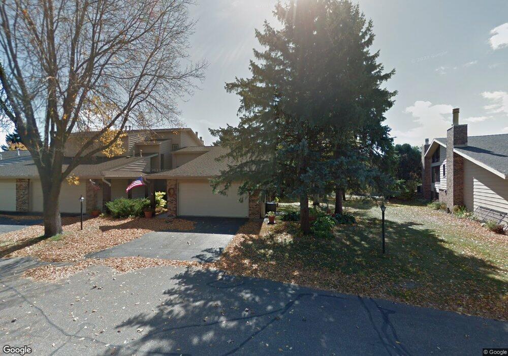
1950 Westfield Ct SW Rochester, MN 55902
Estimated Value: $368,000 - $514,000
3
Beds
2
Baths
1,460
Sq Ft
$315/Sq Ft
Est. Value
About This Home
This home is located at 1950 Westfield Ct SW, Rochester, MN 55902 and is currently estimated at $460,569, approximately $315 per square foot. 1950 Westfield Ct SW is a home located in Olmsted County with nearby schools including Bamber Valley Elementary School, John Adams Middle School, and Mayo Senior High School.
Ownership History
Date
Name
Owned For
Owner Type
Purchase Details
Closed on
Apr 9, 2020
Sold by
Felten Jeffrey A and Felten Debra S
Bought by
Deutsch Teri
Current Estimated Value
Purchase Details
Closed on
Apr 19, 2017
Sold by
Feldt Barbara F and The Barbara F Feldt Trust
Bought by
Felten Jeffrey and Felten Debra
Purchase Details
Closed on
Feb 14, 2005
Sold by
Feldt Barbara F
Bought by
Feldt Barbara F and Barbara F Feldt Trust
Create a Home Valuation Report for This Property
The Home Valuation Report is an in-depth analysis detailing your home's value as well as a comparison with similar homes in the area
Home Values in the Area
Average Home Value in this Area
Purchase History
| Date | Buyer | Sale Price | Title Company |
|---|---|---|---|
| Deutsch Teri | $480,000 | Title Services Inc | |
| Felten Jeffrey | $300,000 | Title Services Inc | |
| Feldt Barbara F | -- | None Available |
Source: Public Records
Tax History Compared to Growth
Tax History
| Year | Tax Paid | Tax Assessment Tax Assessment Total Assessment is a certain percentage of the fair market value that is determined by local assessors to be the total taxable value of land and additions on the property. | Land | Improvement |
|---|---|---|---|---|
| 2024 | $6,228 | $448,200 | $60,000 | $388,200 |
| 2023 | $5,612 | $445,600 | $60,000 | $385,600 |
| 2022 | $5,062 | $400,200 | $60,000 | $340,200 |
| 2021 | $4,434 | $371,200 | $60,000 | $311,200 |
| 2020 | $4,002 | $328,400 | $60,000 | $268,400 |
| 2019 | $3,738 | $288,300 | $40,000 | $248,300 |
| 2018 | $1,506 | $272,300 | $40,000 | $232,300 |
| 2017 | $3,012 | $240,200 | $30,200 | $210,000 |
| 2016 | $2,730 | $203,700 | $27,800 | $175,900 |
| 2015 | $2,590 | $180,200 | $27,300 | $152,900 |
| 2014 | $2,504 | $182,500 | $27,300 | $155,200 |
| 2012 | -- | $181,200 | $27,307 | $153,893 |
Source: Public Records
Map
Nearby Homes
- 3125 Glenwood Rd SW
- 2961 Glenwood Rd SW
- 3177 Glenwood Rd SW
- 1911 Greenfield Ln SW Unit E
- 1568 Salem Ct SW
- 1747 Mayowood Rd SW
- 1598 Salem Ct SW
- 1810 Mayowood Rd SW
- 1814 Mayowood Rd SW
- 2449 Salem Heights Ln SW
- 1941 Waterford Place SW
- 2114 Ponderosa Dr SW
- 2234 Baihly Hills Dr SW
- 2141 Ponderosa Dr SW
- 2308 Baihly Hills Dr SW
- 1932 Baihly Estates Ln SW
- 1203 Baihly View Ln SW
- 2229 Ponderosa Dr SW
- 1429 20th St SW
- 2236 Ponderosa Dr SW
- 1948 Westfield Ct SW
- 1946 Westfield Ct SW
- 1964 Westfield Ct SW
- 1944 Westfield Ct SW
- 1966 Westfield Ct SW
- 1968 Westfield Ct SW
- 1930 Westfield Ct SW
- 1970 Westfield Ct SW
- 1928 Westfield Ct SW
- 1924 Westfield Ct SW
- 1920 Westfield Ct SW
- 1900 Lakeview Ct SW
- 1900 Lakeview Ct SW
- 1900 Lakeview Ct SW
- 1900 Lakeview Ct SW
- 1900 Lakeview Ct SW Unit 102
- 1900 Lakeview Ct SW Unit 101
- 1900 Lakeview Ct SW Unit 102
- 1900 Lakeview Ct SW Unit B1
- 1900 Lakeview Ct SW Unit 101