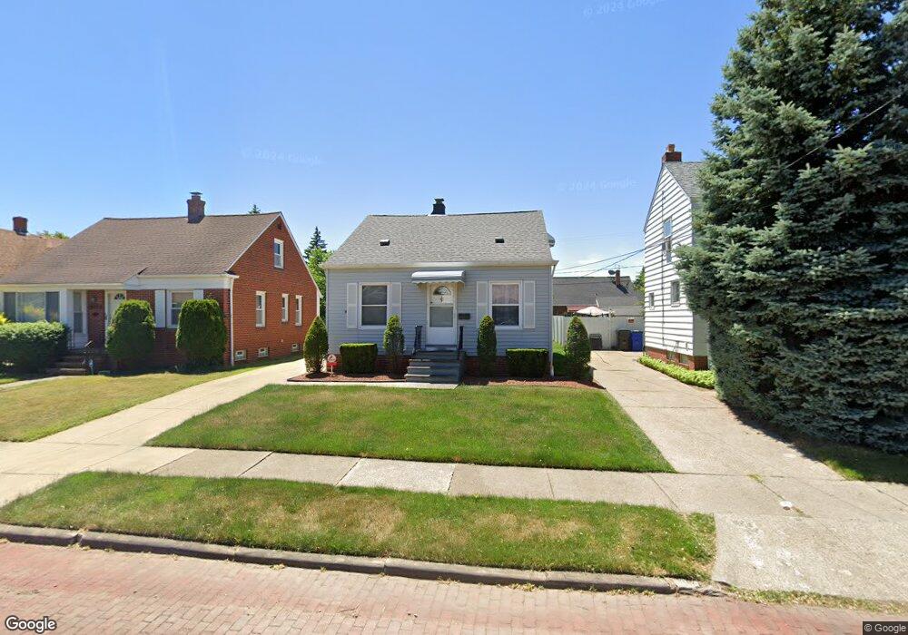
19500 Chickasaw Ave Cleveland, OH 44119
North Collinwood NeighborhoodEstimated Value: $90,411 - $151,000
2
Beds
1
Bath
720
Sq Ft
$154/Sq Ft
Est. Value
About This Home
This home is located at 19500 Chickasaw Ave, Cleveland, OH 44119 and is currently estimated at $110,853, approximately $153 per square foot. 19500 Chickasaw Ave is a home located in Cuyahoga County with nearby schools including Bolton, Anton Grdina School, and Adlai Stevenson School.
Ownership History
Date
Name
Owned For
Owner Type
Purchase Details
Closed on
Nov 23, 1998
Sold by
Lost Nation Management Inc
Bought by
Sieferd Harold D
Current Estimated Value
Home Financials for this Owner
Home Financials are based on the most recent Mortgage that was taken out on this home.
Original Mortgage
$50,000
Outstanding Balance
$11,318
Interest Rate
7.01%
Estimated Equity
$99,535
Purchase Details
Closed on
Jan 22, 1998
Sold by
Gross Gerald
Bought by
Mastrangelo Peter A
Home Financials for this Owner
Home Financials are based on the most recent Mortgage that was taken out on this home.
Original Mortgage
$43,600
Interest Rate
7.75%
Purchase Details
Closed on
Jan 1, 1975
Bought by
Gross Gerald and Gross Janet J
Create a Home Valuation Report for This Property
The Home Valuation Report is an in-depth analysis detailing your home's value as well as a comparison with similar homes in the area
Home Values in the Area
Average Home Value in this Area
Purchase History
| Date | Buyer | Sale Price | Title Company |
|---|---|---|---|
| Sieferd Harold D | $67,000 | -- | |
| Lost Nation Managment Inc | -- | Approved Statewide Title Age | |
| Mastrangelo Peter A | $48,500 | Approved Statewide Title Age | |
| Gross Gerald | -- | -- |
Source: Public Records
Mortgage History
| Date | Status | Borrower | Loan Amount |
|---|---|---|---|
| Open | Sieferd Harold D | $50,000 | |
| Previous Owner | Mastrangelo Peter A | $43,600 |
Source: Public Records
Tax History Compared to Growth
Tax History
| Year | Tax Paid | Tax Assessment Tax Assessment Total Assessment is a certain percentage of the fair market value that is determined by local assessors to be the total taxable value of land and additions on the property. | Land | Improvement |
|---|---|---|---|---|
| 2024 | $1,847 | $28,175 | $5,460 | $22,715 |
| 2023 | $1,418 | $18,690 | $3,990 | $14,700 |
| 2022 | $1,410 | $18,690 | $3,990 | $14,700 |
| 2021 | $1,395 | $18,690 | $3,990 | $14,700 |
| 2020 | $1,415 | $16,380 | $3,500 | $12,880 |
| 2019 | $1,308 | $46,800 | $10,000 | $36,800 |
| 2018 | $1,365 | $16,380 | $3,500 | $12,880 |
| 2017 | $1,438 | $17,440 | $2,560 | $14,880 |
| 2016 | $1,427 | $17,440 | $2,560 | $14,880 |
| 2015 | $1,279 | $17,440 | $2,560 | $14,880 |
| 2014 | $1,279 | $15,580 | $2,280 | $13,300 |
Source: Public Records
Map
Nearby Homes
- 19409 Cherokee Ave
- 19511 Muskoka Ave
- 19716 Mohawk Ave
- 18707 Shawnee Ave
- 19702 Pawnee Ave
- 18606 Cherokee Ave
- 19901 Pawnee Ave
- 18806 Mohawk Ave
- 19326 Tyronne Ave
- 18715 Mohawk Ave
- 20430 Miller Ave
- 18404 Neff Rd
- 560 E 200th St
- 18111 Marcella Rd
- 901 E 210th St
- 21070 N Vine Ave
- 19450 Naumann Ave
- 983 E 179th St
- 950 E 216th St
- 18225 Landseer Rd
- 19420 Chickasaw Ave
- 19504 Chickasaw Ave
- 19416 Chickasaw Ave
- 19602 Chickasaw Ave
- 19505 Kewanee Ave
- 19419 Kewanee Ave
- 19509 Kewanee Ave
- 19413 Kewanee Ave
- 19606 Chickasaw Ave
- 19412 Chickasaw Ave
- 19501 Chickasaw Ave
- 19513 Kewanee Ave
- 19505 Chickasaw Ave
- 19421 Chickasaw Ave
- 19509 Chickasaw Ave Unit Lower
- 19509 Chickasaw Ave Unit Upper
- 19417 Chickasaw Ave
- 19409 Kewanee Ave
- 19513 Chickasaw Ave
- 19517 Kewanee Ave