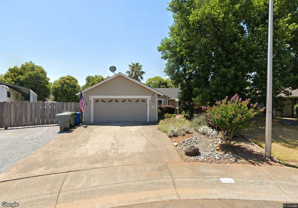
1951 Carol Jean Ct Redding, CA 96002
Starview NeighborhoodEstimated Value: $289,000 - $312,000
2
Beds
2
Baths
1,110
Sq Ft
$272/Sq Ft
Est. Value
About This Home
This home is located at 1951 Carol Jean Ct, Redding, CA 96002 and is currently estimated at $302,116, approximately $272 per square foot. 1951 Carol Jean Ct is a home located in Shasta County with nearby schools including Alta Mesa Elementary School, Parsons Junior High School, and Enterprise High School.
Ownership History
Date
Name
Owned For
Owner Type
Purchase Details
Closed on
Apr 9, 2007
Sold by
Parker Arthur T
Bought by
Parker Arthur T and Parker Theresa A
Current Estimated Value
Purchase Details
Closed on
Mar 17, 2006
Sold by
Parker Arthur T
Bought by
Parker Arthur T
Home Financials for this Owner
Home Financials are based on the most recent Mortgage that was taken out on this home.
Original Mortgage
$160,000
Interest Rate
6.18%
Mortgage Type
Stand Alone Refi Refinance Of Original Loan
Create a Home Valuation Report for This Property
The Home Valuation Report is an in-depth analysis detailing your home's value as well as a comparison with similar homes in the area
Home Values in the Area
Average Home Value in this Area
Purchase History
| Date | Buyer | Sale Price | Title Company |
|---|---|---|---|
| Parker Arthur T | -- | None Available | |
| Parker Arthur T | -- | Alliance Title Company |
Source: Public Records
Mortgage History
| Date | Status | Borrower | Loan Amount |
|---|---|---|---|
| Closed | Parker Arthur T | $160,000 |
Source: Public Records
Tax History Compared to Growth
Tax History
| Year | Tax Paid | Tax Assessment Tax Assessment Total Assessment is a certain percentage of the fair market value that is determined by local assessors to be the total taxable value of land and additions on the property. | Land | Improvement |
|---|---|---|---|---|
| 2025 | $1,348 | $128,978 | $36,537 | $92,441 |
| 2024 | $1,327 | $126,450 | $35,821 | $90,629 |
| 2023 | $1,327 | $123,971 | $35,119 | $88,852 |
| 2022 | $1,288 | $121,541 | $34,431 | $87,110 |
| 2021 | $1,243 | $119,158 | $33,756 | $85,402 |
| 2020 | $1,236 | $117,937 | $33,410 | $84,527 |
| 2019 | $1,225 | $115,625 | $32,755 | $82,870 |
| 2018 | $1,209 | $113,359 | $32,113 | $81,246 |
| 2017 | $1,228 | $111,137 | $31,484 | $79,653 |
| 2016 | $1,148 | $108,959 | $30,867 | $78,092 |
| 2015 | $1,138 | $107,323 | $30,404 | $76,919 |
| 2014 | $1,128 | $105,222 | $29,809 | $75,413 |
Source: Public Records
Map
Nearby Homes
- 3897 Sunwood Dr
- 2145 Venus Way
- 2068 Solar Way
- 2269 Corona St
- 3466 Silverwood St
- 1959 Alexis Ct
- 3628 Somerset Ave
- 2408 Castlewood Dr
- 3341 Timbercreek Dr
- 4151 Saratoga Dr
- 3688 Polaris Way
- 3896 Cambria Dr
- 3361 Alta Mesa Dr
- 3703 Harrow Ct
- 3849 Capricorn Way
- 2366 Templeton Dr
- 3710 Indio Way
- 3293 Middleton Ln
- 3512 Capricorn Way
- 3387 Bridger Dr
- 1905 Carol Jean Ct
- 4032 Cirrus St
- 4044 Cirrus St Unit 1
- 4044 Cirrus St
- 1993 Carol Jean Ct Unit 1
- 1993 Carol Jean Ct
- 4020 Cirrus St
- 4143 Cirrus St
- 1900 Carol Jean Ct
- 4155 Cirrus St
- 4068 Cirrus St
- 1954 Carol Jean Ct
- 4173 Cirrus St
- 1990 Carol Jean Ct Unit 1
- 1990 Carol Jean Ct
- 4181 Cirrus St
- 3969 Cirrus St Unit 1
- 3969 Cirrus St
- 3957 Cirrus St
- 4037 Cirrus St