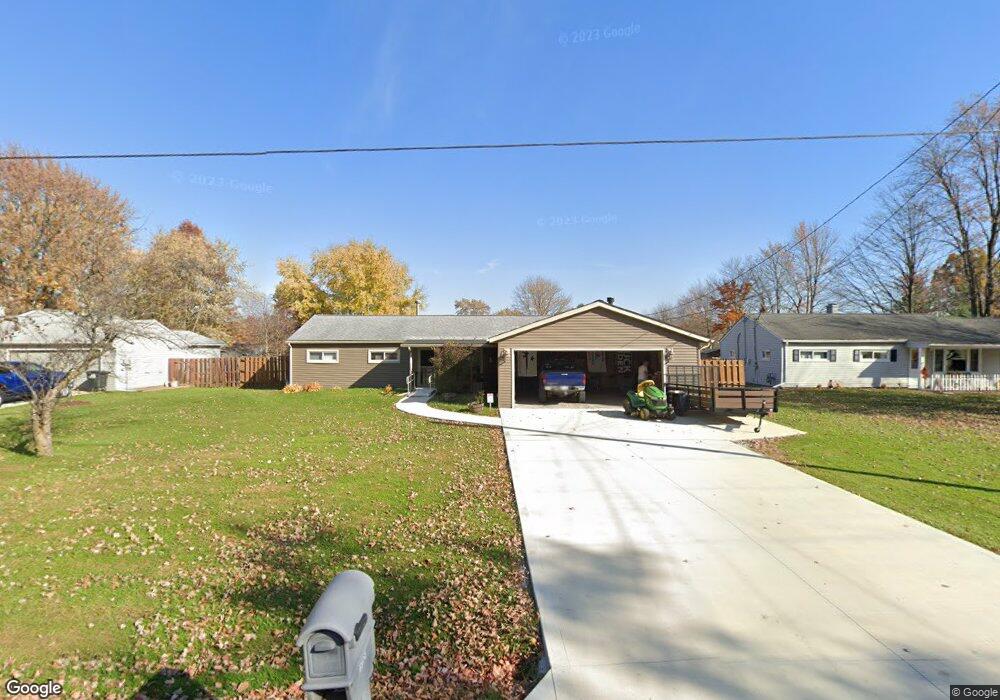
1951 Coventry Dr Brunswick, OH 44212
Estimated Value: $214,063 - $234,000
3
Beds
2
Baths
1,152
Sq Ft
$197/Sq Ft
Est. Value
About This Home
This home is located at 1951 Coventry Dr, Brunswick, OH 44212 and is currently estimated at $226,516, approximately $196 per square foot. 1951 Coventry Dr is a home located in Medina County with nearby schools including Huntington Elementary School, Willets Middle School, and Brunswick High School.
Ownership History
Date
Name
Owned For
Owner Type
Purchase Details
Closed on
Sep 17, 1996
Sold by
Fulkerson Lovilla M
Bought by
Kasco Kevin R and Kasco Hope A
Current Estimated Value
Home Financials for this Owner
Home Financials are based on the most recent Mortgage that was taken out on this home.
Original Mortgage
$97,239
Outstanding Balance
$8,416
Interest Rate
8.29%
Mortgage Type
FHA
Estimated Equity
$218,100
Create a Home Valuation Report for This Property
The Home Valuation Report is an in-depth analysis detailing your home's value as well as a comparison with similar homes in the area
Home Values in the Area
Average Home Value in this Area
Purchase History
| Date | Buyer | Sale Price | Title Company |
|---|---|---|---|
| Kasco Kevin R | $98,000 | -- |
Source: Public Records
Mortgage History
| Date | Status | Borrower | Loan Amount |
|---|---|---|---|
| Open | Kasco Kevin R | $97,239 |
Source: Public Records
Tax History
| Year | Tax Paid | Tax Assessment Tax Assessment Total Assessment is a certain percentage of the fair market value that is determined by local assessors to be the total taxable value of land and additions on the property. | Land | Improvement |
|---|---|---|---|---|
| 2024 | $2,928 | $53,170 | $19,400 | $33,770 |
| 2023 | $2,630 | $52,780 | $19,400 | $33,380 |
| 2022 | $2,469 | $52,780 | $19,400 | $33,380 |
| 2021 | $2,186 | $41,890 | $15,400 | $26,490 |
| 2020 | $1,967 | $41,890 | $15,400 | $26,490 |
| 2019 | $1,967 | $41,890 | $15,400 | $26,490 |
| 2018 | $1,846 | $37,270 | $13,460 | $23,810 |
| 2017 | $1,848 | $37,270 | $13,460 | $23,810 |
| 2016 | $1,846 | $37,270 | $13,460 | $23,810 |
| 2015 | $1,754 | $34,260 | $13,740 | $20,520 |
| 2014 | $1,515 | $29,670 | $13,740 | $15,930 |
| 2013 | $1,481 | $29,670 | $13,740 | $15,930 |
Source: Public Records
Map
Nearby Homes
- 3812 Laurel Rd
- 3805 Laurel Rd
- 3667 Sleepy Hollow Rd
- 1916 Hathaway Dr
- 3827 Sleepy Hollow Rd
- 3852 Sleepy Hollow Rd
- 1661 Devonshire Dr
- 1623 Devonshire Dr
- 1632 Scarborough Dr
- 3542 Sandlewood Dr
- 1535 Alderwood Oval
- 3183 Blossom Trail Dr
- 2105 Glenmont
- 2090 Glenmont
- 1533 Diana Dr
- 2075 Glenmont
- 2088 Glenmont
- 1445 Andrea Dr
- 2000 Baintree Ct
- 1441 Stanford Dr
- 1943 Coventry Dr
- 1959 Coventry Dr
- 1935 Coventry Dr
- 1963 Coventry Dr
- 1952 Yorkshire Dr
- 1942 Yorkshire Dr
- 1960 Yorkshire Dr
- 1965 Coventry Dr
- 1934 Yorkshire Dr
- 1940 Coventry Dr
- 1958 Coventry Dr
- 1968 Yorkshire Dr
- 3734 Applewood Dr
- 3722 Applewood Dr
- 1964 Coventry Dr
- 1932 Coventry Dr
- 1976 Yorkshire Dr
- 1967 Coventry Dr
- 3710 Applewood Dr
- 1966 Coventry Dr
Your Personal Tour Guide
Ask me questions while you tour the home.