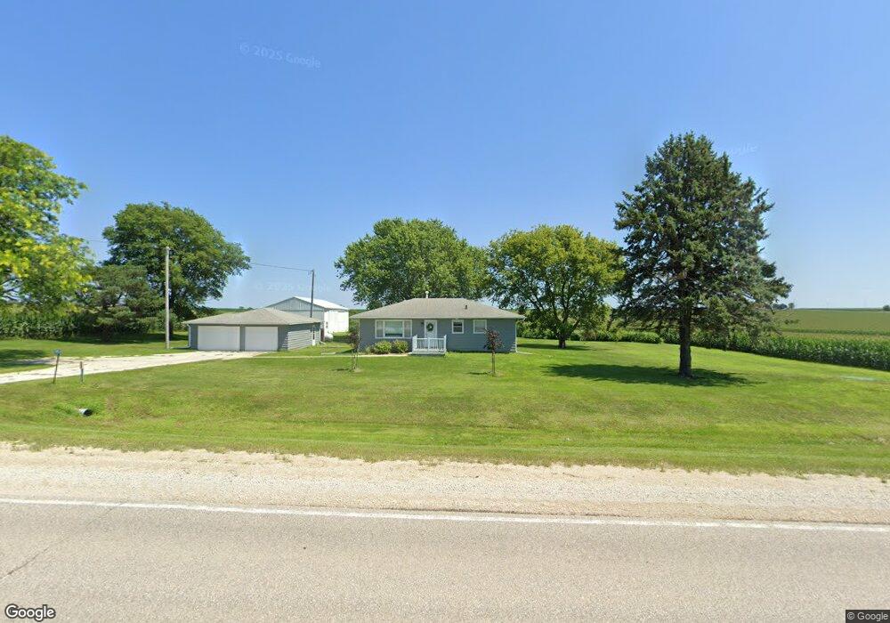
1951 Euclid Ave Waverly, IA 50677
Estimated Value: $211,026 - $258,000
3
Beds
1
Bath
1,040
Sq Ft
$226/Sq Ft
Est. Value
About This Home
This home is located at 1951 Euclid Ave, Waverly, IA 50677 and is currently estimated at $235,507, approximately $226 per square foot. 1951 Euclid Ave is a home located in Bremer County with nearby schools including Waverly-Shell Rock Senior High School and St. Paul's Lutheran School.
Ownership History
Date
Name
Owned For
Owner Type
Purchase Details
Closed on
Sep 4, 2020
Sold by
Espr004246 Loretta M Davidson Estate
Bought by
Spratt Timothy R and Spratt Christine E
Current Estimated Value
Home Financials for this Owner
Home Financials are based on the most recent Mortgage that was taken out on this home.
Original Mortgage
$134,400
Outstanding Balance
$119,050
Interest Rate
2.8%
Mortgage Type
New Conventional
Estimated Equity
$116,457
Create a Home Valuation Report for This Property
The Home Valuation Report is an in-depth analysis detailing your home's value as well as a comparison with similar homes in the area
Home Values in the Area
Average Home Value in this Area
Purchase History
| Date | Buyer | Sale Price | Title Company |
|---|---|---|---|
| Spratt Timothy R | $168,000 | None Available |
Source: Public Records
Mortgage History
| Date | Status | Borrower | Loan Amount |
|---|---|---|---|
| Open | Spratt Timothy R | $134,400 |
Source: Public Records
Tax History Compared to Growth
Tax History
| Year | Tax Paid | Tax Assessment Tax Assessment Total Assessment is a certain percentage of the fair market value that is determined by local assessors to be the total taxable value of land and additions on the property. | Land | Improvement |
|---|---|---|---|---|
| 2025 | $2,436 | $214,310 | $75,900 | $138,410 |
| 2024 | $2,436 | $206,200 | $75,900 | $130,300 |
| 2023 | $1,974 | $180,690 | $54,750 | $125,940 |
| 2022 | $1,934 | $155,600 | $54,750 | $100,850 |
| 2021 | $1,822 | $155,600 | $54,750 | $100,850 |
| 2020 | $1,822 | $143,970 | $45,850 | $98,120 |
| 2019 | $1,814 | $143,970 | $0 | $0 |
| 2018 | $1,742 | $143,970 | $0 | $0 |
| 2017 | $1,742 | $135,390 | $0 | $0 |
| 2016 | $1,740 | $135,390 | $0 | $0 |
| 2015 | $1,740 | $126,530 | $0 | $0 |
| 2014 | $1,666 | $126,530 | $0 | $0 |
Source: Public Records
Map
Nearby Homes
- 1366 190th St
- 777 Cedar Glyn Dr
- 509 Tumbleweed Trail
- 505 Tumbleweed Trail
- 207 Sandcastle Ln
- Lot 1B Cedar Square
- 114 Deerfield Cir Unit Whitetail Bluff Lot
- 110 Deerfield Cir Unit Whitetail Bluff Lot
- 102 Deerfield Cir Unit Whitetail Bluff Lot
- 106 Deerfield Cir Unit Whitetail Bluff Lot
- 207 Deerfield Cir Unit Whitetail Bluff Lot
- 1111 Fawn Hollow Unit Whitetail Bluff Lot
- 128 Red Fox Trail
- 1107 Fawn Hollow Unit Whitetail Bluff Lot
- 1109 5th St NW
- 102 9th Ave NW
- 607 10th Ave NW
- 910 6th St NW
- 1109 Copper Terrace
- 315 3rd Ave NE