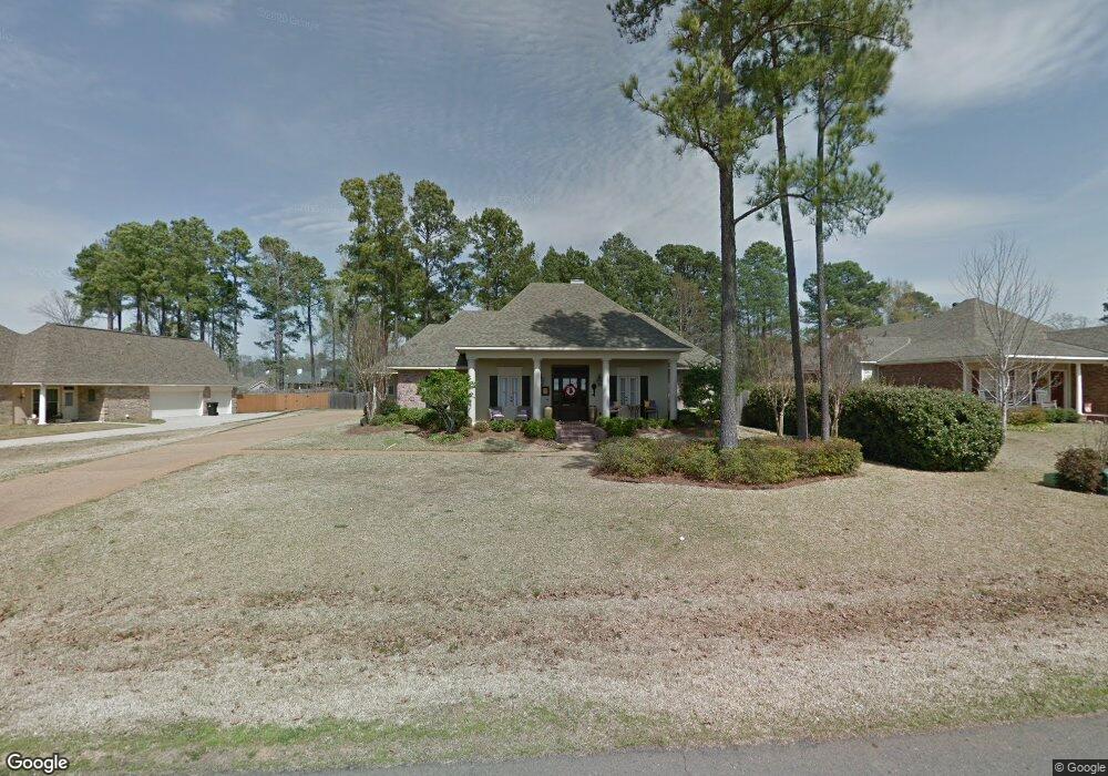
1951 Honeytree Trail Haughton, LA 71037
Eastwood NeighborhoodEstimated Value: $368,000 - $410,650
4
Beds
2
Baths
2,355
Sq Ft
$167/Sq Ft
Est. Value
About This Home
This home is located at 1951 Honeytree Trail, Haughton, LA 71037 and is currently estimated at $393,663, approximately $167 per square foot. 1951 Honeytree Trail is a home located in Bossier Parish with nearby schools including T.L. Rodes Elementary School, Platt Elementary School, and Princeton Elementary School.
Ownership History
Date
Name
Owned For
Owner Type
Purchase Details
Closed on
Jan 23, 2009
Sold by
King Stacey Alan and King Amber Michelle Mccollum
Bought by
Stovall Matthew Wayne and Stovall Leslie Michelle Grosjean
Current Estimated Value
Home Financials for this Owner
Home Financials are based on the most recent Mortgage that was taken out on this home.
Original Mortgage
$274,928
Outstanding Balance
$175,993
Interest Rate
5.42%
Mortgage Type
Unknown
Estimated Equity
$217,670
Purchase Details
Closed on
Nov 2, 2005
Sold by
Stonebridge Development Llc
Bought by
King Stacy A and King Amber M
Home Financials for this Owner
Home Financials are based on the most recent Mortgage that was taken out on this home.
Original Mortgage
$57,712
Interest Rate
5.75%
Mortgage Type
Unknown
Create a Home Valuation Report for This Property
The Home Valuation Report is an in-depth analysis detailing your home's value as well as a comparison with similar homes in the area
Home Values in the Area
Average Home Value in this Area
Purchase History
| Date | Buyer | Sale Price | Title Company |
|---|---|---|---|
| Stovall Matthew Wayne | $280,000 | None Available | |
| King Stacy A | $67,500 | None Available |
Source: Public Records
Mortgage History
| Date | Status | Borrower | Loan Amount |
|---|---|---|---|
| Open | Stovall Matthew Wayne | $274,928 | |
| Previous Owner | King Stacy A | $57,712 |
Source: Public Records
Tax History Compared to Growth
Tax History
| Year | Tax Paid | Tax Assessment Tax Assessment Total Assessment is a certain percentage of the fair market value that is determined by local assessors to be the total taxable value of land and additions on the property. | Land | Improvement |
|---|---|---|---|---|
| 2024 | $3,162 | $35,067 | $5,200 | $29,867 |
| 2023 | $2,641 | $28,782 | $3,950 | $24,832 |
| 2022 | $2,626 | $28,782 | $3,950 | $24,832 |
| 2021 | $2,626 | $28,782 | $3,950 | $24,832 |
| 2020 | $2,626 | $28,782 | $3,950 | $24,832 |
| 2019 | $2,498 | $27,480 | $2,400 | $25,080 |
| 2018 | $2,498 | $27,480 | $2,400 | $25,080 |
| 2017 | $2,468 | $27,480 | $2,400 | $25,080 |
| 2016 | $2,468 | $27,480 | $2,400 | $25,080 |
| 2015 | $2,310 | $27,340 | $2,400 | $24,940 |
| 2014 | $2,310 | $27,340 | $2,400 | $24,940 |
Source: Public Records
Map
Nearby Homes
- 1940 Honeytree Trail
- 2228 Grapevine Ln
- 2117 Forest Hills Blvd
- 2805 Clearbrook Way
- 2200 Grapevine Ln
- 2816 Sunrise Point
- 3030 Sagefield Ln
- 2115 Hollow Wood Way
- 213 Whispering Pine Dr
- 4705 Highway 80 Unit 1
- 109 Flagg Dr
- 212 Sweetgum Dr
- 105 Flagg Dr
- 506 Whispering Pine Cir
- 774 Chandler Rd
- 117 Martha Dr
- 123 Taylor Bend St
- 128 Taylor Bend St
- 615 Lawrence Dr
- 109 Woodcrest Dr
- 1955 Honeytree Trail
- 1959 Honeytree Trail
- 2136 Forest Hills Blvd
- 1952 Honeytree Trail
- 1956 Honeytree Trail
- 1948 Honeytree Trail
- 2144 Forest Hills Blvd
- 1937 Honeytree Trail
- 1944 Honeytree Trail
- 1963 Honeytree Trail
- 2132 Forest Hills Blvd
- 1960 Honeytree Trail
- 2152 Forest Hills Blvd
- 1964 Honeytree Trail
- 1967 Honeytree Trail
- 1867 Sparrow Ridge
- 2128 Forest Hills Blvd
- 1871 Sparrow Ridge
- 1863 Sparrow Ridge
- 1936 Honeytree Trail