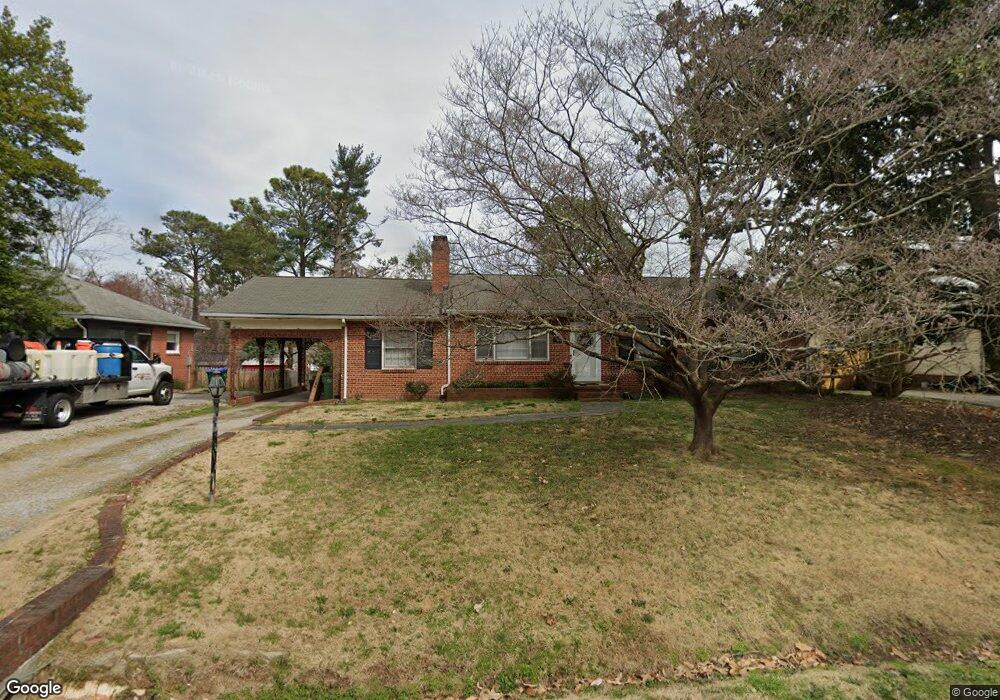
1951 Lansing Ave Richmond, VA 23225
Westlake Hills NeighborhoodEstimated Value: $322,799 - $380,000
--
Bed
2
Baths
1,430
Sq Ft
$248/Sq Ft
Est. Value
About This Home
This home is located at 1951 Lansing Ave, Richmond, VA 23225 and is currently estimated at $354,200, approximately $247 per square foot. 1951 Lansing Ave is a home located in Richmond City with nearby schools including Southampton Elementary School, Lucille M. Brown Middle, and Huguenot High School.
Ownership History
Date
Name
Owned For
Owner Type
Purchase Details
Closed on
Dec 2, 2005
Sold by
Rollins Blake A
Bought by
Polen Michael W
Current Estimated Value
Home Financials for this Owner
Home Financials are based on the most recent Mortgage that was taken out on this home.
Original Mortgage
$100,000
Outstanding Balance
$55,451
Interest Rate
6.14%
Mortgage Type
New Conventional
Estimated Equity
$298,749
Purchase Details
Closed on
Jun 27, 2002
Sold by
Rollins Blake A
Bought by
Rollins Blake A
Home Financials for this Owner
Home Financials are based on the most recent Mortgage that was taken out on this home.
Original Mortgage
$86,266
Interest Rate
6.92%
Mortgage Type
New Conventional
Purchase Details
Closed on
Oct 29, 1999
Sold by
Hart Thomas C
Bought by
Rollins Blake A and Lynch Cathleen M
Home Financials for this Owner
Home Financials are based on the most recent Mortgage that was taken out on this home.
Original Mortgage
$86,288
Interest Rate
7.78%
Mortgage Type
FHA
Create a Home Valuation Report for This Property
The Home Valuation Report is an in-depth analysis detailing your home's value as well as a comparison with similar homes in the area
Home Values in the Area
Average Home Value in this Area
Purchase History
| Date | Buyer | Sale Price | Title Company |
|---|---|---|---|
| Polen Michael W | $125,000 | -- | |
| Rollins Blake A | -- | -- | |
| Rollins Blake A | $87,000 | -- |
Source: Public Records
Mortgage History
| Date | Status | Borrower | Loan Amount |
|---|---|---|---|
| Open | Polen Michael W | $100,000 | |
| Previous Owner | Rollins Blake A | $86,266 | |
| Previous Owner | Rollins Blake A | $86,288 |
Source: Public Records
Tax History Compared to Growth
Tax History
| Year | Tax Paid | Tax Assessment Tax Assessment Total Assessment is a certain percentage of the fair market value that is determined by local assessors to be the total taxable value of land and additions on the property. | Land | Improvement |
|---|---|---|---|---|
| 2025 | $3,564 | $297,000 | $68,000 | $229,000 |
| 2024 | $3,156 | $263,000 | $45,000 | $218,000 |
| 2023 | $3,096 | $258,000 | $45,000 | $213,000 |
| 2022 | $2,616 | $218,000 | $45,000 | $173,000 |
| 2021 | $2,196 | $186,000 | $35,000 | $151,000 |
| 2020 | $2,195 | $183,000 | $35,000 | $148,000 |
| 2019 | $3,039 | $161,000 | $35,000 | $126,000 |
| 2018 | $1,812 | $151,000 | $35,000 | $116,000 |
| 2017 | $1,764 | $147,000 | $35,000 | $112,000 |
| 2016 | $1,764 | $147,000 | $35,000 | $112,000 |
| 2015 | $1,740 | $146,000 | $35,000 | $111,000 |
| 2014 | $1,740 | $145,000 | $35,000 | $110,000 |
Source: Public Records
Map
Nearby Homes
- 1937 Lansing Ave
- 2021 Cedarhurst Dr
- 2024 Cedarhurst Dr
- 5600 Riverside Heights Way
- 2320 Pineway Dr
- 5504 Riverside Heights Way
- 5636 Forest Hill Ave
- 2324 N Riverside Dr
- 2831 Braidwood Rd
- 6616 Wexford Ln
- 5804 Riverside Dr
- 1704 German School Rd
- 5612 Southern Pine Dr
- 1722 Leicester Rd
- 1112 Blandy Ave
- 1 R Forest Hill Ave Unit U1
- 2956 Hathaway Rd Unit U1108
- 2956 Hathaway Rd Unit U202
- 2956 Hathaway Rd Unit U104
- 2956 Hathaway Rd Unit 803
- 1943 Lansing Ave
- 1957 Lansing Ave
- 2012 Briarcliff Rd
- 2006 Briarcliff Rd
- 1965 Lansing Ave
- 2000 Briarcliff Rd
- 1952 Lansing Ave
- 2018 Briarcliff Rd
- 1946 Lansing Ave
- 1940 Lansing Ave
- 1929 Lansing Ave
- 1924 Briarcliff Rd
- 1962 Lansing Ave
- 1932 Lansing Ave
- 1918 Briarcliff Rd
- 2100 Briarcliff Rd
- 1921 Lansing Ave
- 6253 Nicolet Rd
- 2013 Briarcliff Rd
- 2007 Briarcliff Rd