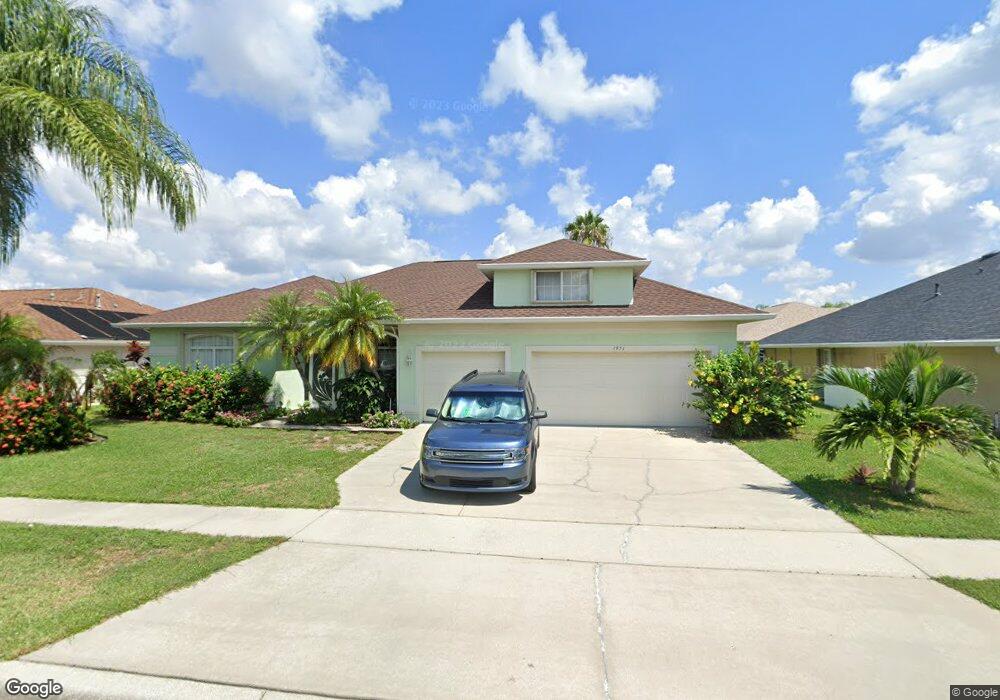
1951 Thesy Dr Melbourne, FL 32940
Estimated Value: $482,816 - $592,000
3
Beds
2
Baths
2,127
Sq Ft
$247/Sq Ft
Est. Value
About This Home
This home is located at 1951 Thesy Dr, Melbourne, FL 32940 and is currently estimated at $525,704, approximately $247 per square foot. 1951 Thesy Dr is a home located in Brevard County with nearby schools including Quest Elementary School, John F. Kennedy Middle School, and Pinecrest Academy Space Coast.
Ownership History
Date
Name
Owned For
Owner Type
Purchase Details
Closed on
Feb 5, 1997
Sold by
Sun Castles Inc
Bought by
Moroz Michael T and Moroz Barbara J
Current Estimated Value
Home Financials for this Owner
Home Financials are based on the most recent Mortgage that was taken out on this home.
Original Mortgage
$100,000
Outstanding Balance
$11,438
Interest Rate
7.69%
Estimated Equity
$514,266
Purchase Details
Closed on
Jan 21, 1997
Sold by
Clerc Jean Yves
Bought by
Sun Castles Inc
Home Financials for this Owner
Home Financials are based on the most recent Mortgage that was taken out on this home.
Original Mortgage
$100,000
Outstanding Balance
$11,438
Interest Rate
7.69%
Estimated Equity
$514,266
Create a Home Valuation Report for This Property
The Home Valuation Report is an in-depth analysis detailing your home's value as well as a comparison with similar homes in the area
Home Values in the Area
Average Home Value in this Area
Purchase History
| Date | Buyer | Sale Price | Title Company |
|---|---|---|---|
| Moroz Michael T | $33,000 | -- | |
| Sun Castles Inc | $33,000 | -- |
Source: Public Records
Mortgage History
| Date | Status | Borrower | Loan Amount |
|---|---|---|---|
| Open | Moroz Michael T | $100,000 |
Source: Public Records
Tax History Compared to Growth
Tax History
| Year | Tax Paid | Tax Assessment Tax Assessment Total Assessment is a certain percentage of the fair market value that is determined by local assessors to be the total taxable value of land and additions on the property. | Land | Improvement |
|---|---|---|---|---|
| 2025 | $2,665 | $210,850 | -- | -- |
| 2024 | $2,612 | $204,910 | -- | -- |
| 2023 | $2,612 | $198,950 | $0 | $0 |
| 2022 | $2,430 | $193,160 | $0 | $0 |
| 2021 | $2,508 | $187,540 | $0 | $0 |
| 2020 | $2,447 | $184,960 | $0 | $0 |
| 2019 | $2,393 | $180,810 | $0 | $0 |
| 2018 | $2,396 | $177,440 | $0 | $0 |
| 2017 | $2,414 | $173,800 | $0 | $0 |
| 2016 | $2,451 | $170,230 | $45,000 | $125,230 |
| 2015 | $2,525 | $169,050 | $42,000 | $127,050 |
| 2014 | $2,541 | $167,710 | $39,000 | $128,710 |
Source: Public Records
Map
Nearby Homes
- 1872 Freedom Dr
- 2108 Lionel Dr
- 1911 Fabien Cir
- 1372 Independence Ave
- 1198 Continental Ave
- 1958 Crane Creek Blvd
- 1317 Independence Ave
- 2045 Bayhill Dr
- 1964 Bayhill Dr
- 1423 Independence Ave
- 1493 Laramie Cir
- 1484 Independence Ave
- 1555 Knoll Ridge Dr
- 1605 Freedom Dr
- 1413 Old Millpond Rd
- 1582 Laramie Cir
- 1531 Independence Ave
- 1360 Democracy Ave
- 1340 Democracy Ave
- 1551 Independence Ave