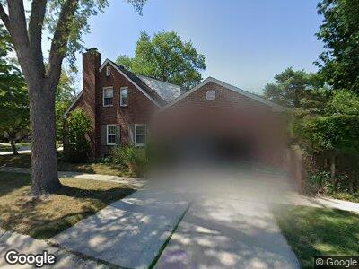
1952 Lancaster St Grosse Pointe Woods, MI 48236
Estimated Value: $269,000 - $320,000
3
Beds
2
Baths
1,606
Sq Ft
$187/Sq Ft
Est. Value
About This Home
This home is located at 1952 Lancaster St, Grosse Pointe Woods, MI 48236 and is currently estimated at $300,306, approximately $186 per square foot. 1952 Lancaster St is a home located in Wayne County with nearby schools including Stevens T. Mason Elementary School, Parcells Middle School, and Grosse Pointe North High School.
Ownership History
Date
Name
Owned For
Owner Type
Purchase Details
Closed on
Nov 23, 2011
Sold by
Burchett Roger Kevin and Burchett Mary A
Bought by
Wells Fargo Bank Na
Current Estimated Value
Purchase Details
Closed on
Jun 18, 2004
Sold by
Burchett Mary A
Bought by
Burchett Roger Kevin
Home Financials for this Owner
Home Financials are based on the most recent Mortgage that was taken out on this home.
Original Mortgage
$200,750
Interest Rate
6.37%
Mortgage Type
FHA
Purchase Details
Closed on
Apr 26, 2001
Sold by
Burchett Kevin R
Bought by
Burchett Mary A
Create a Home Valuation Report for This Property
The Home Valuation Report is an in-depth analysis detailing your home's value as well as a comparison with similar homes in the area
Home Values in the Area
Average Home Value in this Area
Purchase History
| Date | Buyer | Sale Price | Title Company |
|---|---|---|---|
| Wells Fargo Bank Na | $97,600 | None Available | |
| Burchett Roger Kevin | -- | Metropolitan Title Company | |
| Burchett Mary A | -- | -- |
Source: Public Records
Mortgage History
| Date | Status | Borrower | Loan Amount |
|---|---|---|---|
| Previous Owner | Burchett Roger Kevin | $200,750 | |
| Closed | Burchett Mary A | -- |
Source: Public Records
Tax History Compared to Growth
Tax History
| Year | Tax Paid | Tax Assessment Tax Assessment Total Assessment is a certain percentage of the fair market value that is determined by local assessors to be the total taxable value of land and additions on the property. | Land | Improvement |
|---|---|---|---|---|
| 2024 | $2,684 | $143,600 | $0 | $0 |
| 2023 | $2,581 | $134,800 | $0 | $0 |
| 2022 | $4,042 | $116,000 | $0 | $0 |
| 2021 | $3,853 | $113,000 | $0 | $0 |
| 2020 | $3,968 | $114,300 | $0 | $0 |
| 2019 | $3,884 | $107,200 | $0 | $0 |
| 2018 | $2,309 | $89,600 | $0 | $0 |
| 2017 | $2,683 | $87,900 | $0 | $0 |
| 2016 | $3,658 | $80,400 | $0 | $0 |
| 2015 | $6,340 | $70,200 | $0 | $0 |
| 2013 | $6,160 | $62,900 | $0 | $0 |
| 2012 | -- | $62,200 | $14,300 | $47,900 |
Source: Public Records
Map
Nearby Homes
- 2049 Lochmoor Blvd
- 2048 Hunt Club Dr
- 2080 Hunt Club Dr
- 21111 Fleetwood Dr
- 21159 Lennon St
- 21102 Lancaster St
- 1930 Kenmore Dr
- 2180 Vernier Rd
- 1981 Kenmore Dr
- 20950 Norwood Dr
- 2048 Anita Ave
- 1750 Vernier Rd Unit 10
- 20971 Kenmore Ave
- 21128 Kenmore Ave
- 2057 Hawthorne Rd
- 2107 Hollywood Ave
- 1810 Hawthorne Rd
- 1602 Anita Ave
- 1427 N Renaud Rd
- 20681 Beaufait St
- 1952 Lancaster St
- 1960 Lancaster St
- 1968 Lancaster St
- 1930 Lancaster St
- 1976 Lancaster St
- 1953 Fleetwood Dr
- 1961 Fleetwood Dr
- 1922 Lancaster St
- 1969 Fleetwood Dr
- 1984 Lancaster St
- 1931 Fleetwood Dr Unit Bldg-Unit
- 1931 Fleetwood Dr
- 1977 Fleetwood Dr
- 1914 Lancaster St
- 1953 Lancaster St
- 1961 Lancaster St
- 1923 Fleetwood Dr
- 1992 Lancaster St
- 1993 Fleetwood Dr
- 1969 Lancaster St