1952 Woods Point Waconia, MN 55387
Estimated Value: $408,000 - $711,990
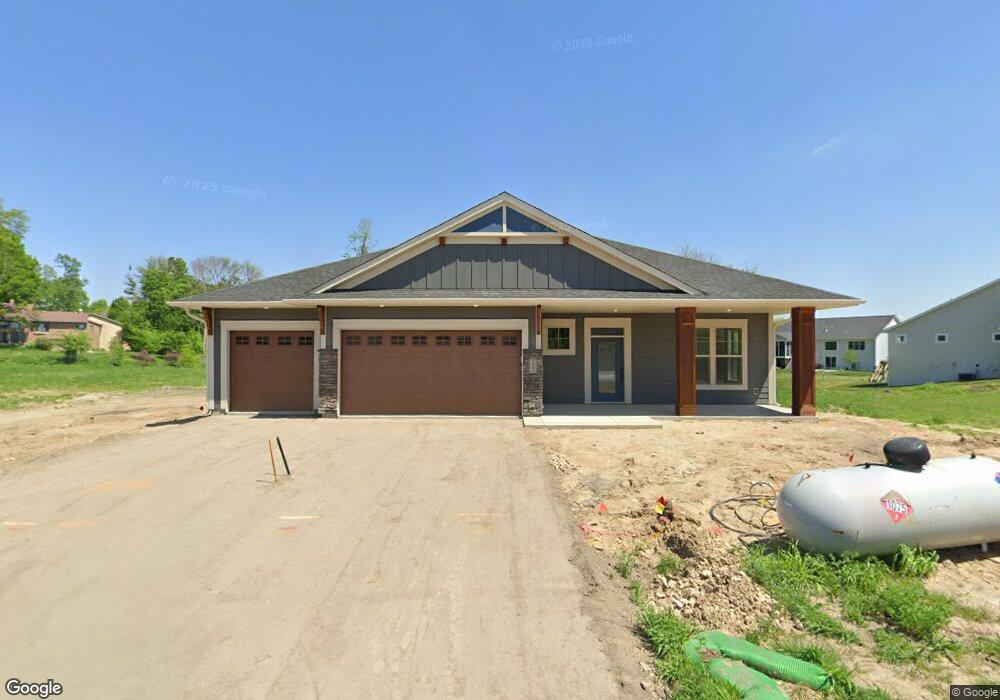
About This Home
This home is located at 1952 Woods Point, Waconia, MN 55387 and is currently estimated at $603,248. 1952 Woods Point is a home with nearby schools including Southview Elementary School, Waconia Middle School, and Waconia High School.
Ownership History
We collect this data history from publicly available records. To have your information removed, we recommend requesting removal directly through your county’s website.
Purchase Details
Home Financials for this Owner
Home Financials are based on the most recent Mortgage that was taken out on this home.Purchase Details
Home Financials for this Owner
Home Financials are based on the most recent Mortgage that was taken out on this home.Home Values in the Area
Average Home Value in this Area
Purchase History
We collect this data history from publicly available records. To have your information removed, we recommend requesting removal directly through your county’s website.
| Date | Buyer | Sale Price | Title Company |
|---|---|---|---|
| $714,612 | Trademark Title | ||
| $645,000 | Trademark Title |
Mortgage History
We collect this data history from publicly available records. To have your information removed, we recommend requesting removal directly through your county’s website.
| Date | Status | Borrower | Loan Amount |
|---|---|---|---|
| Open | $240,500 | ||
| Previous Owner | $762,750 | ||
| Previous Owner | $204,750 |
Tax History
We collect this data history from publicly available records. To have your information removed, we recommend requesting removal directly through your county’s website.
| Year | Tax Paid | Tax Assessment Tax Assessment Total Assessment is a certain percentage of the fair market value that is determined by local assessors to be the total taxable value of land and additions on the property. | Land | Improvement |
|---|---|---|---|---|
| 2026 | $1,962 | $669,700 | $155,000 | $514,700 |
| 2025 | $1,962 | $175,600 | $150,000 | $25,600 |
| 2024 | $782 | $150,000 | $150,000 | $0 |
Map
- 1954 Woods Point
- 1956 Woods Point
- 1949 Campfire Dr E
- 1884 Campfire Dr W
- 1774 Campfire Dr W
- 1767 Campfire Dr W
- 1961 Sierra Pkwy
- 677 Sierra Pkwy
- 669 Sierra Pkwy
- 657 Sierra Pkwy
- 661 Sierra Pkwy
- 1920 Clearwater Rd
- 668 Sierra Pkwy
- 1936 Clearwater Rd
- 649 Sierra Pkwy
- 641 Sierra Pkwy
- 2081 Silver St
- 716 Longmeadow Ln
- 221 Huntington Dr
- 216 Huntington Dr
- 1948 Woods Point
- at
- 1951 Woods Point St Unit 40895087
- at
- at
- 1951 Woods Point St Unit 37183572
- 1949 Woods Point
- 1947 Woods Point
- 1948 Campfire Ct
- 1944 Woods Point
- 1945 Woods Point
- 1950 Campfire Dr E
- 1950 1950 E Campfire Dr
- 1891 Campfire Ct
- 1891 Campfire Dr W
- 1890 Campfire Ct
- 1889 Campfire Dr W
- 1889 Campfire Dr W
- 1887 Campfire Dr W
- 1947 Campfire Dr E
Ask me questions while you tour the home.