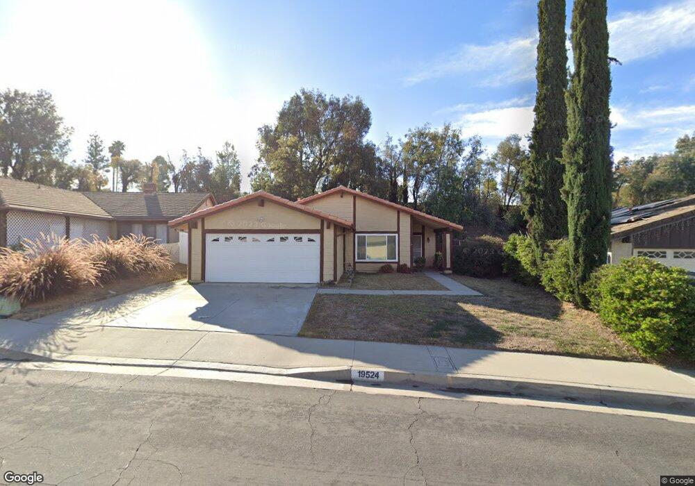
19524 Rogan Ct Rowland Heights, CA 91748
Estimated Value: $954,255 - $1,169,000
3
Beds
2
Baths
1,507
Sq Ft
$680/Sq Ft
Est. Value
About This Home
This home is located at 19524 Rogan Ct, Rowland Heights, CA 91748 and is currently estimated at $1,024,064, approximately $679 per square foot. 19524 Rogan Ct is a home located in Los Angeles County with nearby schools including Shelyn Elementary School, Alvarado Intermediate School, and John A. Rowland High School.
Ownership History
Date
Name
Owned For
Owner Type
Purchase Details
Closed on
Aug 12, 2019
Sold by
Chia Ti Sun Family Trust and Sun Chia Ti
Bought by
Chakang Sun Separate Property Trust and Chia Ti Sun Family Trust
Current Estimated Value
Purchase Details
Closed on
Sep 5, 2017
Sold by
Sun Chia Ti
Bought by
Sun Chia Ti and Chia Ti Sun Family Trust
Purchase Details
Closed on
Jul 27, 2017
Sold by
Chen Kwang Yuen
Bought by
Sun Chia Ti
Purchase Details
Closed on
May 18, 2012
Sold by
Chang Peter Hung Liang and Chang Grace Hsiang Heng
Bought by
Sun Chia Ti and Sun Cha Kang
Create a Home Valuation Report for This Property
The Home Valuation Report is an in-depth analysis detailing your home's value as well as a comparison with similar homes in the area
Home Values in the Area
Average Home Value in this Area
Purchase History
| Date | Buyer | Sale Price | Title Company |
|---|---|---|---|
| Chakang Sun Separate Property Trust | -- | Accommodation/Courtesy Recordi | |
| Sun Chia Ti | -- | None Available | |
| Sun Chia Ti | -- | None Available | |
| Sun Chia Ti | $350,000 | Advantage Title Inc |
Source: Public Records
Tax History Compared to Growth
Tax History
| Year | Tax Paid | Tax Assessment Tax Assessment Total Assessment is a certain percentage of the fair market value that is determined by local assessors to be the total taxable value of land and additions on the property. | Land | Improvement |
|---|---|---|---|---|
| 2025 | $5,798 | $439,607 | $314,008 | $125,599 |
| 2024 | $5,798 | $430,988 | $307,851 | $123,137 |
| 2023 | $5,610 | $422,538 | $301,815 | $120,723 |
| 2022 | $5,488 | $414,254 | $295,898 | $118,356 |
| 2021 | $5,397 | $406,133 | $290,097 | $116,036 |
| 2020 | $5,329 | $401,970 | $287,123 | $114,847 |
| 2019 | $5,239 | $394,090 | $281,494 | $112,596 |
| 2018 | $4,974 | $386,364 | $275,975 | $110,389 |
| 2016 | $4,784 | $371,362 | $265,259 | $106,103 |
| 2015 | $4,707 | $365,785 | $261,275 | $104,510 |
| 2014 | $4,703 | $358,620 | $256,157 | $102,463 |
Source: Public Records
Map
Nearby Homes
- 2124 Camwood Ave
- 19519 Greenwillow Ln
- 2366 Pepperdale Dr
- 1953 Camwood Ave
- 2402 Pepperdale Dr
- 2350 Robert Rd
- 2189 Wind River Ln
- 2147 Wind River Ln
- 2225 Wind River Ln
- 19319 Temre Ln
- 1703 Hollandale Ave
- 2446 Hillman Ln
- 2100 Whistler Ct
- 1919 Brea Canyon Cut-Off Rd
- 19173 Hastings St
- 19527 Cronin Dr
- 2270 Paso Real Ave
- 2572 Carlton Place
- 2360 Oakleaf Canyon Rd
- 1560 S Otterbein Ave Unit 153
- 19530 Rogan Ct
- 19520 Rogan Ct
- 19534 Rogan Ct
- 19510 Rogan Ct
- 19540 Rogan Ct
- 2202 Arcdale Ave
- 2303 Bluehaven Dr
- 2208 Arcdale Ave
- 19523 Rogan Ct
- 19533 Rogan Ct
- 2222 Arcdale Ave
- 2144 Arcdale Ave
- 19544 Rogan Ct
- 2300 Arcdale Ave
- 19535 Rogan Ct
- 2315 Bluehaven Dr
- 2140 Arcdale Ave
- 19543 Rogan Ct
- 2310 Arcdale Ave
- 19550 Rogan Ct