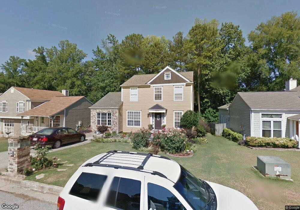
1953 Longwood Ct Unit 2 Lithonia, GA 30058
Estimated Value: $236,419 - $262,000
3
Beds
3
Baths
1,736
Sq Ft
$143/Sq Ft
Est. Value
About This Home
This home is located at 1953 Longwood Ct Unit 2, Lithonia, GA 30058 and is currently estimated at $248,855, approximately $143 per square foot. 1953 Longwood Ct Unit 2 is a home located in DeKalb County with nearby schools including Redan Elementary School, Lithonia Middle School, and Lithonia High School.
Ownership History
Date
Name
Owned For
Owner Type
Purchase Details
Closed on
Nov 25, 2019
Sold by
Trans Am Sfe Ii Llc
Bought by
Alto Asset Co 1 Llc
Current Estimated Value
Purchase Details
Closed on
Apr 4, 2017
Sold by
Worthy Inetta L
Bought by
Trans Am Sfe Ii Llc
Purchase Details
Closed on
Jul 11, 2001
Sold by
Williams David M
Bought by
Worthy Inetta L
Purchase Details
Closed on
Jan 12, 1994
Sold by
Brown Carol M
Bought by
Williams David M
Home Financials for this Owner
Home Financials are based on the most recent Mortgage that was taken out on this home.
Original Mortgage
$71,500
Interest Rate
10.5%
Mortgage Type
FHA
Create a Home Valuation Report for This Property
The Home Valuation Report is an in-depth analysis detailing your home's value as well as a comparison with similar homes in the area
Home Values in the Area
Average Home Value in this Area
Purchase History
| Date | Buyer | Sale Price | Title Company |
|---|---|---|---|
| Alto Asset Co 1 Llc | $173,852 | -- | |
| Trans Am Sfe Ii Llc | $69,200 | -- | |
| Worthy Inetta L | $112,500 | -- | |
| Williams David M | $7,000 | -- |
Source: Public Records
Mortgage History
| Date | Status | Borrower | Loan Amount |
|---|---|---|---|
| Previous Owner | Williams David M | $71,500 |
Source: Public Records
Tax History Compared to Growth
Tax History
| Year | Tax Paid | Tax Assessment Tax Assessment Total Assessment is a certain percentage of the fair market value that is determined by local assessors to be the total taxable value of land and additions on the property. | Land | Improvement |
|---|---|---|---|---|
| 2025 | $5,043 | $103,320 | $17,564 | $85,756 |
| 2024 | $5,010 | $103,320 | $17,564 | $85,756 |
| 2023 | $5,010 | $103,320 | $18,000 | $85,320 |
| 2022 | $2,639 | $52,920 | $7,409 | $45,511 |
| 2021 | $2,675 | $52,920 | $7,409 | $45,511 |
| 2020 | $2,651 | $52,920 | $7,200 | $45,720 |
| 2019 | $2,005 | $38,560 | $7,200 | $31,360 |
| 2018 | $1,283 | $38,560 | $7,200 | $31,360 |
| 2017 | $1,085 | $33,200 | $4,200 | $29,000 |
| 2016 | $867 | $27,600 | $4,200 | $23,400 |
| 2014 | $762 | $24,440 | $3,720 | $20,720 |
Source: Public Records
Map
Nearby Homes
- 6653 Eastbriar Dr
- 6380 Phillips Place
- 6403 Charter Way
- 6351 Stablewood Way
- 2041 Marbut Trace
- 2060 Bedford Ct Unit 1
- 6238 Phillips Lake Ct
- 6240 Giles Rd
- 6347 Princeton Ridge Dr
- 6350 Princeton Ridge Dr
- 2049 Charter Ln
- 6415 Shalks Crossing Dr
- 6396 Stablewood Way
- 2107 Bedford Ct
- 1884 Plainsboro Dr
- 1871 Plainsboro Dr
- 6510 Charter Way
- 2191 Phillips Rd
- 6420 Marbut Rd
- 6322 Scudders Dr
- 1947 Longwood Ct
- 1957 Longwood Ct Unit 2
- 0 Longwood Ct Unit 7309927
- 1963 Longwood Ct
- 1963 Longwood Ct Unit 108
- 1941 Longwood Ct Unit 2
- 1946 Big Branch Ct
- 6646 Eastbriar Dr
- 6646 Eastbriar Dr Unit 115
- 1950 Big Branch Ct
- 1967 Longwood Ct
- 1956 Longwood Ct
- 1952 Longwood Ct
- 1948 Longwood Ct Unit 2
- 1960 Longwood Ct
- 6654 Eastbriar Dr
- 1942 Longwood Ct
- 1964 Longwood Ct Unit 2
- 1958 Big Branch Ct
- 1971 Longwood Ct