Estimated Value: $46,000 - $67,183
2
Beds
1
Bath
1,064
Sq Ft
$52/Sq Ft
Est. Value
About This Home
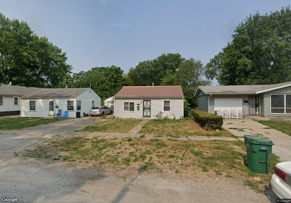
This home is located at 1953 S 19th St, Springfield, IL 62703 and is currently estimated at $54,796, approximately $51 per square foot. 1953 S 19th St is a home located in Sangamon County with nearby schools including Sandburg Elementary School, Benjamin Franklin Middle School, and Springfield Southeast High School.
Ownership History
Date
Name
Owned For
Owner Type
Purchase Details
Closed on
Jul 23, 2015
Current Estimated Value
Purchase Details
Closed on
Jun 4, 2012
Purchase Details
Closed on
Dec 16, 2009
Purchase Details
Closed on
Dec 12, 2008
Purchase Details
Closed on
May 9, 2008
Purchase Details
Closed on
Nov 19, 2007
Purchase Details
Closed on
Apr 24, 2006
Purchase Details
Closed on
Jun 13, 2001
Create a Home Valuation Report for This Property
The Home Valuation Report is an in-depth analysis detailing your home's value as well as a comparison with similar homes in the area
Home Values in the Area
Average Home Value in this Area
Purchase History
| Date | Buyer | Sale Price | Title Company |
|---|---|---|---|
| -- | -- | -- | |
| -- | -- | -- | |
| -- | $2,000 | -- | |
| -- | -- | -- | |
| -- | -- | -- | |
| -- | -- | -- | |
| -- | $32,000 | -- | |
| -- | -- | -- |
Source: Public Records
Tax History
| Year | Tax Paid | Tax Assessment Tax Assessment Total Assessment is a certain percentage of the fair market value that is determined by local assessors to be the total taxable value of land and additions on the property. | Land | Improvement |
|---|---|---|---|---|
| 2024 | $834 | $9,927 | $1,656 | $8,271 |
| 2023 | $802 | $9,068 | $1,513 | $7,555 |
| 2022 | $752 | $8,389 | $1,435 | $6,954 |
| 2021 | $727 | $8,075 | $1,381 | $6,694 |
| 2020 | $712 | $8,087 | $1,383 | $6,704 |
| 2019 | $699 | $8,059 | $1,378 | $6,681 |
| 2018 | $751 | $8,891 | $1,372 | $7,519 |
| 2017 | $736 | $8,776 | $1,354 | $7,422 |
| 2016 | $721 | $8,648 | $1,334 | $7,314 |
| 2015 | $360 | $4,306 | $1,318 | $2,988 |
| 2014 | $376 | $4,278 | $1,309 | $2,969 |
| 2013 | $262 | $3,234 | $1,309 | $1,925 |
Source: Public Records
Map
Nearby Homes
- 1838 S 19th St
- 2114 S Renfro St
- 1622 E Cornell Ave
- 1909 E Cedar St
- 2325 E Spruce St
- 9 Alken Ct
- 1833 S Street Ct
- 2041 E Cedar St
- 1942 S 11th St
- 2233 S 12th St
- 6 Ridge Ct Unit 1
- Lot 1 & 2 Bunn Dr
- 2205 S 11th St
- 2310 E Kansas St
- 2339 S 10th St
- 725 E Spruce St
- 1800 E Stanford Ave Unit 1
- 1430 S 8th St
- 2324 S 8th St
- 2420 Mayfair Rd
- 1949 S 19th St
- 1955 S 19th St
- 1947 S 19th St
- 1957 S 19th St
- 1933 S 19th St
- 1956 S 19th St
- 1936 S 19th St
- 1974 S 19th St
- 1925 S 19th St
- 1962 S Martin Luther King Junior Dr
- 2929 E Ash St
- 1924 S 19th St
- 1974 S M l King Dr Unit M
- 1962 S M l King Dr Unit M
- 1931 S Wirt Ave
- 1948 S Martin Luther King jr Dr Unit M
- 1960 S M l King Dr Unit M
- 1968 S Martin Luther King jr Dr Unit M
- 1958 S M l King Dr Unit M
- 1923 S 19th St
Your Personal Tour Guide
Ask me questions while you tour the home.