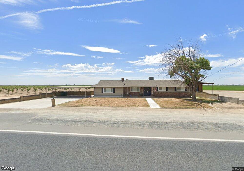
19531 Spacer Dr Tulare, CA 93274
Estimated Value: $404,000 - $417,971
3
Beds
2
Baths
1,508
Sq Ft
$274/Sq Ft
Est. Value
About This Home
This home is located at 19531 Spacer Dr, Tulare, CA 93274 and is currently estimated at $412,990, approximately $273 per square foot. 19531 Spacer Dr is a home located in Tulare County with nearby schools including Cypress Elementary School, Alpine Vista School, and Mission Oak High School.
Ownership History
Date
Name
Owned For
Owner Type
Purchase Details
Closed on
Jun 30, 2021
Sold by
Fox Lynette
Bought by
Fox Lynette and The Lynette Fox Separate Prope
Current Estimated Value
Purchase Details
Closed on
Aug 23, 2007
Sold by
Correia Frank P
Bought by
Correia Frank P and Correia Geneva L
Purchase Details
Closed on
May 9, 2000
Sold by
Lentzner Randy Scott
Bought by
Lentzner Cathryn Elaine
Purchase Details
Closed on
Jun 20, 1997
Sold by
Carroll Jeffrey Eugene
Bought by
Fox Lynette Cathleen
Create a Home Valuation Report for This Property
The Home Valuation Report is an in-depth analysis detailing your home's value as well as a comparison with similar homes in the area
Home Values in the Area
Average Home Value in this Area
Purchase History
| Date | Buyer | Sale Price | Title Company |
|---|---|---|---|
| Fox Lynette | -- | None Available | |
| Correia Frank P | -- | None Available | |
| Lentzner Cathryn Elaine | -- | Chicago Title Co | |
| Fox Lynette Cathleen | $104,828 | -- |
Source: Public Records
Tax History Compared to Growth
Tax History
| Year | Tax Paid | Tax Assessment Tax Assessment Total Assessment is a certain percentage of the fair market value that is determined by local assessors to be the total taxable value of land and additions on the property. | Land | Improvement |
|---|---|---|---|---|
| 2025 | $2,503 | $229,973 | $55,193 | $174,780 |
| 2024 | $2,503 | $225,464 | $54,111 | $171,353 |
| 2023 | $2,439 | $221,044 | $53,050 | $167,994 |
| 2022 | $2,368 | $216,710 | $52,010 | $164,700 |
| 2021 | $2,337 | $212,461 | $50,990 | $161,471 |
| 2020 | $2,376 | $210,282 | $50,467 | $159,815 |
| 2019 | $2,436 | $206,158 | $49,477 | $156,681 |
| 2018 | $2,397 | $202,116 | $48,507 | $153,609 |
| 2017 | $2,375 | $198,153 | $47,556 | $150,597 |
| 2016 | $2,271 | $194,268 | $46,624 | $147,644 |
| 2015 | $2,194 | $191,350 | $45,924 | $145,426 |
| 2014 | $2,194 | $187,601 | $45,024 | $142,577 |
Source: Public Records
Map
Nearby Homes
- 0 Road 112 Unit 202510708
- 0 Road 112 Unit 11681417
- 0 Road 112 Unit 232822
- 900 E Rankin Rd Unit 3
- 900 E Rankin Rd Unit 18
- 900 E Rankin Rd Unit 26
- 900 E Rankin Rd Unit 72
- 900 E Rankin Rd Unit 69
- 900 E Rankin Rd
- 900 E Rankin Rd Unit 5
- 900 E Rankin Rd Unit 134
- 900 E Rankin Rd Unit 30
- 1968 Tahoe Ave
- 1797 Clearwater St
- 1849 Softwind Dr
- 1851 Softwind Dr
- 014 S Laspina St
- 182330014 S Laspina St
- 1599 Softwind Dr
- 3043 Parks Ave