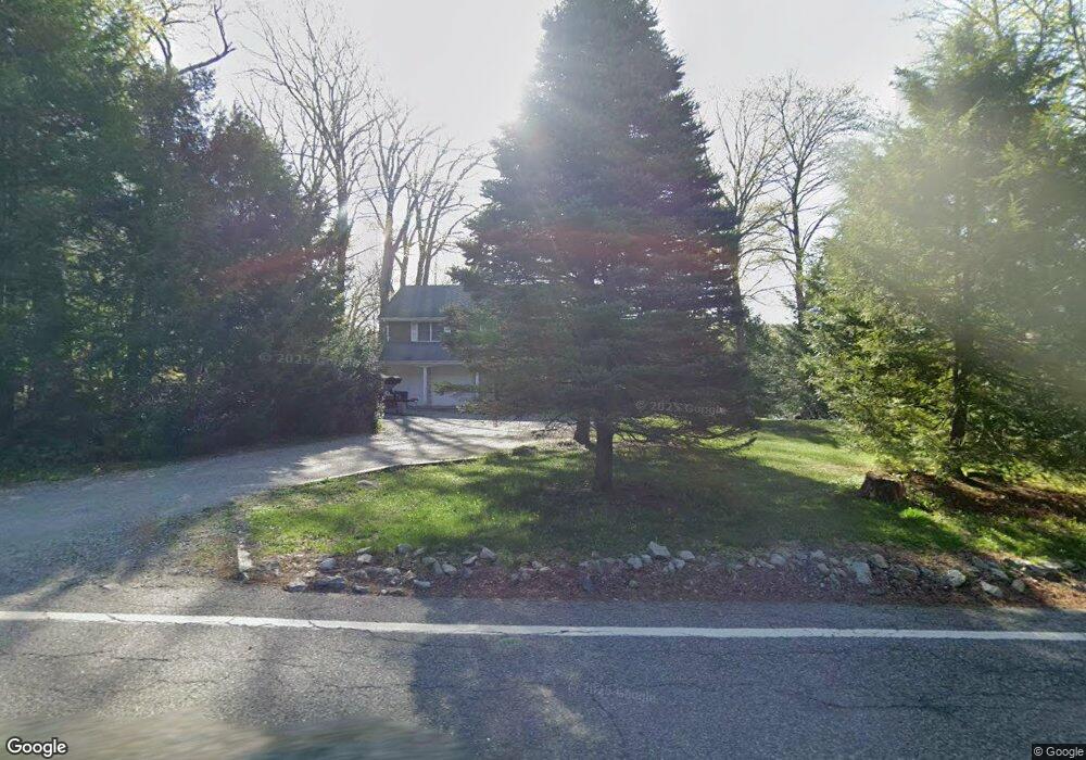
1954 Clinton Rd Hewitt, NJ 07421
Estimated Value: $527,613 - $634,000
--
Bed
--
Bath
2,000
Sq Ft
$289/Sq Ft
Est. Value
About This Home
This home is located at 1954 Clinton Rd, Hewitt, NJ 07421 and is currently estimated at $577,903, approximately $288 per square foot. 1954 Clinton Rd is a home located in Passaic County with nearby schools including Macopin Middle School and West Milford High School.
Ownership History
Date
Name
Owned For
Owner Type
Purchase Details
Closed on
Nov 9, 2021
Sold by
John Fabbo
Bought by
Fabbo John
Current Estimated Value
Purchase Details
Closed on
Mar 4, 2011
Sold by
Fasani Sara
Bought by
Garcia Juan and Bitar Maria T
Purchase Details
Closed on
May 12, 2003
Sold by
Behrens Scot
Bought by
Fabbo John and Fabbo Lynda
Home Financials for this Owner
Home Financials are based on the most recent Mortgage that was taken out on this home.
Original Mortgage
$265,000
Interest Rate
5.84%
Purchase Details
Closed on
Apr 20, 2000
Sold by
Hickling Richard G and Hickling Mildred S
Bought by
Behrens Scott E and Behrens Bernadette
Home Financials for this Owner
Home Financials are based on the most recent Mortgage that was taken out on this home.
Original Mortgage
$114,200
Interest Rate
8.19%
Create a Home Valuation Report for This Property
The Home Valuation Report is an in-depth analysis detailing your home's value as well as a comparison with similar homes in the area
Home Values in the Area
Average Home Value in this Area
Purchase History
| Date | Buyer | Sale Price | Title Company |
|---|---|---|---|
| Fabbo John | -- | None Listed On Document | |
| Garcia Juan | $115,000 | -- | |
| Fabbo John | $335,000 | -- | |
| Behrens Scott E | $259,900 | -- |
Source: Public Records
Mortgage History
| Date | Status | Borrower | Loan Amount |
|---|---|---|---|
| Previous Owner | Fabbo John | $265,000 | |
| Previous Owner | Behrens Scott E | $114,200 |
Source: Public Records
Tax History Compared to Growth
Tax History
| Year | Tax Paid | Tax Assessment Tax Assessment Total Assessment is a certain percentage of the fair market value that is determined by local assessors to be the total taxable value of land and additions on the property. | Land | Improvement |
|---|---|---|---|---|
| 2025 | $11,412 | $281,500 | $86,600 | $194,900 |
| 2024 | $11,471 | $281,500 | $86,600 | $194,900 |
| 2022 | $10,888 | $281,500 | $86,600 | $194,900 |
| 2021 | $10,655 | $281,500 | $86,600 | $194,900 |
| 2020 | $10,542 | $281,500 | $86,600 | $194,900 |
| 2019 | $10,401 | $281,500 | $86,600 | $194,900 |
| 2018 | $10,376 | $281,500 | $86,600 | $194,900 |
| 2017 | $10,424 | $281,500 | $86,600 | $194,900 |
| 2016 | $10,441 | $281,500 | $86,600 | $194,900 |
| 2015 | $10,320 | $281,500 | $86,600 | $194,900 |
| 2014 | $10,069 | $281,500 | $86,600 | $194,900 |
Source: Public Records
Map
Nearby Homes
- 0 Brook Rd Unit 3989068
- 54 Shadyside Rd
- 8 Tyler Place
- 00-1 Clinton Rd
- 42 Witte Rd
- 24 Caldwell Rd
- 67 Hanover Rd
- 4 Wyckoff Ct
- 6 Florence Rd
- 1761 Clinton Rd
- 119 Lake Shore Dr
- 3 Neptune Rd
- 628-630 N Lake Shore Dr
- 13 Landing Rd
- 54 Race Track Dr
- 12 Henry Rd
- 0 Shady Ln
- 30 Hemlock Ln
- 00 Jenkins Rd
- 0 Kresson Rd
- 1948 Clinton Rd
- 1960 Clinton Rd
- 1943 Clinton Rd
- 1968 Clinton Rd
- 6 Charissaa Ct
- 6 Charissa Ct
- 5 Bear Trail
- 0 Shadyside Rd
- 1974 Clinton Rd
- 1935 Clinton Rd
- 1975 Clinton Rd
- 38 Commanche Ln
- 40 Commanche Ln
- 14 Charissaa Ct
- 42 Commanche Ln
- 24 Charissaa Ct
- 24 Charissa Ct
- 30 Commanche Ln
- 8 Bear Trail
- 16 Bear Trail