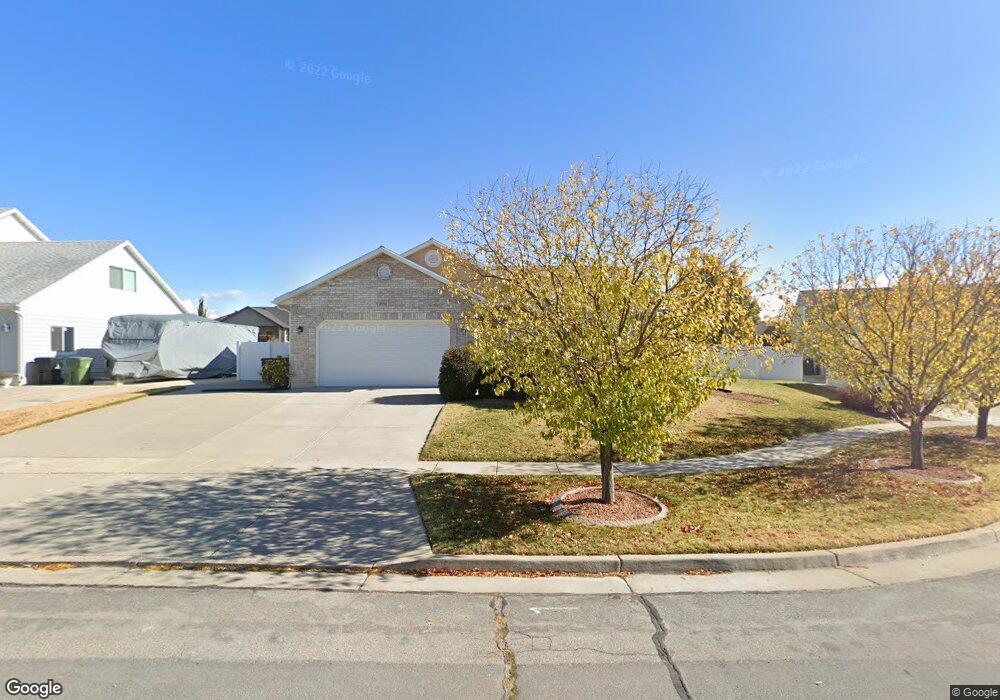
1954 S 2500 W Syracuse, UT 84075
Estimated Value: $499,312 - $519,000
3
Beds
2
Baths
1,308
Sq Ft
$390/Sq Ft
Est. Value
About This Home
This home is located at 1954 S 2500 W, Syracuse, UT 84075 and is currently estimated at $510,578, approximately $390 per square foot. 1954 S 2500 W is a home located in Davis County with nearby schools including Syracuse Elementary School, Syracuse Junior High School, and Syracuse High School.
Ownership History
Date
Name
Owned For
Owner Type
Purchase Details
Closed on
Aug 10, 2017
Sold by
Thatcher Becky L
Bought by
Thatcher Trust
Current Estimated Value
Purchase Details
Closed on
Jun 23, 1999
Sold by
Glauser Lynn and Glauser Sandi
Bought by
Thatcher Becky L
Home Financials for this Owner
Home Financials are based on the most recent Mortgage that was taken out on this home.
Original Mortgage
$142,943
Interest Rate
7.05%
Mortgage Type
FHA
Create a Home Valuation Report for This Property
The Home Valuation Report is an in-depth analysis detailing your home's value as well as a comparison with similar homes in the area
Home Values in the Area
Average Home Value in this Area
Purchase History
| Date | Buyer | Sale Price | Title Company |
|---|---|---|---|
| Thatcher Trust | -- | -- | |
| Thatcher Becky L | -- | Security Title Company |
Source: Public Records
Mortgage History
| Date | Status | Borrower | Loan Amount |
|---|---|---|---|
| Previous Owner | Thatcher Becky L | $142,943 |
Source: Public Records
Tax History
| Year | Tax Paid | Tax Assessment Tax Assessment Total Assessment is a certain percentage of the fair market value that is determined by local assessors to be the total taxable value of land and additions on the property. | Land | Improvement |
|---|---|---|---|---|
| 2025 | $2,582 | $249,150 | $131,930 | $117,220 |
| 2024 | $2,463 | $239,250 | $109,799 | $129,451 |
| 2023 | $2,305 | $408,000 | $152,953 | $255,047 |
| 2022 | $2,494 | $242,000 | $87,952 | $154,048 |
| 2021 | $2,177 | $327,000 | $130,051 | $196,949 |
| 2020 | $1,939 | $282,000 | $112,945 | $169,055 |
| 2019 | $1,874 | $269,000 | $110,818 | $158,182 |
| 2018 | $1,825 | $260,000 | $106,801 | $153,199 |
| 2016 | $1,690 | $126,280 | $40,977 | $85,303 |
| 2015 | $1,634 | $116,270 | $40,977 | $75,293 |
| 2014 | $1,363 | $98,823 | $40,977 | $57,846 |
| 2013 | -- | $100,679 | $31,283 | $69,396 |
Source: Public Records
Map
Nearby Homes
- 2475 Craig Ln
- 4344 W 1825 S Unit 102
- 4354 W 1825 S Unit 104
- 2679 W Antelope Dr
- 2329 W 1700 S
- 2803 W 2025 S
- 2297 W 2175 S
- 2138 Craig Ln
- 2136 W 2200 S
- 2104 W 2200 S
- 2982 S 3000 W
- 2912 S 3000 W
- 2961 S 2425 W Unit 1123
- 2696 2495 S Unit 207
- 2574 S 2430 W Unit 503
- 2594 S 2430 W Unit 501
- 2965 S 3000 W
- 2971 S 2425 W Unit 1124
- 3062 W Solace St
- 2635 S 2430 W Unit 114
- 1954 S 2500 W Unit 19
- 1934 S 2500 W
- 1934 S 2500 W Unit 20
- 1968 S 2500 W
- 1968 S 2500 W Unit 18
- 1956 S 2465 W
- 1938 S 2465 W
- 1972 S 2465 W
- 1974 S 2500 W
- 1974 S 2500 W Unit 17
- 1916 S 2500 W
- 1953 S 2500 W
- 1953 S 2500 W Unit 14
- 1933 S 2500 W
- 1933 S 2500 W Unit 13
- 1973 S 2500 W
- 1973 S 2500 W Unit 16
- 1967 S 2500 W
- 1967 S 2500 W Unit 15
- 1988 S 2465 W
Your Personal Tour Guide
Ask me questions while you tour the home.