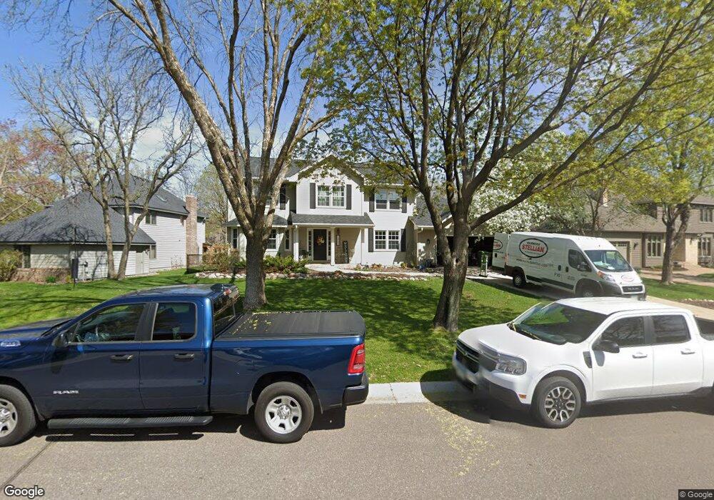
1955 127th Ln NW Coon Rapids, MN 55448
Estimated Value: $438,000 - $492,000
5
Beds
4
Baths
2,362
Sq Ft
$202/Sq Ft
Est. Value
About This Home
This home is located at 1955 127th Ln NW, Coon Rapids, MN 55448 and is currently estimated at $476,955, approximately $201 per square foot. 1955 127th Ln NW is a home located in Anoka County with nearby schools including Lucile Bruner Elementary School, Morris Bye Elementary School, and Laughlin Junior/Senior High School.
Ownership History
Date
Name
Owned For
Owner Type
Purchase Details
Closed on
Feb 26, 2010
Sold by
Delmonico Joyce A and Delmonico Anthony D
Bought by
Fischer Daniel B and Fischer Lisa R
Current Estimated Value
Home Financials for this Owner
Home Financials are based on the most recent Mortgage that was taken out on this home.
Original Mortgage
$184,000
Outstanding Balance
$122,134
Interest Rate
5.01%
Mortgage Type
New Conventional
Estimated Equity
$354,821
Purchase Details
Closed on
Nov 30, 2000
Sold by
Morgan Monya L
Bought by
Delmonico Joyce A and Delmonico Anthony D
Purchase Details
Closed on
Dec 10, 1996
Sold by
Bratlie Stephen P and Bratlie Cynthia G
Bought by
Morgan Larry D and Morgan Monya L
Create a Home Valuation Report for This Property
The Home Valuation Report is an in-depth analysis detailing your home's value as well as a comparison with similar homes in the area
Home Values in the Area
Average Home Value in this Area
Purchase History
| Date | Buyer | Sale Price | Title Company |
|---|---|---|---|
| Fischer Daniel B | $230,000 | -- | |
| Delmonico Joyce A | $215,400 | -- | |
| Morgan Larry D | $175,000 | -- |
Source: Public Records
Mortgage History
| Date | Status | Borrower | Loan Amount |
|---|---|---|---|
| Open | Fischer Daniel B | $184,000 |
Source: Public Records
Tax History Compared to Growth
Tax History
| Year | Tax Paid | Tax Assessment Tax Assessment Total Assessment is a certain percentage of the fair market value that is determined by local assessors to be the total taxable value of land and additions on the property. | Land | Improvement |
|---|---|---|---|---|
| 2025 | $4,856 | $445,200 | $90,000 | $355,200 |
| 2024 | $4,856 | $431,300 | $87,000 | $344,300 |
| 2023 | $4,638 | $434,500 | $72,000 | $362,500 |
| 2022 | $4,047 | $442,800 | $72,000 | $370,800 |
| 2021 | $3,700 | $342,400 | $56,000 | $286,400 |
| 2020 | $3,764 | $326,400 | $56,000 | $270,400 |
| 2019 | $3,706 | $318,300 | $56,000 | $262,300 |
| 2018 | $3,595 | $304,700 | $0 | $0 |
| 2017 | $3,265 | $287,300 | $0 | $0 |
| 2016 | $3,340 | $258,200 | $0 | $0 |
| 2015 | $3,244 | $258,200 | $50,000 | $208,200 |
| 2014 | -- | $217,400 | $35,400 | $182,000 |
Source: Public Records
Map
Nearby Homes
- 1930 127th Cir NW
- 12888 Nightingale St NW
- 12759 Ibis St NW
- 12760 Raven St NW
- 2147 125th Ln NW
- 12554 Grouse St NW
- 2068 124th Ln NW
- 12365 Jay St NW
- 1593 126th Ln NW
- 1520 129th Ave NW
- 1687 131st Ln NW
- 1450 126th Ln NW
- 12463 Drake St NW
- 1776 133rd Ave NW
- 1727 121st Ln NW
- 13416 Swallow St NW
- 1234 128th Cir NW
- 2675 128th Ave NW
- 13182 Zion St NW
- 13519 Partridge Cir NW
- 1945 127th Ln NW
- 1965 127th Ln NW
- 1941 127th Ln NW
- 2013 127th Ln NW
- 1958 127th Ln NW
- 1948 127th Ln NW
- 2036 128th Ave NW
- 2040 128th Ave NW
- 1938 127th Cir NW
- 2032 128th Ave NW
- 1968 127th Ln NW
- 2048 128th Ave NW
- 2023 127th Ln NW
- 1909 127th Ln NW
- 1934 127th Cir NW
- 2022 127th Ln NW
- 2024 128th Ave NW
- 2056 128th Ave NW
- 2033 127th Ln NW
- 2032 127th Ln NW