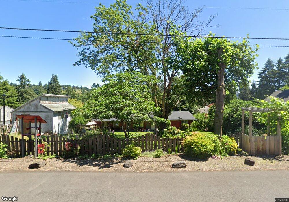
1955 16th St West Linn, OR 97068
Willamette NeighborhoodEstimated Value: $508,737 - $638,000
3
Beds
2
Baths
1,152
Sq Ft
$493/Sq Ft
Est. Value
About This Home
This home is located at 1955 16th St, West Linn, OR 97068 and is currently estimated at $568,434, approximately $493 per square foot. 1955 16th St is a home located in Clackamas County with nearby schools including Willamette Primary School, Athey Creek Middle School, and West Linn High School.
Ownership History
Date
Name
Owned For
Owner Type
Purchase Details
Closed on
Apr 23, 2021
Sold by
Foehringer Matthew James and Foehringer Matthew J
Bought by
Foehringer Matthew James
Current Estimated Value
Purchase Details
Closed on
Dec 22, 2015
Sold by
Foehringer Jodanelle and Grindheim Jodanelle
Bought by
Foehringer Matthew J
Home Financials for this Owner
Home Financials are based on the most recent Mortgage that was taken out on this home.
Original Mortgage
$210,000
Outstanding Balance
$166,012
Interest Rate
3.94%
Mortgage Type
New Conventional
Estimated Equity
$402,422
Purchase Details
Closed on
Jul 25, 1995
Sold by
Rufer Walter J and Rufer Carole L
Bought by
Foehringer Matthew J and Foehringer Jodanelle
Home Financials for this Owner
Home Financials are based on the most recent Mortgage that was taken out on this home.
Original Mortgage
$125,869
Interest Rate
7.62%
Mortgage Type
FHA
Create a Home Valuation Report for This Property
The Home Valuation Report is an in-depth analysis detailing your home's value as well as a comparison with similar homes in the area
Home Values in the Area
Average Home Value in this Area
Purchase History
| Date | Buyer | Sale Price | Title Company |
|---|---|---|---|
| Foehringer Matthew James | -- | Ticor Title | |
| Foehringer Matthew J | -- | Fidelity Natl Title Co Of Or | |
| Foehringer Matthew J | $127,000 | Stewart Title |
Source: Public Records
Mortgage History
| Date | Status | Borrower | Loan Amount |
|---|---|---|---|
| Open | Foehringer Matthew J | $210,000 | |
| Closed | Foehringer Matthew J | $125,869 |
Source: Public Records
Tax History Compared to Growth
Tax History
| Year | Tax Paid | Tax Assessment Tax Assessment Total Assessment is a certain percentage of the fair market value that is determined by local assessors to be the total taxable value of land and additions on the property. | Land | Improvement |
|---|---|---|---|---|
| 2025 | $4,532 | $235,150 | -- | -- |
| 2024 | $4,362 | $228,301 | -- | -- |
| 2023 | $4,242 | $221,652 | $0 | $0 |
| 2022 | $4,117 | $215,197 | $0 | $0 |
| 2021 | $3,908 | $208,930 | $0 | $0 |
| 2020 | $3,935 | $202,845 | $0 | $0 |
| 2019 | $3,752 | $196,937 | $0 | $0 |
| 2018 | $3,585 | $191,201 | $0 | $0 |
| 2017 | $3,446 | $185,632 | $0 | $0 |
| 2016 | $3,357 | $180,225 | $0 | $0 |
| 2015 | $3,180 | $174,976 | $0 | $0 |
| 2014 | $3,032 | $169,880 | $0 | $0 |
Source: Public Records
Map
Nearby Homes
- 1733 Jamie Cir
- 1925 Hillhouse Dr
- 1721 Dollar St Unit 1721
- 1931 13th St
- 2026 Virginia Ln
- 1694 16th St
- 1690 16th St
- 1791 Blankenship Rd
- 975 Springtree Ln
- 25540 Cheryl Dr
- 850 Springtree Ln Unit 850
- 880 Springtree Ln Unit 880
- 1765 Ostman Rd
- 800 Springtree Ln
- 640 Springtree Ln
- 1160 Blankenship Rd
- 4630 Summerlinn Way
- 4650 Summerlinn Way
- 1296 13th St
- 3850 Summerlinn Dr Unit 58
- 1935 16th St
- 2009 16th St
- 1615 Jamie Cir
- 1700 Jamie Cir
- 1933 16th St
- 1716 Jamie Cir
- 1960 16th St
- 1950 16th St
- 1980 16th St
- 1915 16th St
- 2005 16th St
- 0 No Site Address Unit 319754
- 0 W L Sandwich Shop Unit 8012116
- 0 No Site Address Unit 10087194
- 0 No Site Address Unit 12691334
- 1940 16th St
- 1621 Jamie Cir
- 1990 16th St
- 2008 16th St
- 1920 16th St