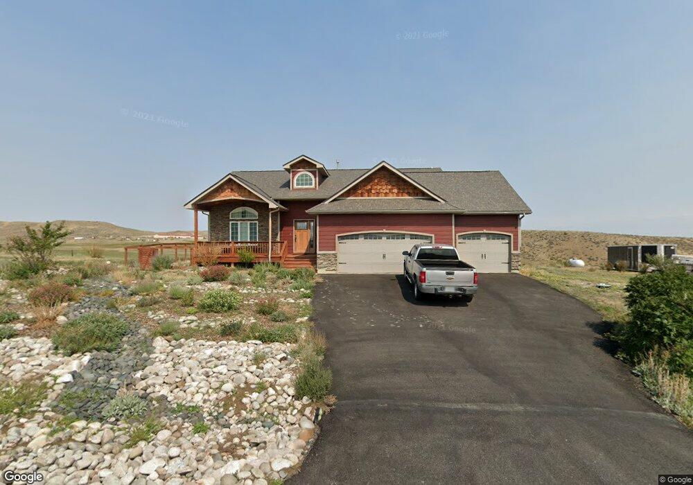
1955 Coyote Ridge Rd N Laurel, MT 59044
Estimated Value: $423,000 - $498,000
4
Beds
3
Baths
1,274
Sq Ft
$369/Sq Ft
Est. Value
About This Home
This home is located at 1955 Coyote Ridge Rd N, Laurel, MT 59044 and is currently estimated at $469,831, approximately $368 per square foot. 1955 Coyote Ridge Rd N is a home located in Yellowstone County with nearby schools including Fred W. Graff School, West School, and Laurel Middle School.
Ownership History
Date
Name
Owned For
Owner Type
Purchase Details
Closed on
Jul 23, 2007
Sold by
Beartooth Pointe Estates Inc
Bought by
Marie Steven Allan and Marie Lisa L
Current Estimated Value
Home Financials for this Owner
Home Financials are based on the most recent Mortgage that was taken out on this home.
Original Mortgage
$252,633
Outstanding Balance
$157,987
Interest Rate
6.51%
Mortgage Type
Unknown
Estimated Equity
$311,845
Create a Home Valuation Report for This Property
The Home Valuation Report is an in-depth analysis detailing your home's value as well as a comparison with similar homes in the area
Home Values in the Area
Average Home Value in this Area
Purchase History
| Date | Buyer | Sale Price | Title Company |
|---|---|---|---|
| Marie Steven Allan | -- | Stewart Title Of Billings |
Source: Public Records
Mortgage History
| Date | Status | Borrower | Loan Amount |
|---|---|---|---|
| Open | Marie Steven Allan | $252,633 |
Source: Public Records
Tax History Compared to Growth
Tax History
| Year | Tax Paid | Tax Assessment Tax Assessment Total Assessment is a certain percentage of the fair market value that is determined by local assessors to be the total taxable value of land and additions on the property. | Land | Improvement |
|---|---|---|---|---|
| 2025 | $2,961 | $481,300 | $105,710 | $375,590 |
| 2024 | $2,961 | $405,900 | $69,325 | $336,575 |
| 2023 | $2,960 | $405,900 | $69,325 | $336,575 |
| 2022 | $2,514 | $324,800 | $0 | $0 |
| 2021 | $2,506 | $324,800 | $0 | $0 |
| 2020 | $2,400 | $302,900 | $0 | $0 |
| 2019 | $2,343 | $302,900 | $0 | $0 |
| 2018 | $2,530 | $278,900 | $0 | $0 |
| 2017 | $1,826 | $278,900 | $0 | $0 |
| 2016 | $2,302 | $281,800 | $0 | $0 |
| 2015 | $2,271 | $281,800 | $0 | $0 |
| 2014 | $1,880 | $120,098 | $0 | $0 |
Source: Public Records
Map
Nearby Homes
- 1960 Coyote Ridge Rd N
- 512 W 14th St
- 1013 W 12th St
- 403 Grandview Blvd
- 1106 W 12th St
- 1109 10th Ave
- 1336 Pennsylvania Ave
- 1036 9th Ave
- 109 E 12th St
- TBD Block 1 Lot 2
- 1014 Rochelle Ln
- TBD Block 3 Lot 9
- TBD Block 1 Lot 3
- TBD Block 3 Lot 6
- TBD Block 3 Lot 1
- TBD Block 3 Lot 4
- 1018 Els Dr
- 1712 Paynes Place
- 1003 Montana Ave
- 110 E 5th St
- 1065 Timber Wolf Trail
- 895 Timber Wolf Trail
- 1975 Coyote Ridge Rd N
- LOT 4 N Coyote Ridge Rd
- LOT 3 N Coyote Ridge Rd
- 1980 Coyote Ridge Rd N
- 1195 Timber Wolf Trail
- 900 Timber Wolf Trail
- 1920 Coyote Ridge Rd S
- LOT 7 Timber Wolf Trail
- LOT 9 Timber Wolf Trail
- LOT 8 Timber Wolf Trail
- LOT 6 Timber Wolf Trail
- LOT 1 Timber Wolf Trail
- 1000 Timber Wolf Trail
- 1200 Timber Wolf Trail
- 1495 Timber Wolf Trail
- 1900 Coyote Ridge Rd S
- 2000 Coyote Ridge Rd N
- 1605 Timber Wolf Trail