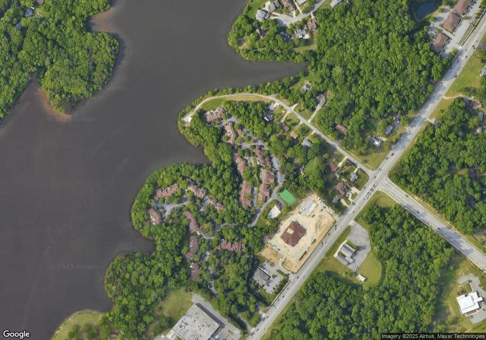
1955 Eastchester Dr Unit D High Point, NC 27265
Festival Park NeighborhoodEstimated Value: $288,000 - $324,000
3
Beds
4
Baths
2,200
Sq Ft
$140/Sq Ft
Est. Value
About This Home
This home is located at 1955 Eastchester Dr Unit D, High Point, NC 27265 and is currently estimated at $308,413, approximately $140 per square foot. 1955 Eastchester Dr Unit D is a home located in Guilford County with nearby schools including Montlieu Academy of Technology, Welborn Academy of Science & Technology, and T.W. Andrews High School.
Ownership History
Date
Name
Owned For
Owner Type
Purchase Details
Closed on
Mar 13, 2023
Sold by
Bedell Linda J
Bought by
Burge Timothy Wayne and Bodenheimer Ginger Annette
Current Estimated Value
Purchase Details
Closed on
Sep 25, 2007
Sold by
Siegal Barry S and Siegal Claudia F
Bought by
Bedell Raymond G and Bedell Linda J
Home Financials for this Owner
Home Financials are based on the most recent Mortgage that was taken out on this home.
Original Mortgage
$151,200
Interest Rate
6.55%
Mortgage Type
Purchase Money Mortgage
Purchase Details
Closed on
Sep 17, 2007
Sold by
Siegal Lester M
Bought by
Siegal Barry S
Home Financials for this Owner
Home Financials are based on the most recent Mortgage that was taken out on this home.
Original Mortgage
$151,200
Interest Rate
6.55%
Mortgage Type
Purchase Money Mortgage
Create a Home Valuation Report for This Property
The Home Valuation Report is an in-depth analysis detailing your home's value as well as a comparison with similar homes in the area
Home Values in the Area
Average Home Value in this Area
Purchase History
| Date | Buyer | Sale Price | Title Company |
|---|---|---|---|
| Burge Timothy Wayne | $260,000 | -- | |
| Burge Timothy Wayne | $260,000 | None Listed On Document | |
| Bedell Raymond G | $189,000 | None Available | |
| Siegal Barry S | $95,000 | None Available |
Source: Public Records
Mortgage History
| Date | Status | Borrower | Loan Amount |
|---|---|---|---|
| Previous Owner | Bedell Raymond G | $151,200 |
Source: Public Records
Tax History Compared to Growth
Tax History
| Year | Tax Paid | Tax Assessment Tax Assessment Total Assessment is a certain percentage of the fair market value that is determined by local assessors to be the total taxable value of land and additions on the property. | Land | Improvement |
|---|---|---|---|---|
| 2025 | $3,346 | $242,800 | $65,000 | $177,800 |
| 2024 | $3,346 | $231,600 | $65,000 | $166,600 |
| 2023 | $3,346 | $231,600 | $65,000 | $166,600 |
| 2022 | $3,273 | $242,800 | $65,000 | $177,800 |
| 2021 | $2,530 | $183,600 | $30,000 | $153,600 |
| 2020 | $2,530 | $183,600 | $30,000 | $153,600 |
| 2019 | $2,530 | $183,600 | $0 | $0 |
| 2018 | $2,517 | $183,600 | $0 | $0 |
| 2017 | $2,530 | $183,600 | $0 | $0 |
| 2016 | $2,770 | $197,500 | $0 | $0 |
| 2015 | $2,785 | $197,500 | $0 | $0 |
| 2014 | $2,832 | $197,500 | $0 | $0 |
Source: Public Records
Map
Nearby Homes
- 1935 Eastchester Dr
- 2200 Delaine Point
- 3521 Sunset Hollow Ct
- 2115 Mirus Ct
- 3630 Sunset Hollow Dr
- 1924 Middlewood Ct
- 4307 Oak Hollow Dr
- 3741 Georgia Pond Ln
- 4407 Oak Hollow Dr
- 4218 Pelican St
- 3710 Spanish Peak Dr Unit 2D
- 1906 Greenstone Place
- 3724 Spanish Peak Dr Unit 2B
- 3400 Herron Point
- 3753 Carvette Ct
- 2806 Splitbrooke Dr
- 4404 Essex Ct
- 2218 Hilton Ct
- 2302 Gordon Rd
- 4004 Baywater Point
- 1955 Eastchester Dr Unit C
- 1955 Eastchester Dr Unit B
- 1955 Eastchester Dr Unit A
- 1955 Eastchester Dr
- 1953 Eastchester Dr Unit C
- 1953 Eastchester Dr Unit B
- 1953 Eastchester Dr Unit A
- 1953 Eastchester Dr
- 1949 Eastchester Dr Unit D
- 1949 Eastchester Dr Unit C
- 1949 Eastchester Dr Unit B
- 1949 Eastchester Dr Unit A
- 1951 Eastchester Dr
- 1951 Eastchester Dr Unit D
- 1951 Eastchester Dr Unit C
- 1951 Eastchester Dr Unit B
- 1951 Eastchester Dr Unit A
- 1951 Eastchester Dr Unit E
- 1951 Eastchester Dr Unit D
- 1957 Eastchester Dr Unit D
