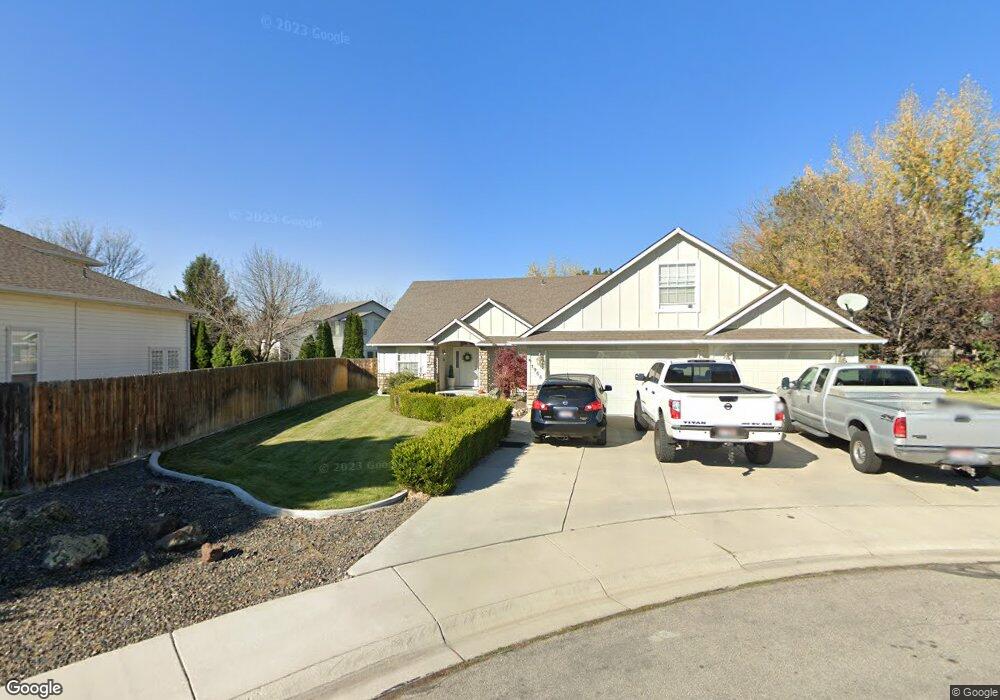
1955 S Lost Trail Place Boise, ID 83709
Southwest Boise NeighborhoodEstimated Value: $543,766 - $562,000
3
Beds
2
Baths
2,047
Sq Ft
$270/Sq Ft
Est. Value
About This Home
This home is located at 1955 S Lost Trail Place, Boise, ID 83709 and is currently estimated at $553,442, approximately $270 per square foot. 1955 S Lost Trail Place is a home located in Ada County with nearby schools including Amity Elementary School, West Junior High School, and Borah Senior High School.
Ownership History
Date
Name
Owned For
Owner Type
Purchase Details
Closed on
Jul 20, 2001
Sold by
Fenix Construction Inc
Bought by
Dunning Todd A and Dunning Andrea D
Current Estimated Value
Home Financials for this Owner
Home Financials are based on the most recent Mortgage that was taken out on this home.
Original Mortgage
$155,750
Outstanding Balance
$59,372
Interest Rate
7.15%
Mortgage Type
Purchase Money Mortgage
Estimated Equity
$494,070
Purchase Details
Closed on
Jun 1, 1999
Sold by
Boulder Creek Associates Llp
Bought by
Fenix Construction Inc
Home Financials for this Owner
Home Financials are based on the most recent Mortgage that was taken out on this home.
Original Mortgage
$142,000
Interest Rate
6.89%
Mortgage Type
Construction
Create a Home Valuation Report for This Property
The Home Valuation Report is an in-depth analysis detailing your home's value as well as a comparison with similar homes in the area
Home Values in the Area
Average Home Value in this Area
Purchase History
| Date | Buyer | Sale Price | Title Company |
|---|---|---|---|
| Dunning Todd A | -- | Stewart Title | |
| Fenix Construction Inc | -- | Pioneer Title Company |
Source: Public Records
Mortgage History
| Date | Status | Borrower | Loan Amount |
|---|---|---|---|
| Open | Dunning Todd A | $155,750 | |
| Previous Owner | Fenix Construction Inc | $142,000 | |
| Closed | Dunning Todd A | $19,470 |
Source: Public Records
Tax History Compared to Growth
Tax History
| Year | Tax Paid | Tax Assessment Tax Assessment Total Assessment is a certain percentage of the fair market value that is determined by local assessors to be the total taxable value of land and additions on the property. | Land | Improvement |
|---|---|---|---|---|
| 2025 | $3,510 | $537,100 | -- | -- |
| 2024 | $3,401 | $511,800 | -- | -- |
| 2023 | $3,401 | $481,200 | $0 | $0 |
| 2022 | $3,873 | $571,700 | $0 | $0 |
| 2021 | $3,182 | $416,100 | $0 | $0 |
| 2020 | $2,626 | $321,200 | $0 | $0 |
| 2019 | $2,630 | $293,800 | $0 | $0 |
| 2018 | $2,293 | $251,000 | $0 | $0 |
| 2017 | $2,399 | $250,100 | $0 | $0 |
| 2016 | $2,272 | $233,500 | $0 | $0 |
| 2015 | $2,279 | $216,700 | $0 | $0 |
| 2012 | -- | $173,200 | $0 | $0 |
Source: Public Records
Map
Nearby Homes
- 2033 S Stonyfield Place
- 2029 S Wilde Creek Way
- 10875 W Hollandale Dr
- 10685 W Hollandale Dr
- 10776 W Smoke Ranch Dr
- 10471 W Bantam St
- 2484 S Culpeper Ave
- 10334 W Bantam St
- 11505 W Baserri Dr
- 9999 W Hollandale Dr
- 2476 S Amaya Ln
- 11712 W Annalee Ln
- 971 S Wavetrain Ave
- 10324 W Antietam St
- 11899 W Blueberry Ct
- 960 S Nautilus Ave
- 10512 W Martingale Dr
- 11225 W Camas St
- 1877 S Rustic Mill Place
- 941 S Wavetrain Ave
- 1951 S Lost Trail Place
- 1961 S Lost Trail Place
- 10852 W K Bar T Dr
- 1952 S Lost Trail Place
- 10874 W K Bar T Dr
- 10780 W Southerland St
- 1958 S Lost Trail Place
- 10747 W Southerland St
- 1970 S Lost Trail Place
- 10850 W High Rock Dr
- 10872 W High Rock Dr
- 10828 W High Rock Dr
- 10714 W K Bar T Dr
- 10737 W Southerland St
- 10894 W High Rock Dr
- 2032 S Tollgate Way
- 10742 W Southerland St
- 2057 S Stonyfield Place
- 1998 S Whisper Cove Way
- 1956 S Whisper Cove Place